Montana is a landlocked state in the Northwestern United States. Montana has several nicknames, although none are official, including "Big Sky Country" and "The Treasure State", and slogans that include "Land of the Shining Mountains" and more recently "The Last Best Place".

The Absaroka Range is a sub-range of the Rocky Mountains in the United States. The range stretches about 150 mi (240 km) across the Montana-Wyoming border, and 75 miles at its widest, forming the eastern boundary of Yellowstone National Park along Paradise Valley (Montana), and the western side of the Bighorn Basin. The range borders the Beartooth Mountains to the north and the Wind River Range to the south. The northern edge of the range rests along I-90 and Livingston, Montana. The highest peak in the range is Francs Peak, located in Wyoming at 13,153 ft (4,009 m). There are 46 other peaks over 12,000 ft (3,700 m).

The Canadian Rockies or Canadian Rocky Mountains comprise the Canadian segment of the North American Rocky Mountains. They are the eastern part of the Canadian Cordillera, which is a system of multiple ranges of mountains which runs from the Canadian Prairies to the Pacific Coast. The Canadian Rockies mountain system comprises the southeastern part of this system, lying between the Interior Plains of Alberta and Northeastern British Columbia on the east to the Rocky Mountain Trench of BC on the west. The southern end borders Idaho and Montana of the United States. In geographic terms the boundary is at the Canada/US border, but in geological terms it might be considered to be at Marias Pass in northern Montana. The northern end is at the Liard River in northern British Columbia.

The Crazy Mountains, often called the Crazies, are a mountain range in the northern Rocky Mountains in the U.S. state of Montana.

Heavens Peak is located in the Livingston Range, Glacier National Park in the U.S. state of Montana. Heavens Peak is a little more than 1 mile (1.6 km) north of McPartland Mountain.
Grizzly Peak may refer to:

The Lewis Range is a mountain range located in the Rocky Mountains of northern Montana, United States and extreme southern Alberta, Canada. It was formed as a result of the Lewis Overthrust, a geologic thrust fault resulted in the overlying of younger Cretaceous rocks by older Proterozoic rocks. The range is located within Waterton Lakes National Park in Alberta, Canada and Glacier National Park and the Bob Marshall Wilderness Complex in Montana, United States. The highest peak is Mount Cleveland at 10,466 ft (3,190 m).

The Gallatin Range is a mountain range of the Rocky Mountains, located in the U.S. states of Montana and Wyoming. It includes more than 10 mountains over 10,000 feet (3,000 m). The highest peak in the range is Electric Peak at 10,969 feet (3,343 m).
The following is an alphabetical list of articles related to the U.S. state of Montana.

Factory Hill el. 9,527 feet (2,904 m) is a mountain peak in the Red Mountains of Yellowstone National Park. It is directly north of Mount Sheridan and west of the Heart Lake Geyser Basin. Early in the history of Yellowstone, this peak was call Red Mountain by the Hayden surveys, a name later transferred to the range in which it resides. In 1885, the Hague Geological Survey gave the peak its present name based on the following passage by Nathaniel P. Langford in his 1871 Scribner's account of the Washburn–Langford–Doane Expedition. Langford's party was camped near the south arm of Yellowstone Lake at the time.

Mount Chittenden el. 10,182 feet (3,103 m) is a mountain peak in the Absaroka Range in Yellowstone National Park. The peak was named by Henry Gannett of the Hayden Geological Survey of 1878 for George B. Chittenden. Chittenden was a Geological Survey member who had worked with Gannett, Hayden and others in surveys in Montana, Idaho and Wyoming. Chittenden never participated in any of the Yellowstone surveys.
The Castle Mountains, highest point Elk Peak, el. 8,589 feet (2,618 m), are an island range east of White Sulphur Springs in Meagher County, Montana, United States. About 30,000 acres of the Castles were roadless as of 1995. The western portion of the Castles are moist, while the eastside is dry, porous limestone hills. The range gets its name from "castle turrets", 50-foot high igneous rock spires on the western slopes. The range was the focus of mining activity in the previous century; crumbling remains of old miners' cabins and diggings are present throughout the area. The landscape is characterized by a central cluster of peaks over 8,000 feet and extensive grassy parks surrounded by lodgepole pine and limber pine. The Castles are lightly used by recreationists except for hunters in the fall. On the peak of Castle Mountain itself is a login book for the few who reach the top. There is no trail that leads to the peak.

The Pryor Mountains are a mountain range in Carbon and Big Horn counties of Montana. They are located on the Crow Indian Reservation and the Custer National Forest, and portions of them are on private land. They lie south of Billings, Montana, and north of Lovell, Wyoming.

In Montana, the South Hills are the small foothills in various Montana communities, most notably those at el. 3,592 feet (1,095 m), south of Missoula, Montana in Missoula County, Montana. Several districts of Missoula, Montana are, also, in the South Hills.

Sluice Boxes State Park is a public recreation area in the Little Belt Mountains of Montana, United States, twelve miles (19 km) south of Belt on the Kings Hill Scenic Byway. The state park consists of the northernmost eight miles of the Belt Creek canyon, highlighted by large cliffs and dramatic ledges where the canyon curves out of the Little Belt Mountains and winds toward the town of Belt. Remains of the area's mining and railroading days are found throughout the canyon. The park offers hiking, floating, picnicking, and backcountry camping..
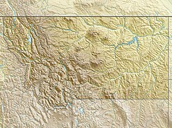
The Regional designations of Montana vary widely within the U.S state of Montana. The state is a large geographical area that is split by the Continental Divide, resulting in watersheds draining into the Pacific Ocean, Gulf of Mexico and Hudson's Bay. The state is approximately 545 miles (877 km) east to west along the Canada–United States border and 320 miles (510 km) north to south. The fourth largest state in land area, it has been divided up in official and unofficial ways into a variety of regions. Additionally, Montana is part of a number of larger federal government administrative regions.