Parsathua

Last updated

Parsathua
Village
Kochas block map.png
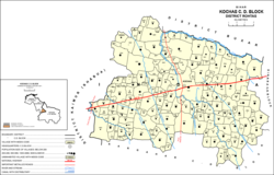
Map of Parsathua (#685) in Kochas block
India Bihar location map.svg
Red pog.svg
Parsathua
Location in Bihar, India
India location map.svg
Red pog.svg
Parsathua
Parsathua (India)
Coordinates: 25°12′39″N83°48′34″E / 25.21089°N 83.80939°E / 25.21089; 83.80939 [1]
CountryIndia
State Bihar
District Bhojpur
Area
[2]
  Total1.6794 km2 (0.6484 sq mi)
Elevation
[1]
76 m (249 ft)
Population
 (2011)
  Total4,762 [2]
Languages
  Official Bhojpuri, Hindi
Time zone UTC+5:30 (IST)

Parsathua is a village in Kochas block of Rohtas district in Bihar, India. As of 2011, its population was 4,762, in 719 households. It has a regular mandi and a weekly haat. Drinking water is provided by hand pump. The village's area covers an area of 167.94 hectares, of which most is farmland: 163.9 ha are under cultivation, and 159.1 are irrigated. 1.1 ha consists of permanent pastures, and 0.4 ha consists of orchards. An area of 0.9 ha is devoted to non-agricultural use. [2]

See also

Related Research Articles

<span class="mw-page-title-main">Sasaram</span> City in Bihar, India

Sasaram, also spelled as Shahasaram, is a historical city and a municipal corporation region in the Rohtas district of Bihar state in eastern India.

<span class="mw-page-title-main">Buxar district</span> District of Bihar in India

Buxar district is one of the 38 districts of Bihar, India. Located in the southwestern part of the state, it is a primarily agricultural district. The district headquarters is at the town of Buxar. Buxar district was carved out from Bhojpur district on 17 March 1991.

<span class="mw-page-title-main">Kaimur district</span> District of Bihar in India

Kaimur district is one of the 38 districts of Bihar, India. The district headquarters are at Bhabua. Before 1991, it was part of Rohtas District. Till 1764 the region was a part of Ghazipur District and was a part of Kamsaar Raj and later it was a part of Chainpur Estate till 1837.

<span class="mw-page-title-main">Rohtas district</span> District of Bihar in India

Rohtas District is one of the thirty-eight districts of Bihar state, India. It came into existence when Shahabad District was bifurcated into Bhojpur & Rohtas in 1972. Administrative headquarter of the district is Sasaram. Rohtas district has the highest literacy in Bihar. The literacy rate of Rohtas district which is 73.37% as per 2011 census is highest among all 38 districts of Bihar.

Bikramganj is a nagar parishad city and community development block in Rohtas district, Bihar, India. In the 2011 census, Bikramganj had a population of 48,465 in 7,968 households. The main commodities produced in Bikramganj are rice and pulses. It has a slum known as Dhangai, which had a 2011 population of 3,955 in 637 households. Bikramganj is located at 25.2°N 84.25°E, and has an average elevation of 77 metres (252 feet).

<span class="mw-page-title-main">Nasriganj</span> Nagar panchayat town in Bihar, India

Nasriganj is a nagar panchayat town and corresponding community development block situated in Rohtas District of Bihar, India. Located on the banks of the Son River, the town was a vibrant economic hub in the late 19th century. The town of Nasriganj had a population of 23,819, according to the 2011 Census of India, while the total population of Nasriganj block was 115,117. Besides the town of Nasriganj itself, the block consisted of 53 villages, of which 50 were inhabited and 3 were uninhabited.

Kanchanpur is a small village located in Rohtas district, Bihar state, India. It is near the National Highway 2. As of the year 2011, it had a total population of 2,865.

<span class="mw-page-title-main">Nokha, Rohtas</span> Town in Bihar, India

Nokha is a nagar panchayat town and corresponding community development block in Rohtas district in the Indian state of Bihar. As of 2011, the population of the town of Nokha was 27,302 in 4,381 households. The rural population of Nokha block was 146,025, thus bringing the total block population 173,327. The economic situation of this region is mainly dependent on parboiled rice processed by number of rice mills in this area.

<span class="mw-page-title-main">Tilouthu</span> Town in Bihar, India

Tilothu, also spelled Tilauthu or Tilothu, is a village and corresponding community development block in Rohtas district, Bihar, India. It is located 15 km from Dehri-on-Sone on the west bank of the Son River. As of 2011, the population of Tilouthu was 16,402, in 2,745 families, while the corresponding block population was 109,249.

<span class="mw-page-title-main">Bhojpur district, India</span> District of Bihar in India

Bhojpur district is one of the 38 districts of the Indian state of Bihar. Arrah city is the administrative headquarters of this district. Bhojpur district came into existence in 1972. Earlier it was the part of Shahabad district. This district is named "Bhojpur" after great Parmara King Bhoja as most early settlers were Rajput rulers of Parmara dynasty then called as Ujjainiya.

<span class="mw-page-title-main">Kochas</span> Town in Bihar, India

Kochas is a town and corresponding community development block in Rohtas district of Bihar state, India. It is located at an elevation of 69 m above MSL. National Highway 319 passes through Kochas. The nearest airport is Varanasi Airport (105 km).The most famous cultural event of Kochas is Krishn Lila unfortunately it is known and famous as "Kans Lila". Beside Krishn Lila other famous cultural activities are Chhath Puja, Durga Puja and other religious functions. Kochas's Surya Mandir sun temple is identity of Kochas. It is situated in center of a Pond "Pokhara". It was established on 1 October (SS).

<span class="mw-page-title-main">Dinara, Bihar</span> Village in Bihar, India

Dinara is a CD Block in Rohtas district, Bihar, India. It is situated on the National Highway 319. The birthplace of the famous poet Dariya Saheb is just 5 km from Dinara.

<span class="mw-page-title-main">Sheosagar</span> Village in Bihar, India

Sheosagar, also spelled Shiusagar or Shivsagar, is a village and corresponding community development block in Rohtas district of Bihar, India. As of 2011, the village of Sheosagar had a population of 2,065, in 345 households, while the entire block had a population of 176,080. The nearest major city is Sasaram, the capital of Rohtas district.

<span class="mw-page-title-main">Chenari, Bihar</span> Census town in Bihar, India

Chenāri or Chanāri is a census town and corresponding community development block in Rohtas district of Bihar, India. As of 2011, the town of Chenari had a population of 6,569, while Chenari block had a population of 131,528. Major commodities produced in the town of Chenari are chironji, rice, and pulses. The census town of Bhardua is administratively counted as part of Chenari block.

<span class="mw-page-title-main">Rohtas block</span> Place in Bihar, India

Rohtas is a community development block in Rohtas district of Bihar, India. The block headquarters is in the village of Akbarpur, 5 km east of the historic Rohtas Fort. As of 2011, the population of Rohtas block was 86,049.

Akbarpur is a village in Rohtas block of Rohtas district, Bihar, India. Located on the bank of the Son river, a short distance east of the historic Rohtasgarh fort, Akbarpur is the headquarters of Rohtas block. As of 2011, it had a population of 9,236, in 1,491 households. Akbarpur covers 333 hectares and 6.73 km2.

<span class="mw-page-title-main">Akorhi Gola</span> Village in Bihar, India

Akorhi Gola is a village and corresponding community development block in Rohtas district of Bihar, India. Located 6 km north of Dehri, Akorhi Gola is known for its blanket weaving industry. As of 2011, the village had a population of 3,810, in 601 households, while the total block population was 120,145.

<span class="mw-page-title-main">Suryapura, Bihar</span> Village in Bihar, India

Suryapura, also spelled Surajpura, is a village and corresponding community development block in Rohtas district of Bihar, India. As of 2011, the village of Suryapura had a population of 6,347, in 900 households, while Suryapura block had a population of 57,529, in 8,728 households. It is the least populous of Rohtas's 19 blocks.

<span class="mw-page-title-main">Nauhatta, Rohtas</span> Village in Bihar, India

Nauhatta is a village and corresponding community development block in Rohtas district of Bihar, India. As of 2011, the village of Nauhatta had a population of 5,103, in 909 households, while Nauhatta block had a population of 94,065, in 16,387 households. The nearest city is Dehri.

<span class="mw-page-title-main">Habbupur</span> Village in Bihar, India

Habbupur is a village in Akorhi Gola block of Rohtas district in Bihar, India. As of 2011, its population was 1,247, in 210 households. It covers an area of 141.7 hectares, of which most is under agricultural use: 118.9 hectares are farmland, all of which is irrigated, and the remaining 22.8 hectares are under non-agricultural use.

References

  1. 1 2 "Geonames.org. Parsathua" . Retrieved 27 October 2020.
  2. 1 2 3 "Census of India 2011: Bihar District Census Handbook - Rohtas, Part A (Village and Town Directory)". Census 2011 India. pp. 228–307. Retrieved 27 October 2020.