
A municipality is usually a single administrative division having corporate status and powers of self-government or jurisdiction as granted by national and regional laws to which it is subordinate.

Ilocos Norte is a province of the Philippines located in the Ilocos Region. Its capital is Laoag City, located in the northwest corner of Luzón Island, bordering Cagayan and Apayao to the east, and Abra to the southeast, and Ilocos Sur to the southwest. Ilocos Norte faces the West Philippine Sea to the west and the Luzon Strait to the north.

A hamlet is a small human settlement. In different jurisdictions and geographies, a hamlet may be the size of a town, village or parish, or may be considered to be a smaller settlement or subdivision or satellite entity to a larger settlement. The word and concept of a hamlet have roots in the Anglo-Norman settlement of England, where the old French hamlet came to apply to small human settlements. In British geography, a hamlet is considered smaller than a village and distinctly without a church or other place of worship.

Manisa Province is a province in western Turkey. Its neighboring provinces are İzmir to the west, Aydın to the south, Denizli to the southeast, Uşak to the east, Kütahya to the northeast, and Balıkesir to the north. The city of Manisa is the seat and capital of the province. The traffic code is 45.
Poblacion or población is the common term used for the central, downtown, old town or central business district area of a Philippine city or municipality, which may take up the area of a single barangay or multiple barangays. It is sometimes shortened to Pob.

Sembakkam is a residential locality in Greater Chennai City in Tamil Nadu State, India. It is located between Tambaram and Medavakkam and belongs to Tambaram Taluk Region.

Cabo Verde is a Brazilian municipality located in the southwest of the state of Minas Gerais. Its population as of 2007 was 14,024 people living in a total area of 367 km². The city belongs to the meso-region of Sul e Sudoeste de Minas and to the micro-region of São Sebastião do Paraíso. It became a municipality in 1877. The municipality is an important producer of coffee.
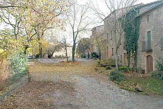
Montclar is a municipality in the comarca of Berguedà, Catalonia. The municipality includes an exclave to the north-east.

The Rural Municipality of Grant No. 372 is a rural municipality (RM) in the Canadian province of Saskatchewan within Census Division No. 15 and SARM Division No. 5. The RM's office is located in Vonda.

The Rural Municipality of Kingsley No. 124 is a rural municipality (RM) in the Canadian province of Saskatchewan within Census Division No. 5 and SARM Division No. 1. It is located in the southeast portion of the province.

The Rural Municipality of Fertile Belt No. 183 is a rural municipality (RM) in the Canadian province of Saskatchewan within Census Division No. 5 and SARM Division No. 1.

The Rural Municipality of McLeod No. 185 is a rural municipality (RM) in the Canadian province of Saskatchewan within Census Division No. 5 and SARM Division No. 1. It is located in the southeast portion of the province.

The Rural Municipality of Longlaketon No. 219 is a rural municipality (RM) in the Canadian province of Saskatchewan within Census Division No. 6 and SARM Division No. 2.

The Rural Municipality of Sliding Hills No. 273 is a rural municipality (RM) in the Canadian province of Saskatchewan within Census Division No. 9 and SARM Division No. 4.


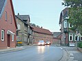 The main street
 The Lutheran church
 The Baptist church
 The catholic church
 The former station


