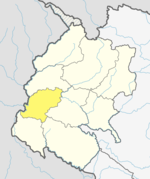
Dadeldhura, a part of Sudurpashchim Province, is one of the seventy-seven districts of Nepal. The district, with Dadeldhura as its district headquarters, covers an area of 1,538 km2 (594 sq mi) and had a population of 126,162 in 2001 and 142,094 in 2011.
Basnyat/Basnet family or Basnyat/Basnet dynasty was a Khas-Chhetri and a warlord clan family involved in the politics and administration of the Gorkha Kingdom and Kingdom of Nepal. This family got entry into Thar Ghar aristocracy group of Gorkha at the time of King Prithvi Narayan Shah. It was one of the four noble families to be involved in active politics of Nepal together with Shah dynasty, Pande family and Thapa dynasty before the rise of Rana dynasty. This family is descended from Shivaram Singh Basnyat, the commander of Gorkhali forces and a member of Shreepali Basnyat clan of Gorkha. This family was maritally linked to Kala (Black) Pande section of Pande dynasty through Chitravati Pande who married Kaji Kehar Singh Basnyat. This family was the last Kshatriya (Chhetri) political family to be wiped out from the central power by Jung Bahadur Rana of Kunwar family during the Bhandarkhal Massacre in 1846 for the conspiracy to take the power leading to people suffering from the Rana rule for 104 long years.
Parshuram is an upazila of Feni District in the Division of Chittagong, in southeast Bangladesh.
Narayan is a municipality located in Dailekh District of Karnali Province of Nepal.
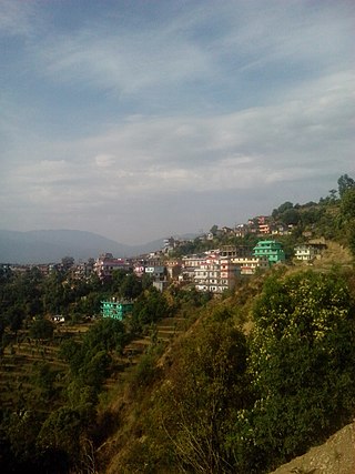
Jogbuda is a village development committee in Dadeldhura District in the Mahakali Zone of western Nepal. At the time of the 1991 Nepal census it had a population of 13,521 people living in 2191 individual households.

Chandragiri is a municipality in Kathmandu District in Bagmati Province of Nepal that was declared as municipality on 2 December 2014 by merging the former Village Development Committees Baad Bhanjyang, Balambu, Dahachok, Mahadevsthan, Machhegaun, Matatirtha, Naikap Naya Bhanjyang, Naikap Purano Bhanjyang, Satungal, Thankot and Tinthana. The urban administration is located in Old-Balambu. The city's main attractions include Chandragiri Hill, Nepal with its Cable Car.

Kageshwori-Manohara is a municipality in Kathmandu District in the Bagmati Province of Nepal that was established on 2 December 2014 by merging the former Village development committees of Aalapot, Bhadrabas, Danchhi, Gagalphedi, Gothatar and Mulpani. The office of the municipality is in Thali Danchhi in Ward No. 5.

Tokha is a municipality in Kathmandu District in Bagmati Province of Nepal that was established on 2 December 2014 by merging the former Village development committees Dhapasi, Jhor Mahankal, Gongabu, Tokha Chandeshwari and Tokha Saraswati on 2 December 2014. The municipality derives its name from the historical town of Tokha.

A municipality in Nepal is an administrative division in the Provinces of Nepal. The urban population of Nepal refers to the inhabitants residing in the designated municipal area. Population size has been taken as the principal criteria in the declaration of urban areas in Nepal since 1961. Municipalities can therefore also include rural areas. It functions as a sub-unit of a district. Nepal currently has 293 municipalities, which given the 2011 population estimate of 16,656,057.

On 27 July 2000, de Havilland Canada DHC-6 Twin Otter operated by Royal Nepal Airlines crashed in Nepal en route from Bajhang Airport to Dhangadhi Airport on a domestic passenger flight. The wreckage of the aircraft, registration 9N-ABP, was found in Jogbuda, Dadeldhura District. All 22 passengers and the three crew aboard were killed in the crash. An investigation into the crash was launched by Nepalese authorities after the accident site was located.
Sundar Haraicha is a municipality in Morang District of Koshi Province in Nepal. It is centered around Biratchowk town which is the gateway to Biratnagar. It borders Itahari Sub- Metropolitan city to the West, Dharan Sub- Metropolitan city to the Northwest and Belbari municipality to the East and is connected by the Mahendra Highway. It is one of the fastest growing cities in the Eastern Nepal and the second largest city of Morang district after Biratnagar with 121,305 inhabitants living in 26,677 households. It consists the town centres of Biratchowk and Gothgaun which are parts of the Greater Birat Development Area which incorporates the cities of Biratnagar-Itahari-Gothgau-Biratchowk-Dharan primarily located on the Koshi Highway in Eastern Nepal, with an estimated total urban agglomerated population of 804,300 people living in 159,332 households.
Chamunda Bindrasaini is an urban municipality located in Dailekh District of Karnali Province of Nepal.
Tripurasundari is an urban municipality located in Dolpa District of Karnali Province of Nepal.
Gurans is a rural municipality located in Dailekh District of Karnali Province of Nepal.
Thantikandh is a rural municipality located in Dailekh District of Karnali Province of Nepal.
Dungeshwar is a rural municipality located in Dailekh District of Karnali Province of Nepal.

The Samajbadi Party, Nepal, abbr. SPN was the third-largest political party in Nepal party after the Nepali Congress and the Nepal Communist Party. It was formed on 6 May 2019 by the merger of the Federal Socialist Forum, Nepal, led by Deputy Prime Minister Upendra Yadav, and the Naya Shakti Party, Nepal, led by former Prime Minister Baburam Bhattarai. The party was founded with the ideology of democratic socialism and ethnic federalism. It uses the flag and election symbol of the Federal Socialist Forum, Nepal.
Bungal is a municipality located in Bajhang District of Sudurpashchim province of Nepal. It is surrounded by Darchula District in the west, Baitadi District in the south, Surma, Chabispathivera, Durgathali, Kedarseu and Bithadchir in the East and Saipal touches it from the North.
Panchadewal Binayak is a municipality located in Accham District of Sudurpashchim province of Nepal. It is surrounded by Kalikot District of Karnali Province in the East, Kamalbazar in the West, Ramaroshan in the North and Dailekh District in the South.