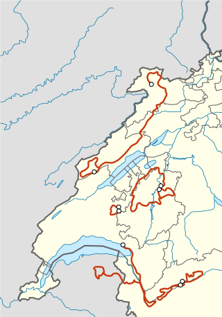
Valais, more formally, the Canton of Valais, is one of the 26 cantons forming the Swiss Confederation. It is composed of thirteen districts and its capital and largest city is Sion.

The Col du Galibier is a mountain pass in the southern region of the French Dauphiné Alps near Grenoble. It is the eighth highest paved road in the Alps, and recurrently the highest point of the Tour de France.

The Great St Bernard Pass is the third highest road pass in Switzerland, at an elevation of 2,469 m (8,100 ft). It connects Martigny in the canton of Valais in Switzerland with Aosta in the region Aosta Valley in Italy. It is the lowest pass lying on the ridge between the two highest mountains of the Alps, Mont Blanc and Monte Rosa. It is located on the main watershed that separates the basin of the Rhône from that of the Po.

Les Portes du Soleil is a major skisports destination in the Alps, encompassing thirteen resorts between Mont Blanc in France and Lake Geneva in Switzerland. With more than 650 km of marked pistes and about 200 lifts in total, spread over 14 valleys and about 1,036 square kilometres (400 sq mi), Portes du Soleil ranks among the two largest ski areas in the world. Almost all of the pistes are connected by lifts – a few marginal towns can be reached only by the free bus services in the area. The highest elevation accessible on skis is 2260 m and the lowest is 930 m. As with many other Alpine ski resorts, the lower slopes of the Portes du Soleil have snow-making facilities to extend the ski season by keeping the lower slopes open during the warmer months.

The French Alps are the portions of the Alps mountain range that stand within France, located in the Auvergne-Rhône-Alpes and Provence-Alpes-Côte d'Azur regions. While some of the ranges of the French Alps are entirely in France, others, such as the Mont Blanc massif, are shared with Switzerland and Italy.

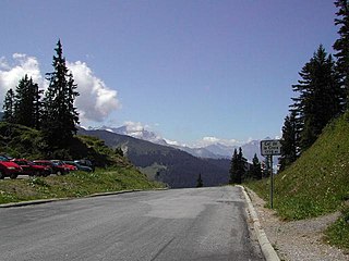
Col de la Croix is an Alpine pass in the canton of Vaud in Switzerland.

The Dents du Midi are a three-kilometre-long mountain range in the Chablais Alps in the canton of Valais, Switzerland. Overlooking the Val d'Illiez and the Rhône valley to the south, they face the Lac de Salanfe, an artificial reservoir, and are part of the geological ensemble of the Giffre massif. Their seven peaks are, from north-east to south-west: the Cime de l'Est, the Forteresse, the Cathédrale, the Éperon, the Dent Jaune, the Doigts and the Haute Cime. They are mainly composed of limestone rock, with gritty limestone rock in the upper parts.

Col de l'Iseran is a mountain pass in France, the highest paved pass in the Alps. A part of the Graian Alps, it is in the department of Savoie, near the border with Italy, and is crossed by the D902 roadway.

The Col des Aravis is a mountain pass in the French Alps that connects the towns of La Clusaz in Haute-Savoie with La Giettaz in Savoie. At 1487 m it is the lowest pass in the Aravis Range of mountains.

Col de la Forclaz is a mountain pass in the Alps in the Canton of Valais in Switzerland. It connects Martigny at 471 m (1,545 ft) and Le Châtelard (Finhaut). The road from Martigny to the Col has an average gradient of 6% but in parts is closer to 8%. After the Col, and Le Châtelard, the road leads to Chamonix in France via Vallorcine and the Col des Montets.

Col des Montets is a mountain pass in the French Alps in the Haute-Savoie department of France. It is on the road between Chamonix, the Swiss Col de la Forclaz and Martigny in the canton of Valais, Switzerland.

Col du Granon is a high mountain pass in the Alps in the department of Hautes-Alpes in France. A narrow tarmac road winds steeply up the southern approach. Gravel roads continue beyond the pass, in a military training zone.

The Cornettes de Bise is a mountain in the Chablais Alps, overlooking Lake Geneva. At 2,432 metres above sea level, it is the highest summit of the subrange running from Pas de Morgins to Lake Geneva. The mountain is located on the border between France (west) and Switzerland (east).

Pas de Peyrol is a mountain pass located in Auvergne, France, and is the highest road pass in the Massif Central. The pass is on the slopes of Puy Mary and is situated at the junction of three roads:

Morgins is a village in the municipality of Troistorrents in the district of Monthey in the canton of Valais in southern Switzerland.

The 2010 Tour de Romandie cycling road race started on 27 April and finished on 2 May in Switzerland. It was the 6th event in the 2010 UCI ProTour, and the 13th event in the World Calendar. The race winner had been declared as Alejandro Valverde, who won the final stage to take the race by 11 seconds. However, some four weeks after the end of the race the UCI placed Valverde under a two-year suspension for his involvement in the 2006 Operación Puerto doping case, which was backdated to, and involved removal of all his results since, 1 January 2010. Simon Špilak was thus promoted to winner of the event.

The Stelvio Pass is a mountain pass in northern Italy bordering Switzerland at an elevation of 2,757 m (9,045 ft) above sea level. It is the highest paved mountain pass in the Eastern Alps, and the second highest in the Alps, 7 m (23 ft) below France's Col de l'Iseran.

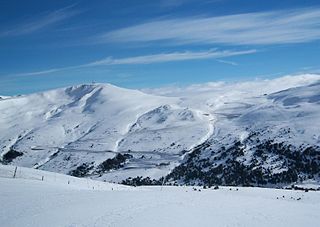
Port d'Envalira is a mountain pass in the Pyrenees in Andorra, that connects El Pas de la Casa with the rest of the country. It is the highest paved road in the Pyrenees. The climb has been featured several times at the Tour de France and Vuelta a España cycling races.
The 2016 Tour de Romandie was a road cycling stage race that took place in the Romandie region of Switzerland between 26 April and 1 May 2016. It was the 70th edition of the Tour de Romandie cycling stage race and the 14th event in the 2016 UCI World Tour. The defending champion was Team Katusha's Ilnur Zakarin.


