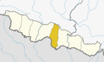
Mahottari District, a part of Province No. 2, is one of the seventy-seven districts of Nepal. The district, with Jaleshwar as its district headquarters, covers an area of 1,002 km2 (387 sq mi) and had a population of 553,481 in 2001 and 627,580 in 2011. Its headquarters is located in Jaleshwar, a neighbouring town of the historical city of Janakpur. The name Jaleshwar means the 'God in Water'. One can find a famous temple of Lord Shiva in Water there. Jaleshwar lies at a few kilometres distance from the Nepal-India border and has a majority Maithili population. In Janakpur zone there are two districts ; mahottari and Dhanusha and both are in a distance of 1 hour.

Sarlahi, a part of Province No. 2, is one of the seventy-seven districts of Nepal. According to new laws, combination of more than 2 or 4 villages makes a municipality, which covers an area of 1,259 km2 (486 sq mi) and had a population of 635,701 in 2001 and 769,729 in 2011.

Bardibas is a municipal area (municipality) and a town located in Mahottari District of Province No. 2 of Nepal. It is located at latitude: 26°54'6.84" to 27°08'46.90" and longitude: 85°47'42.67" to 85°56'42.97". The municipality is surrounded by Dhanusha District in the East and Sarlahi District in the West, Bagmati Pradesh falls in the North and Bhangaha, Aurahi and Gaushala municipalities are located in the South.
Bathnaha is a village development committee in Mahottari District in the Janakpur Zone of south-eastern Nepal. At the time of the 1991 Nepal census it had a population of 7210 people living in 1206 individual households.
Bharatpur, Mahottari is a village development committee in Mahottari District in the Janakpur Zone of south-eastern Nepal. At the time of the 1991 Nepal census it had a population of 6410 people living in 1131 individual households.

Bijayalpura or Bijalpura is a neighborhood or a Tol (Nepali:टोल) in Bardibas city. It was a village development committee in Mahottari District before 2015. In 2015, when Government of Nepal decided to dissolve the old thousands of VDCs and declare new 753 local level body then this VDC merged with Bardibas. Bijalpura is located at ward No. 12 and 13 of Bardibas municipality
Gauribas is a village development committee in Mahottari District in the Janakpur Zone of south-eastern Nepal. At the time of the 1991 Nepal census it had a population of 4308 people living in 810 individual households.
Hariharpur Harinagari is a village development committee in Mahottari District in the Janakpur Zone of south-eastern Nepal. At the time of the 1991 Nepal census it had a population of 5223 people living in 1030 individual households.
Kolhusa Bagaiya is a village development committee in Mahottari District in the Janakpur Zone of south-eastern Nepal. At the time of the 1991 Nepal census it had a population of 5193 people living in 947 individual households.
Lakshminiya is a village development committee in Mahottari District in the Janakpur Zone of south-eastern Nepal. At the time of the 1991 Nepal census it had a population of 7540 people living in 1444 individual households.

Matihani is a town situated in Mahottari district of Nepal. The village is well known for its historical significance and its way of celebrating any festival. It was formed in as a municipality in 2016 occupying current 9 sections (wards) from previous 9 former VDCs. It occupies an area of 29.02 sq. km with a total population of 31,026.
Padaul is a village development committee in Mahottari District in the Janakpur Zone of south-eastern Nepal. At the time of the 1991 Nepal census it had a population of 4806 people living in 868 individual households.
Pokharibhinda Samgrampur is a village development committee in Mahottari District in the Janakpur Zone of south-eastern Nepal. At the time of the 1991 Nepal census it had a population of 3549 people living in 699 individual households.
Raghunathpur, Mahottari is a village development committee in Mahottari District in the Janakpur Zone of south-eastern Nepal. At the time of the 1991 Nepal census it had a population of 4079 people living in 743 individual households.
Sripur is a Village Development Committee in Mahottari District in the Janakpur Zone of south-eastern Nepal. At the time of the 1991 Nepal census it had a population of 7666 people residing in 1472 individual households.
Sonaum is a village development committee in Mahottari District in the Janakpur Zone of south-eastern Nepal. At the time of the 1991 Nepal census it had a population of 2842 people living in 506 individual households.
Suga Bhawani is a village development committee in Mahottari District in the Janakpur Zone of south-eastern Nepal. At the time of the 1991 Nepal census it had a population of 4527 people living in 726 individual households.
Magarthana is a Village Development Committee in Mahottari District in the Janakpur Zone of south-eastern Nepal. At the time of the 1991 Nepal census it had a population of 8971 people residing in 1766 individual households.

Bhiman is a town in Kamalamai Municipality Ward no. 11 in Sindhuli District in the Janakpur Zone of south-eastern Nepal. At the time of the 1991 Nepal census it had a population of 7609 people living in 1389 individual households.

Suryodaya Municipality is a municipality in Ilam district of Nepal. Suryodaya is the Nepali translation for “Sunrise".