Passes-Dangereuses | |
|---|---|
 | |
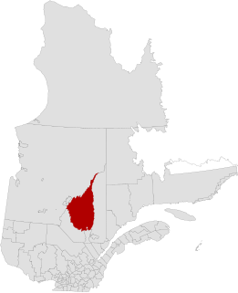
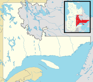
 Passes-Dangereuses Location in Saguenay–Lac-Saint-Jean Quebec. | |
| Coordinates: 48°58′N72°04′W / 48.967°N 72.067°W Coordinates: 48°58′N72°04′W / 48.967°N 72.067°W [1] | |
| Country | |
| Province | |
| Region | Saguenay–Lac-Saint-Jean |
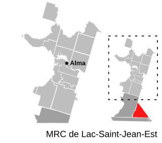
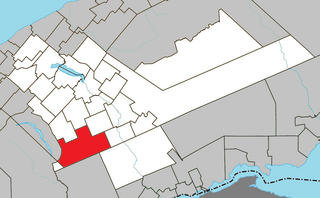
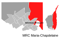
| RCM | Maria-Chapdelaine |
| Constituted | unspecified |
| Government | |
| • Federal riding | Roberval—Lac-Saint-Jean |
| • Prov. riding | Lac-Saint-Jean and Roberval |
| Area | |
| • Total | 16,857.50 km2 (6,508.72 sq mi) |
| • Land | 15,993.30 km2 (6,175.05 sq mi) |
| Population (2011) [3] | |
| • Total | 226 |
| • Density | 0.0/km2 (0/sq mi) |
| • Pop (2006–11) | |
| • Dwellings | 235 |
| Time zone | UTC-5 (EST) |
| • Summer (DST) | UTC-4 (EDT) |
| Area code(s) | 418 and 581 |
Passes-Dangereuses (until May 2009: Chute-des-Passes [4] ) is an unorganized territory in the Canadian province of Quebec, located between the Peribonka River on the east and the Mistassibi River on the west.

The provinces and territories of Canada are sub-national governments within the geographical areas of Canada under the authority of the Canadian Constitution. In the 1867 Canadian Confederation, three provinces of British North America—New Brunswick, Nova Scotia, and the Province of Canada —were united to form a federated colony, becoming a sovereign nation in the next century. Over its history, Canada's international borders have changed several times, and the country has grown from the original four provinces to the current ten provinces and three territories. Together, the provinces and territories make up the world's second-largest country by area.

Quebec is one of the thirteen provinces and territories of Canada. It is bordered to the west by the province of Ontario and the bodies of water James Bay and Hudson Bay; to the north by Hudson Strait and Ungava Bay; to the east by the Gulf of Saint Lawrence and the province of Newfoundland and Labrador; and to the south by the province of New Brunswick and the US states of Maine, New Hampshire, Vermont, and New York. It also shares maritime borders with Nunavut, Prince Edward Island, and Nova Scotia. Quebec is Canada's largest province by area and its second-largest administrative division; only the territory of Nunavut is larger. It is historically and politically considered to be part of Central Canada.

The Peribonka River is a river in the Saguenay-Lac-Saint-Jean area in Quebec, Canada. It is 451 kilometres (280 mi) long and drains an area of 28,200 square kilometres (10,900 sq mi). It drains into Lac Saint-Jean at Pointe-Taillon National Park and is the largest tributary of this lake. The town of Péribonka is located on the north shore of Lac St-Jean at the river's mouth.