Patamea

Last updated
Patamea
Village
Samoa location map.svg
Red pog.svg
Patamea
Coordinates: 13°31′27″S172°18′22″W / 13.52417°S 172.30611°W / -13.52417; -172.30611
Country Flag of Samoa.svg  Samoa
District Gaga'emauga
Population
 (2016)
  Total649
Time zone -11

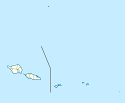
Patamea is a village on the island of Savai'i in Samoa. While most villages on Savai'i are situated near the sea, Patamea is situated inland, away from the coast. The village is in the Gaga'emauga political district near the central north coast of the island. The population is 649. [1]

Contents

Heading north west on the main road from Salelologa township and ferry terminal, the turnoff to Patamea is just before Samalae'ulu village at a T-junction of the road. Turning left (south west direction) at the junction is the road to Patamea, which lies 2 km from the main road. The road is tar sealed to the village.

Geography

The nearest villages to Patamea are Samalae'ulu and Mauga, a village built around the rim of a small volcanic crater. The main tar-sealed road circling Savai'i, which generally follows the coastline around the island where most villages are situated, runs inland where these settlements are located. The main road is considered a life-line for these inland villages for access to schools, churches and nearest hospitals at Tuasivi and Safotu. However, at Samalae'ulu village, the main road crosses a ford at Maliolio River which can become inaccessible during flooding. The river overflowing can also make access to plantations impassable along local roads which cross Molioli River in parts. Loss of access to plantations can have economic and health impacts on the villagers.

In 2007, Patamea and neighbouring villages, came under a Coastal Infrastructure Management Plan by the Government of Samoa [2] to help communities prepare for any type of emergency. Under the plan, the government is responsible for public and district infrastructure while villages are responsible for implementing approved projects locally.

Economy

Like most villages in Samoa, the village of Patamea is based on a cash economy driven by traditional work, mostly in plantations although there is some cattle farming as well as family members working in the capital Apia on the main island Upolu. As the village is situated inland with no coast access, there is little fishing.

In 2006, the Patamea Primary School committee received $245,000 Samoan tala, to rebuild the school, from the Japanese Government Grassroots Human Sector Grant Aid Programme. [3]

Related Research Articles

Savaiʻi Island in the Samoan Islands chain

Savaiʻi is the largest and highest island both in Samoa and in the Samoan Islands chain. The island is also the sixth largest in Polynesia, behind the three main islands of New Zealand and the Hawaiian Islands of Hawaii and Maui.

Salelologa Township & Ferry Terminal in Faasaleleaga, Samoa

Salelologa is a village district at the east end of Savai'i island in Samoa. It is the main entry point into the island with the only ferry terminal on Savai'i. It also serves as the main township for shopping and public amenities with a market selling fresh produce and arts and crafts.

Falealupo Village & Electoral Constituency in Vaisigano, Samoa

Falealupo is a village in Samoa situated at the west end of Savai'i island 20 miles (32 km) from the International Date Line used until 29 December 2011. The village has two main settlements, Falealupo-Uta, situated inland by the main island highway and Falealupo-Tai, situated by the sea. The road to the coastal settlement is about 9 km, most of it unsealed, from the main highway. The village's population is 545.

Gagaʻemauga District in Samoa

Gagaʻemauga is a district on the island of Savaiʻi in Samoa. The district is situated on the central north side of Savaiʻi. The name 'Gagaʻemauga' literally means "near side of the mountain", meaning the eastern side of the mountain chain running through the centre of Savaiʻi Island.

Gagaʻifomauga District in Samoa

Gagaʻifomauga is a political district on the island of Savaiʻi in Samoa. The district is situated on the northern side of the island with a population of 4,878.

Palauli District in Samoa

Palauli is a district and village of Samoa, with a population of 9,300. It consists of two sections on the southern side of Savai'i. The capital is Vailoa which is also referred to as Vailoa i Palauli.

Neiafu, Samoa

Neiafu is a village on the island of Savai'i in Samoa. It is in the Alataua Sisifo electoral district and located at the south west corner of the island. The population of Neiafu Uta is 601 and Neiafu Tai is 307.

Tafua is a seaside village on the island of Savai'i in Samoa. It is situated on a peninsula on the southeast coast of the island in Palauli district. The population is 406.

Matautu is the name of different villages in Samoa. Places named Matautu are found on the two largest islands, Upolu and Savai'i.

Solosolo Village in Atua, Samoa

Solosolo is a village on the northeast coast of Upolu island in Samoa. The village is in the political district of Atua and has a population of 1851. It is one of the prominent settlements in the area with the largest population in its electoral constituency of Anoama'a West.

Aopo Village & Sub-district in Gagaifomauga, Samoa

Aopo is a village in the Gaga'ifomauga district on the island of Savai'i in Samoa. It is situated inland in the central north of the island in the district of Gagaʻifomauga and the electoral district of Gagaʻifomauga 3. The population is 383. The name of the village is derived from two words, ao (day) and po (night) and may be derived from a volcanic eruption.

Satapuala Village in Aana, Samoa

Satapuala is a village situated on the north west coast Upolu island in Samoa. The village is part of A'ana Alofi III Electoral Constituency which forms part of the larger political district A'ana. It has a population of 1963.

Safotu Village in Gagaifomauga, Samoa

Safotu is a village on the central north coast of Savai'i island in Samoa. Safotu is in the district Gagaifomauga and has a population of 1270. Traditionally, it attained the status of 'Pule,' customary political authority, and has been the main centre of the Gagaifomauga district.

Archaeology of Samoa

Archaeology of Samoa began with the first systematic survey of archaeological remains on Savai'i island by Jack Golson in 1957. Since then, surveys and studies in the rest of Samoa have uncovered major findings of settlements, stone and earth mounds including star mounds, Lapita pottery remains and pre-historic artifacts.

Mauga Village in Gagaemauga, Samoa

Mauga is a village in Savai'i island in Samoa. The village is in the Gaga'emauga 1 constituency, a sub-division of the larger Gaga'emauga district. The population is 162.

Tufutafoe is a village on the island of Savai'i in Samoa. It is situated on the west coast of the island in Vaisigano district. The village population is 434.

Samalaeʻulu

Samalaeʻulu is a village on the northeast side of Savaiʻi island in Samoa. The village is situated on the main island highway about a 40-minutes drive north west from Salelologa ferry terminal and township and is part of the electoral constituency of Gaga'emauga 1. The population is 1054, making it one of the more populous villages in Savai'i.

Avao

Avao is a village on the north central coast of Savai'i island in Samoa. The village is part of the electoral constituency of Gaga'emauga 2, which is included in the larger political district of Gaga'emauga.

Vaipouli College

Vaipouli College is a secondary school on Savai'i island in Samoa. The college is co-educational, open to male and female students from Year 9 - 13. The college is also known as Salafai College, in reference to Salafai, another name for the island of Savai'i.

The Maliolio River is one of the largest rivers in the Pacific island nation of Samoa. It is located in the northeast of the island of Savai'i, flowing through the Gaga'emauga district.

References

  1. "Census 2016 Preliminary count" (PDF). Samoa Bureau of Statistics. Retrieved 11 September 2021.
  2. Coastal Infrastructure Management Plan, 2007 Draft, Government of Samoa. Retrieved 31 October 2009
  3. Japan Bulletin, Publication of Japan Embassy, Wellington, New Zealand, No. 2, Vol 29, 2006

Coordinates: 13°29′S172°16′W / 13.483°S 172.267°W / -13.483; -172.267