Kangchenjunga, also spelt Kanchenjunga and Khangchendzonga, is the third highest mountain in the world. Its summit lies at 8,586 m (28,169 ft) in a section of the Himalayas, the Kangchenjunga Himal, which is bounded on the west by the Tamur River, in the north by the Lhonak Chu and Jongsang La, and in the east by the Teesta River. It lies in the border region between the Sikkim state of India and Nepal, with three of the five peaks, namely Main, Central and South, directly on the border, and the peaks West and Kangbachen in Nepal's Taplejung District.

Cho Oyu is the sixth-highest mountain in the world at 8,188 metres (26,864 ft) above sea level. Cho Oyu means "Turquoise Goddess" in Tibetan. The mountain is the westernmost major peak of the Khumbu sub-section of the Mahalangur Himalaya 20 km west of Mount Everest. The mountain stands on the China–Nepal border.

Manaslu is the eighth-highest mountain in the world at 8,163 metres (26,781 ft) above sea level. It is in the Mansiri Himal, part of the Nepalese Himalayas, in the west-central part of Nepal. The name Manaslu means "mountain of the spirit" and is derived from the Sanskrit word manasa, meaning "intellect" or "soul". Manaslu was first climbed on May 9, 1956, by Toshio Imanishi and Gyalzen Norbu, members of a Japanese expedition. It is said that, given the many unsuccessful attempts by the British to climb Everest before New Zealander Edmund Hillary, "just as the British consider Everest their mountain, Manaslu has always been a Japanese mountain".

Shishapangma, also called Gosainthān, is the 14th-highest mountain in the world, at 8,027 metres (26,335 ft) above sea level. It was the last 8,000-metre peak to be climbed, due to its location entirely within Tibet and the restrictions on visits by foreign travelers to the region imposed by Chinese and Tibetan authorities.

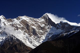
Ama Dablam is a mountain in the eastern Himalayan range of Province No. 1, Nepal. The main peak is 6,812 metres (22,349 ft), the lower western peak is 6,170 metres (20,243 ft). Ama Dablam means "Mother's necklace"; the long ridges on each side like the arms of a mother (ama) protecting her child, and the hanging glacier thought of as the dablam, the traditional double-pendant containing pictures of the gods, worn by Sherpa women. For several days, Ama Dablam dominates the eastern sky for anyone trekking to Mount Everest Base Camp. For its soaring ridges and steep faces Ama Dablam is sometimes referred as the "Matterhorn of the Himalayas." The mountain is featured in one rupee banknote of Nepal.

Saser Kangri is a mountain in India. It is the highest peak in the Saser Muztagh, the easternmost subrange of the Karakoram range. Sasir Kangri is located within Ladakh, the northernmost union territory in India.

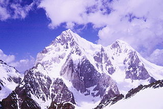
The Buni Zom group is a prominent mountain area of Chitral, in the Hindu Raj range of Pakistan. Buni Zom (main) is the highest peak of the group with an elevation of 6,542 m (21,463 ft). It is located about 50 km (30 mi) northeast of the town of Chitral, and about 50 km (30 mi) east of Tirich Mir, the highest peak in the Hindu Kush.

Namcha Barwa or Namchabarwa is a mountain peak lying in Tibet in the region of Pemako. The traditional definition of the Himalaya extending from the Indus River to the Brahmaputra would make it the eastern anchor of the entire mountain chain, and it is the highest peak of its own section as well as Earth's easternmost peak over 7,600 metres (24,900 ft). It lies in the Nyingchi Prefecture of Tibet. It is the highest peak in the 180 km long Namcha Barwa Himal range, which is considered the easternmost syntaxis/section of the Himalaya in southeastern Tibet and northeastern India where the Himalaya are said to end, although high ranges actually continue another 300 km east.

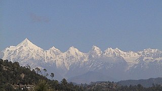
The Panchachuli (पंचाचुली) peaks are a group of five snow-capped Himalayan peaks lying at the end of the eastern Kumaon region, near Dugtu Village Darma valley. The peaks have altitudes ranging from 6,334 metres (20,781 ft) to 6,904 metres (22,651 ft). They form the watershed between the Gori and the Darmaganga valleys. Panchchuli is also located on the Gori Ganga-Lassar Yankti divide. The group lies 138 km (86 mi) from Pithoragarh. The first ascent of this range was done by Indo-Tibet Border Police (ITBP) team in 1972, via Uttari Balati glacier, led by Hukam Singh.
Victor Saunders is a British mountaineer and author. He trained as an architect at the Architectural Association School of Architecture in London. His first book, Elusive Summits, won the Boardman Tasker Prize for Mountain Literature in 1991. He became as a UIAGM/IFMGA ski and mountain guide in 1996 and joined the SNGM in 2003. Saunders first reached the summit of Mount Everest in May 2004, and went on to climb it several more times. In 2020 he became president of the Alpine Club.

Nemjung is a mountain in the Himalayas of Nepal. It is located approximately 150 kilometres (93 mi) northwest of the Nepalese capital Kathmandu and about 25 km northwest of the eight-thousander, Manaslu. Its summit has an elevation of 7,140 metres (23,425 ft).

Kirat Chuli or Tent Peak is a mountain in the Himalayas. It lies on the border between Nepal and India.

Gimmigela Chuli, or The Twins, are two-peak mountains in the Himalayas, located on the border between Taplejung, Mechi, Nepal and Sikkim, India.
The role of The Doon School in Indian mountaineering describes the formative links between The Doon School, an all-boys boarding school in Dehradun, India and early post-Independence Indian mountaineering. From the 1940s onwards, Doon's masters and students like A.E. Foot, R.L. Holdsworth, J.A.K. Martyn, Gurdial Singh, Jack Gibson, Aamir Ali, Hari Dang, Nandu Jayal, were among the first to go on major Himalayan expeditions in a newly independent nation. These early expeditions contributed towards laying the foundation of mountaineering in an independent India.
Bojan Počkar was a Slovenian mountain climber who died on Kabru Mountain in October 1996.

Drago Bregar was a Slovenian mountaineer.

Gangapurna is a mountain in Gandaki Province, Nepal. It is part of the Annapurna mountain range in north-central Nepal at an elevation of 7,455 metres (24,459 ft) and with the prominence of 563 metres (1,847 ft). It was first ascended in 1965 by a German expedition via its south face and east ridge. Gangapurna is entirely located in the Annapurna Conservation Area.
Lugula Himal is a mountain peak in the Himalayas, located on the border of North western region of Nepal and the Tibet Autonomous Region of China.
Ratna Chuli is a mountain peak in the Himalayas on the border of Nepal and Tibet Autonomous Region.


