The Peachland fire started at around 3:00 pm, September 9, 2012, near the Okanagan connector behind the community of Trepanier on the east side of Peachland.
Strong winds, high temperatures, low humidity and extremely dry conditions caused the Peachland fire to grow quickly. By around 7:00 pm, it had reached 200 hectares and burned a path towards Okanagan Lake. At least 1,550 residents were evacuated from the fire zone; four houses and three outbuildings were destroyed.
Seventy firefighters, 17 structural fire protection units and six helicopters fought the Peachland fire at its peak. Light rainfall and cooler temperatures helped bring the fire under control on September 10.
Kelowna is a city on Okanagan Lake in the Okanagan Valley in the southern interior of British Columbia, Canada. It serves as the head office of the Regional District of Central Okanagan. The name Kelowna derives from the Okanagan word kiʔláwnaʔ, referring to a grizzly bear.
Armstrong is a city in the North Okanagan of the Canadian province of British Columbia, between Vernon and Enderby. It overlooks the Spallumcheen Valley, which forms a broad pass between the Okanagan Valley to the south and the Shuswap Country to the north, and is about 480 km (300 mi) from each of Vancouver, B.C. and Spokane, Washington. The City of Armstrong celebrated its centennial in 2013.
Monterey Regional Airport is three miles (5 km) southeast of Monterey, in Monterey County, California, United States. It was created in 1936 and was known as the Monterey Peninsula Airport until the board of directors renamed it on September 14, 2011.
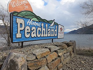
Peachland is a district municipality in the Okanagan Valley on the west side of Okanagan Lake in British Columbia, Canada. It was founded in 1899 by John Moore Robinson, although the region had long been home to the Okanagan people. Peachland is approximately half-an-hour's drive south of the city of Kelowna and about a 20-minute drive north of Summerland. The Okanagan Valley is very narrow in the area and there are few terraces that mark former lake levels and the former lake bottom. As a result, the city is largely located on a steep sidehill. Like many other areas in the Okanagan, Peachland is rapidly growing, with new residents coming from all across Canada. Across the lake from Peachland is Rattlesnake Island, home of the legendary Ogopogo. Peachland is approximately 370 km from Vancouver, British Columbia, on the British Columbia south coast.
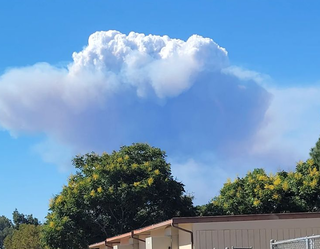
On August 16, 2003, at about 4 a.m. local time, a wildfire started via lightning strike near Rattlesnake Island in Okanagan Mountain Provincial Park, British Columbia, Canada. The wildfire was fuelled by a constant wind and the driest summer on record up to that time. Within a few days it grew into a firestorm.
Okanagan Mountain Provincial Park is a provincial park within the Okanagan-Similkameen Regional District of British Columbia, Canada, focused on the mountain of the same name and located on the east side of Okanagan Lake, opposite Peachland and immediately south of the City of Kelowna. The park is one of the largest in the area, covering 110.38 square kilometres (42.62 sq mi). Most of the park is only accessible by foot, horseback, bicycle, or boat as motor vehicle access is restricted to BC Parks staff and technicians servicing the three telecommunications towers in the park.
West Kelowna, formerly known as Westside and colloquially known as Westbank, is a city in British Columbia's Okanagan Valley on the west shore of Okanagan Lake. The city encompasses several neighbourhoods, including Casa Loma, Gellatly, Glenrosa, Lakeview Heights, Shannon Lake, Smith Creek, Rose Valley, Westbank, and West Kelowna Estates. As of 2021, West Kelowna had an estimated population of 36,078.
Operation Baawar, was a major Afghan-led offensive in Afghanistan west of the city of Kandahar. The operation took place primarily in a sector known as the Horn of Panjwaii. The combat operation started on December 5, 2010. Canadian troops from Task Force Kandahar, including those from the 1st Battalion Royal 22e Régiment Battle Group, worked with the Afghan National Army's 1st Brigade of the 205th (Hero) Corps as part of the larger Operation Hamkari. Part of Operation Baawar included Canadian and Afghan engineering units building 17 kilometres (11 mi) of road between Mushan and Sperwan Ghar.
2014 saw several notable wildfires igniting in California, especially during the month of May, when multiple fires were ablaze concurrently in Southern California, and during September, when several massive wildfires were burning in Northern California. In the context of the 2012–13 North American drought, as well as powerful Santa Ana winds, weather conditions were ideal for wildfires. A total of 7,865 wildfires ignited throughout the year, which burned at least 625,540 acres (2,531.5 km2) of land. The wildfires caused a total of 146 injuries and 2 fatalities, in addition to causing at least $204.05 million in damage.
On July 18, 2009, 3 wildfires broke out around the city of West Kelowna, British Columbia during extremely dry and windy conditions. Over 20,000 people were evacuated as a result of the fires. 9,877 hectares of forest was burned along with 4 buildings. All 3 fires were suspected as human caused but the exact ignition source is still unknown.
The May 2014 San Diego County wildfires were a swarm of 20 wildfires that erupted during May 2014, in San Diego County, California, during severe Santa Ana Wind conditions, historic drought conditions, and a heat wave. The main event during mid-May was preceded by a precursor fire that ignited on May 5. The Bernardo Fire has been declared accidental, and officials believe the Cocos Fire was intentionally set. The causes of the other fires are still under investigation by multiple agencies, and a joint task force was formed to coordinate the investigations and facilitate communications. Six injuries and one fire-related fatality were reported.
The Penticton Aquatic Club was a boathouse, social centre, and clubhouse for aquatic activities in Penticton, British Columbia. Built in 1913 at the foot of Winnipeg Street by Okanagan Lake, it became an important part of Penticton summer life. It was perhaps best known for its annual Aquatic Regatta Day, which featured a variety of activities including a war canoe race. The building was demolished in 1952. The Club's four war canoes are undergoing restoration: one of them is a display at the S.S. Sicamous Heritage Park.
The Boles Fire was a wildfire that burned in Siskiyou County during mid-September 2014. On September 15, at 1:38 p.m. PDT, the Boles Fire ignited near Weed, California. Later on the same day, at 10:30 p.m. PDT, the Boles Fire was reported at 350 acres and 15% containment. Over 100 structures were reported damaged or destroyed on that day. Later that day, the wildfire was reported at nearly 100% containment; however, this report turned out to be erroneous. On September 16, the Boles Fire had burned 375 acres (152 ha) and was only 20% contained. It also destroyed 150 residences and forced the evacuation of 1,500 people in Weed and Siskiyou County.
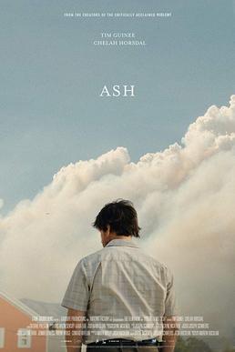
Ash is a 2019 Canadian drama film directed by Andrew Huculiak and starring Tim Guinee, Chelah Horsdal, Eric Keenleyside, and Cameron Crosby. It is the second film directed by Huculiak and the second feature-length film produced by the Vancouver-based production company Amazing Factory Productions. The film premiered at the 2019 Vancouver International Film Festival and is currently making a festival run internationally.
The Grant Fire was a wildfire that burned east of the city of Sacramento near the rural community of Sloughhouse in Sacramento County, California in the United States. It was reported on the afternoon of Friday, June 12, near Grant Line Road the fire quickly grew to the size of 5,042 acres (2,040 ha) as it burned predominantly in light flashy fuels and grasslands as it was fanned by heavy winds in the area. There were no reports of injuries and only one structure was damaged in the fire. However, during the fires peak there were mandatory evacuations ordered near and around Glory Lane and Prairie City OHV Park.
The Route Fire was a wildfire that burned during the 2022 California wildfire season, along Interstate 5 near the community of Castaic in Los Angeles County, California during a dramatic state-wide heatwave in late August and early September, 2022. At least seven firefighters sustained heat-related injuries, while two structures were destroyed and 5,208 acres (2,108 ha) burned.
The McDougall Creek Fire was a wildfire in the Okanagan region of British Columbia, Canada as part of the 2023 Canadian wildfires. It started near West Kelowna on August 15, 2023, and was discovered at 5:59 pm PDT. The wildfire forced the evacuation of West Kelowna and parts of Kelowna.
The Line Fire was a large wildfire that burned in San Bernardino County, California. The fire began on September 5, 2024, at 6:33 PM PDT near the community of Highland and spread into the San Bernardino National Forest. The fire forced the evacuation of multiple communities. On September 10, the San Bernardino County Sheriff's Department identified and arrested 34-year-old Justin Wayne Halstenberg, a resident of Norco, on suspicion of starting the fire on September 5. As of December 23, 2024, the Line Fire is reported as 100 percent contained at 43,978 acres.
This page is based on this Wikipedia article Text is available under the CC BY-SA 4.0 license; additional terms may apply. Images, videos and audio are available under their respective licenses.