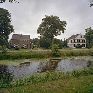
Drenthe is a province of the Netherlands located in the northeastern part of the country. It is bordered by Overijssel to the south, Friesland to the west, Groningen to the north, and the German state of Lower Saxony to the east. As of November 2019, Drenthe had a population of 493,449 and a total area of 2,680 km2 (1,030 sq mi).

Assen is a municipality and a city in the northeastern Netherlands, and is the capital of the province of Drenthe. It received city rights in 1809. Assen is known for TT Circuit Assen, the motorcycle racing circuit, where on the last Sunday in June the Dutch TT is run; and also for the annual Assen Dance Festival.

Orvelte is a village in the Dutch province of Drenthe. It is a part of the municipality of Midden-Drenthe, and lies about 18 km northeast of Hoogeveen.

Peize is a village in the Dutch province of Drenthe. Located in the northern part of Drenthe approximately 10 kilometers south of the city of Groningen. It is part of the municipality of Noordenveld, located between Roden and Eelde.

Groningen Airport Eelde is a minor international airport in the northeastern Netherlands. It is located near Eelde in the Province of Drenthe, 4.8 nautical miles south of the city of Groningen in the province of Groningen. In 2015, the airport handled 220,710 passengers. The airport is also the home base of the KLM Flight Academy, Noord Nederlandse Aero Club (NNAC) and General Enterprises.

Norg is a village in the northeastern Netherlands. It is located in the municipality of Noordenveld, Drenthe. It used to be an independent municipality until 1998. Norg is home to two windmills.

Twist is a municipality in the Emsland district, in Lower Saxony, Germany. It is situated directly on the Dutch border.

Havelte is a village in the Northeastern Netherlands. It is located in the municipality of Westerveld, Drenthe, about 60 km (37.2 mi) south-southwest of Groningen and 120 km (74.5 mi) northeast of Amsterdam. As of 1 January 2021, it had a population of 3,825.

Odoorn is a village in the Dutch province of Drenthe. It is a part of the municipality of Borger-Odoorn, and lies about nine km north of Emmen.

Erica is a town in the north-eastern Netherlands. It is located in Emmen, Drenthe. It started as a peat and buckwheat colony.

Ruinerwold is a village in the Dutch province of Drenthe. It is located in the municipality of De Wolden, about 6 km northeast of Meppel.

Nietap is a village in the Netherlands and is part of the Noordenveld municipality in Drenthe.

Roderesch is a village in the Netherlands, and is part of the Noordenveld municipality in Drenthe.

Veenhuizen is a village with around 800 inhabitants in the province of Drenthe in the Netherlands. In the early 19th century, a reform housing colony for the poor and homeless was established in Veenhuizen by the Society of Benevolence. In the late 19th century, the complex was turned into a penal colony. The village became freely accessible in 1984 and has been part of the municipality of Noordenveld since 1998. The National Prison Museum is located here. Along with other colonies established by the Society of Benevolence, Veenhuizen was inscribed on the UNESCO World Heritage List in 2021, for its testimony to a unique method of housing reform and its urban planning

Zuidvelde is a village in the Netherlands and it is part of the Noordenveld municipality in Drenthe.

Westervelde is a village in the Netherlands and part of the Noordenveld municipality in Drenthe.

Loon is a village in the Netherlands and is part of the Assen municipality in Drenthe. The hunebed (dolmen) D15 is located near the village.

Appelscha is a village in the municipality of Ooststellingwerf in the province of Friesland, Netherlands. It has just under 4,800 inhabitants.

De Hoop is a smock mill in Norg, Drenthe, the Netherlands. It was built in 1857 and is listed as a Rijksmonument, number 30781.

The Bourtanger Moor was a bog in eastern parts in the Dutch provinces of Drenthe and Groningen and the bordering German districts of Bentheim and Emsland. A remaining stretch on the border between Drenthe and the districts Emsland and Betheim is now a nature reserve, the Internationaler Naturpark Bourtanger Moor-Bargerveen.


