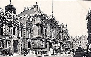
The West End of London is a district of Central London, London, England, west of the City of London and north of the River Thames, in which many of the city's major tourist attractions, shops, businesses, government buildings and entertainment venues, including West End theatres, are concentrated.

The Prospect of Whitby is a historic public house on the northern bank of the River Thames at Wapping, in the East End of London and the London Borough of Tower Hamlets. It lays claim to being the site of the oldest riverside tavern, dating from around 1520.

The Northern line is a London Underground line that runs from North London to South London. It is printed in black on the Tube map. The Northern line is unique on the Underground network in having two different routes through central London, two southern branches and two northern branches. Despite its name, it does not serve the northernmost stations on the Underground, though it does serve the southernmost station at Morden, the terminus of one of the two southern branches.

The Metropolitan Borough of Kensington was a metropolitan borough in the County of London from 1900 to 1965, which since 1901 was known as the Royal Borough of Kensington, following the death of Queen Victoria, in accordance with her wishes.

The Colne is a river and a tributary of the River Thames in England. Just over half its course is in south Hertfordshire. Downstream, it forms the boundary between Buckinghamshire and the London Borough of Hillingdon. The confluence with the River Thames is on the Staines reach at Staines-upon-Thames.
Telehouse is a major carrier-neutral colocation, information and communications technology services provider based in Docklands, London. Established in 1988, it operates eight facilities in London, Paris and Frankfurt. Part of the global Telehouse network of data centres, the brand has 45 colocation facilities in 26 major cities around the world including Moscow, Istanbul, Johannesburg, Cape Town, Beijing, Shanghai, Hong Kong, Singapore, Vietnam, Seoul, Tokyo, New York and Los Angeles. KDDI, Telehouse's Japanese telecommunications and systems integration parent company, operates data centre facilities in America and Asia.
The EC postcode area, also known as the London EC postal area, is a group of postcode districts in central London, England. It includes almost all of the City of London and parts of the London boroughs of Islington, Camden, Hackney, Tower Hamlets and Westminster. The area covered is of very high density development. Deliveries for the EC postcode area are made from Mount Pleasant Mail Centre.
The WC postcode area, also known as the London WC postcode area, is a group of postcode districts in central London, England. The area covered is of high density development, and includes parts of the City of Westminster and the London Boroughs of Camden and Islington, plus a very small part of the City of London.
Wetherby School is a group of private schools for boys aged two to eighteen in Notting Hill, Kensington, and Marylebone, London, owned and operated by the Inspired Education Group. Its prep school is a member of the Independent Association of Preparatory Schools.

Kensington is a former constituency in Greater London which first existed between 1974 and 1997 and was recreated in 2010. Since 2019, it has been represented in the House of Commons of the UK Parliament by Felicity Buchan of the Conservative Party. On 29 November 2023, it was replaced by the Kensington and Bayswater constituency, and will be first contested at the next general election.

Lincoln Square is the name of both a square and the surrounding neighborhood on the Upper West Side of Manhattan in New York City. Lincoln Square is centered on the intersection of Broadway and Columbus Avenue, between West 65th and 66th streets. The neighborhood is bounded by Columbus and Amsterdam avenues to the east and west, and 66th and 63rd streets to the north and south, respectively. However, the term can be extended to refer to the neighborhood between 59th and 72nd streets. It is bounded by Hell's Kitchen, Riverside South, Central Park, and the Upper West Side proper. The Walt Disney Company’s New York City campus is located here, including ABC, ESPN, Hulu and studios for WABC-TV.

St Michael's Wood Street was a church and parish of medieval origin in Cripplegate Ward in the City of London, and is first mentioned in 1225 as St. Michael de Wudestrate. It stood on the west side of Wood Street, initially with a frontage on Huggin Lane but later on Wood Street itself.

St Saviour's is an Anglo-Catholic church in Pimlico, City of Westminster, London, England, located at the north end of St George's Square. It was constructed in the 1860s as part of Thomas Cubitt's development of the area on behalf of the Marquess of Westminster. The church was designed by Thomas Cundy, who had previously built St Gabriel's Pimlico a short distance away. As with St Gabriel's, St Saviour's was designed in the Gothic style and built in ragstone to emphasise the contrast with the classical stucco of its secular neighbours. The church is Grade II listed.

Boyle Street is a short street in central London that is named after the Boyles, the Earls of Burlington, and is on land that was once part of the Burlington Estate.

The Lamb and Flag is a Grade II listed public house at Rose Street, Covent Garden, London, WC2.

The Paddington Canal or Paddington Arm of the Grand Union Canal is a 13+1⁄2-mile (22 km) canal to Paddington in central London, England. It runs from the west of the capital at Bull's Bridge in Hayes. Little Venice — its only junction — is with the Regent's Canal, London that runs to Limehouse Basin to the east. The arm and the two canals it links are fed by water by the Brent Reservoir. The Paddington Arm is part of a long pound that stretches for nearly thirty miles.

The Lancaster Gate Memorial Cross is a grade II listed war memorial in Lancaster Gate, London, commemorating residents of the Metropolitan Borough of Paddington who died fighting in the First World War.

Chepstow Place is a street in London that runs from the junction of Westbourne Grove and Pembridge Villas in the north to Pembridge Square in the south. It is crossed by Dawson Place and joined on its eastern side by Rede Place. The east side is in the City of Westminster and the west side in the Royal Borough of Kensington and Chelsea.

Staunton on Arrow is a village and civil parish in the county of Herefordshire, England. The village is 17 miles (27 km) north-west of Hereford and 8 miles (13 km) to the west of Leominster. Within the parish is the site of the Iron Age hill fort of Wapley Hill.

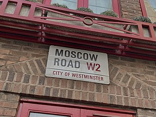
Moscow Road is a street in the Bayswater area of London. Located in the City of Westminster, it runs eastwards from Queensway to Pembridge Square. It was developed by the painter, publisher, and property pioneer Edward Orme in 1814–15, as part of the rapid expansion of the city in the Regency era. It was named in commemoration of Tsar Alexander's participation in the Allied sovereigns' visit to England as part of the victory celebrations following the Napoleonic Wars. An adjacent street was named Petersburgh Place. During the nineteenth century Moscow Road became a centre of the Greek diaspora in London. In 1879 the Greek Orthodox Saint Sophia was opened as a church on the road, and in 1922 became a cathedral. The residential Ossington Street runs off it. Several pubs are today located along the road.


