
Snowdonia, or Eryri, is a mountainous region and national park in North Wales. It contains all 15 mountains in Wales over 3000 feet high, including the country's highest, Snowdon, which is 1,085 metres (3,560 ft) tall. These peaks are all part of the Snowdon, Glyderau, and Carneddau ranges in the north of the region. The shorter Moelwynion and Moel Hebog ranges lie immediately to the south.

Snowdon, or Yr Wyddfa, is a mountain in Snowdonia in North Wales. It has an elevation of 1,085 metres (3,560 ft) above sea level, which makes it both the highest mountain in Wales and the highest in the British Isles south of the Scottish Highlands. Snowdon is designated a national nature reserve for its rare flora and fauna, and is located within Snowdonia National Park.

The Glyderau are a mountain group in Snowdonia, North Wales. The name derives from the highest peaks in the range, Glyder Fawr and Glyder Fach. According to Sir Ifor Williams, the word "Glyder" derives from the Welsh word "Cludair", meaning a heap of stones.

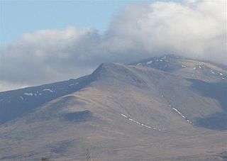
The Carneddau are a group of mountains in Snowdonia, Wales. They include the largest contiguous areas of high ground in Wales and England, as well as six or seven of the highest peaks in the country—the Fifteen Peaks. The range also encloses a number of lakes such as Llyn Cowlyd and Llyn Eigiau, and the Aber Falls waterfall. It is delimited by the Irish Sea to the north, the Conwy valley to the east, and by the A5 road from Betws-y-Coed to Bethesda to the south and west. The area covers nearly 200 square kilometres (80 sq mi), about 10% of the area of Snowdonia. The area is bordered by three main roads—the A55, the A5 to the south and the A470 to the east.

Glyder Fawr is a mountain in Snowdonia, Wales, the highest peak in the Glyderau range at just over 1,000 metres. It is the fifth-highest mountain in Wales and has several walking and scrambling routes leading to its summit. According to Sir Ifor Williams, the word "Glyder" derives from the Welsh word "Gludair", meaning a heap of stones.

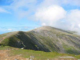
Carnedd Llewelyn, also spelled Carnedd Llywelyn, is a mountain massif in the Carneddau range in Snowdonia, north-west Wales. It is the highest point of the Carneddau at 1,064m (3,491ft) and the second highest peak by relative height in Wales, 49th in the British Isles and lies on the border between Gwynedd and Conwy.

Moel Hebog is a mountain in Snowdonia, north Wales which dominates the view west from the village of Beddgelert. It gives name to a whole range of peaks in the north-western corner of Snowdonia, which include the Nantlle Ridge and Mynydd Mawr.
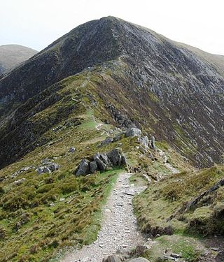
Carnedd Dafydd is a mountain peak in the Carneddau range in Snowdonia, Wales, and is the third highest peak in Wales, or the fourth if Crib y Ddysgl on the Snowdon ridge is counted. Situated south-west of Carnedd Llewelyn and north of Pen yr Ole Wen, Carnedd Dafydd is on the main ridge of the Carneddau, and on the border between Gwynedd and Conwy. The average annual temperature of the mountain is around 3–4 °C (37–39 °F).

Pen yr Ole Wen is the seventh highest mountain in Snowdonia and in Wales. It is the most southerly of the Carneddau range.
Pen yr Helgi Du is a mountain peak in the eastern part of the Carneddau in Snowdonia, North Wales.
Yr Elen is a mountain in the Carneddau range in Snowdonia, Wales. It is the ninth highest mountain in Snowdonia. The average annual temperature of the peak is around 4 °C (39 °F). It lies on a short ridge running north-northwest off the main northeast-to-southwest ridge of the Carneddau, just over one kilometre from Carnedd Llewelyn.

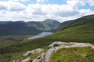
Llyn Cowlyd is the deepest lake in northern Wales. It lies in the Snowdonia National Park at the upper end of Cwm Cowlyd on the south-eastern edge of the Carneddau range of mountains, at a height of 330 metres (1,083 ft) above sea level. The lake is long and narrow, measuring nearly 3 kilometres (2 mi) long and about 500 m wide, and covers an area of 1.1 square kilometres. It has a mean depth of 33 metres (108 ft) and at its deepest has given soundings of 70 metres (230 ft), this being some 14 m (46 ft) greater than its natural depth, the water surface having been raised twice by the building of dams.
Llyn Eigiau is a lake on the edge of the Carneddau range of mountains in Snowdonia, Conwy, Wales. The name Eigiau is thought to refer to the shoals of fish which once lived here. Early maps refer to it as Llynyga. It is thought that a small number of Arctic char exist in the lake after they were transferred here from Llyn Peris, and certainly it is one of the few lakes in Wales to have its own natural brown trout. The lake is surrounded by mountains including Pen Llithrig y Wrach.
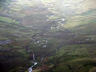
Afon Eigiau is a small river in the Carneddau mountains in Snowdonia, in north-west Wales, which flows down Cwm Eigiau and into Llyn Eigiau.

Tal-y-Bont is a small village in Conwy County Borough, Wales and lies in the Conwy Valley, west of the River Conwy, on the B5106 road, 6 mi (9.7 km) from the town of Conwy to the north, and six miles from Llanrwst to the south, and in the community of Caerhun. It lies adjacent to the village of Dolgarrog to the south, and below the small settlement of Llanbedr-y-Cennin to the west. The population is around 400.

Tal y Fan is an outlying peak of the Carneddau mountains in North Wales. It is one of the four Marilyns that make up the Carneddau, the others being Carnedd Llywelyn, Pen Llithrig y Wrach and Creigiau Gleision.
Craiglwyn is a top of Creigiau Gleision in Snowdonia, Wales, near Capel Curig. It lies at the south end of the Creigiau Gleision ridge, and offers good views of Carnedd Dafydd, Pen yr Helgi Du, Pen Llithrig y Wrach, Gallt yr Ogof, Tryfan and Moel Siabod.

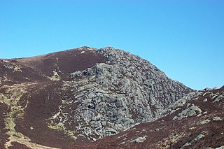
Craig Eigiau is a top of Foel Grach in the Carneddau range in Snowdonia, North Wales, Wales.

Creigiau Gleision is a mountain in Snowdonia, Wales, near Capel Curig. It is the easternmost of the high Carneddau and is separated from the others by Llyn Cowlyd. Directly across this reservoir from Creigiau Gleision is Pen Llithrig y Wrach. To the north-east it runs into the broad ridge of Cefn Cyfarwydd.

Carnedd y Filiast is a mountain near Cerrigydrudion on the border of the Snowdonia National Park, North Wales and is 669 metres (2,195 ft) high.


