Penycloddiau

Last updated

Penycloddiau
Penycloddiau hillfort, Wales.jpg
Penycloddiau hill fort
Highest point
Elevation 440 m (1,440 ft) [1]
Prominence 156 m (512 ft)
Parent peak Moel Famau
Listing Marilyn
Naming
English translationhill of the trenches
Language of name Welsh
PronunciationWelsh: [pɛnəˈklɔðjai]
Geography
Location Flintshire, Wales
Parent range Clwydian Range
OS grid SJ127678 [1]
Topo map OS Landranger 116 [1]

Penycloddiau is a hill in Flintshire, Wales, and one of five Marilyns in the Clwydian Range.

Contents

The hill, like Foel Fenlli and Moel Arthur to the south, has an Iron Age hillfort at its summit. [2] It covers 26 hectares (64 acres) making it one of the largest hillforts in Wales. [2] In 2017, excavations by the Clywdian Range Archaeology Group (CRAG) unearthed a significant number of 4,000-year-old stone tools from the Bronze Age, the discovery indicates human activity occurred much earlier than first thought in the area. [3]

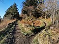
Penycloddiau is crossed by the Offa's Dyke Path and the Clwydian Way, two long distance footpaths that traverse the hills in this area. A free car park exists at the bwlch between Penycloddiau and Moel Arthur, where two footpaths lead to the summit. [4]

See also

Related Research Articles

<span class="mw-page-title-main">Offa's Dyke Path</span> Footpath in Wales and England

Offa's Dyke Path is a long-distance footpath loosely following the Wales–England border. Officially opened on 10 July 1971, by Lord Hunt, it is one of Britain's National Trails and draws walkers from throughout the world. About 60 miles (97 km) of the 177-mile (285 km) route either follows, or keeps close company with, the remnants of Offa's Dyke, an earthwork traditionally thought to have been constructed in the late 8th century on the orders of King Offa of Mercia.

<span class="mw-page-title-main">Flintshire (historic)</span> Historic county of Wales

Until 1974, Flintshire, also known as the County of Flint, was an administrative county in the north-east of Wales, later classed as one of the thirteen historic counties of Wales.

<span class="mw-page-title-main">Moel Famau</span> Hill in the Clwydian Range

Moel Famau is the highest hill in the Clwydian Range and the highest point of the county of Flintshire in Wales. It lies on the boundary between Denbighshire and Flintshire. The hill, which also gives its name to the Moel Famau country park, has been classed as an Area of Outstanding Natural Beauty since 1985. It is also surrounded by several well-preserved Iron Age hill forts. It is also the third-highest peak in the extended AONB of the Clwydian Range and Dee Valley.

<span class="mw-page-title-main">Arenig Fawr</span>

Arenig Fawr is a mountain in Snowdonia, North Wales, close to Llyn Celyn reservoir, alongside the A4212 between Trawsfynydd and Bala.

<span class="mw-page-title-main">Foel Fenlli</span> Hill in Denbighshire, Wales

Foel Fenlli or Moel Fenlli is a hill in Denbighshire, North Wales. With a summit at an elevation of 511 metres (1,677 ft), it is the second highest peak of the Clwydian Range.

<span class="mw-page-title-main">Clwydian Range</span> Hill range in Wales

The Clwydian Range is a series of hills in the north-east of Wales that runs from Llandegla in the south to Prestatyn in the north; the highest point is 554 m (1,818 ft) Moel Famau. The range forms the north-western part of the Clwydian Range and Dee Valley Area of Outstanding Natural Beauty.

The North Wales Path is a long-distance walk of some 60 miles (97 km) that runs close to the coast of northern Wales between Prestatyn in the east and Bangor in the west. Parts of it overlap with the Wales Coast Path. The path runs along parts of the Clwydian Range and Dee Valley Area of Outstanding Natural Beauty (AONB). The path was devised, implemented and maintained by the then Countryside Council for Wales and the three councils of: Gwynedd, Conwy, and Denbighshire.

<span class="mw-page-title-main">Llanferres</span> Village in Denbighshire, Wales

Llanferres is a village and community in the county of Denbighshire in Wales. At the 2001 Census the population of the village was recorded as 676, increasing to 827 at the 2011 census.

<span class="mw-page-title-main">Bwlch Penbarras</span> Mountain pass in Wales

Bwlch Penbarras is a mountain pass in the Clwydian Range and Dee Valley Area of Outstanding Natural Beauty, in north-east Wales. The gap, which is at an altitude of 360 m (1,180 ft), lies between the hills of Moel Famau and Foel Fenlli. An unclassified road between Tafarn-y-Gelyn and Llanbedr-Dyffryn-Clwyd runs from east to west through the pass. Offa's Dyke Path, running broadly south–north, crosses the road at its highest point.

<span class="mw-page-title-main">Clwyd-Powys Archaeological Trust</span> Welsh archaeological charity

The Clwyd-Powys Archaeological Trust is an educational charity which was established in 1975. Its objective is ‘to advance the education of the public in archaeology’. CPAT is one of four Welsh Archaeological Trusts (WATs) which work to help protect, record and interpret all aspects of the historic environment. This includes providing advice to local authorities on archaeology and planning, undertaking archaeological projects for private- and public-sector clients, and delivering a programme of community archaeology events and activities.

<span class="mw-page-title-main">Long Mountain (Powys)</span>

Long Mountain is a hill straddling the boundary between Powys (Wales) and Shropshire (England) to the east of Welshpool though the summit at 408 metres at Beacon Ring is within Wales. Long Mountain is a Marilyn, having a prominence of 305 metres.

<span class="mw-page-title-main">Moel y Gaer, Rhosesmor</span> Hillfort in Flintshire

Moel y Gaer is an Iron Age hillfort located on a summit at the southern end of Halkyn Mountain, overlooking the village of Rhosesmor, Flintshire, Wales. It is a well-preserved hillfort overlooking the Dee Estuary. Excavations in the early 1970s revealed a sequence of defensive structures made of timber and several phases of building work inside the ramparts.

<span class="mw-page-title-main">Moel y Gaer, Bodfari</span> Iron Age hillfort in Denbighshire, Wales

Moel y Gaer is an Iron Age hillfort at the northern end of the Clwydian Range, located on a summit overlooking the valley of the River Wheeler, near the village of Bodfari, Denbighshire, Wales, five miles north-east of Denbigh. The site is a scheduled monument, classified as a prehistoric defensive hillfort.

<span class="mw-page-title-main">Moel y Gaer, Llanbedr</span> Iron Age hillfort in Denbighshire, Wales

Moel y Gaer, also known as Moel-y-Gaer Camp or Moel y Gaer Hillfort, is an Iron Age hillfort located on a western spur of the Clwydian Range, near the village of Llanbedr, Denbighshire, Wales. The site is a scheduled monument, classified as a prehistoric defensive hillfort.

<span class="mw-page-title-main">Moel y Gaer, Llantysilio</span> Hillfort in Denbighshire, Wales

Moel y Gaer is an Iron Age hillfort on a summit of Llantysilio Mountain, northwest of the town of Llangollen, Denbighshire, Wales. The site is a scheduled monument classified as a prehistoric defensive hillfort.

Esclusham Mountain is an area in Wrexham County Borough, Wales, United Kingdom, and is part of the Ruabon Moors. It rises to a height of 460 m, with the nearby spur of Cyrn-y-Brain, to the west, reaching 473 m. It lies mostly within the community of Esclusham. A smaller spur to the north, known as Minera Mountain, is within the neighbouring community of Minera.

<span class="mw-page-title-main">Moel Hiraddug</span> Hillfort in Denbighshire, Wales

Moel Hiraddug, also known as Y Foel, is a hill fort and hill in the Clwydian Range of north-east Wales. The northern part of the hill has been eaten away by limestone quarrying. An Iron Age hillfort crowns the hill, called Moel Hiraddug. Its ridge runs North-South and it lies above the village of Dyserth. The views from the top are extensive and include Snowdonia. It is 265 metres above sea level.

<span class="mw-page-title-main">Aberwheeler</span> Village in Denbighshire, Wales

Aberwheeler is a village and community in the Welsh county of Denbighshire, located on the south bank of the River Wheeler, 4.2 miles (6.8 km) north east of Denbigh, 12.6 miles (20.3 km) north west of Mold and 11.0 miles (17.7 km) north of Ruthin. At the 2001 census the community had a population of 327, reducing to 298 at the 2011 census. The name has been Anglicised from the Welsh.

<span class="mw-page-title-main">Moel Arthur</span> Iron age hillfort in Flintshire, Wales

Moel Arthur is an Iron Age hillfort in Flintshire, Wales, at the boundary with Denbighshire, about 5 miles (8.0 km) east of Denbigh.

<span class="mw-page-title-main">Clwydian Range and Dee Valley</span> Area of Outstanding Natural Beauty in Wales

The Clwydian Range and Dee Valley is a designated Area of Outstanding Natural Beauty (AONB) located in north-east Wales, covering the Clwydian Range, and the valley of the River Dee.

References

  1. 1 2 3 Alan Dawson (1992). Relative Hills of Britain. Cicerone Series. Cicerone Press Limited. p. 125. ISBN   978-1-85284-068-6.
  2. 1 2 John Davies; Nigel Jenkins; Menna Baines, eds. (2008). The Welsh Academy encyclopaedia of Wales. University of Wales Press. pp. 151, 981. ISBN   978-0-7083-1953-6.
  3. "Bronze Age tools unearthed in Clwydian range hillforts dig". BBC News. 7 September 2017.
  4. "Penycloddiau". Sustainable Days Out. Retrieved 19 January 2020.

Further reading

53°12′00″N3°18′30″W / 53.20008°N 3.30834°W / 53.20008; -3.30834