
Salamanca is a province of western Spain, in the western part of the autonomous community of Castile and León. It is bordered by the provinces of Zamora, Valladolid, Ávila, and Cáceres, and on the west by Portugal. It has an area of 12,349 km2 and in 2018 had a population of 331,473 people. It is divided into 362 municipalities, 11 comarcas, 32 mancomunidades and five judicial districts. Of the 362 municipalities, more than half are villages with fewer than 300 people.

Cáceres is a city and Spanish municipality located in the center of the autonomous community of Extremadura. It is the capital and most populated municipality of the province of Cáceres and houses the headquarters of the Superior Court of Justice of Extremadura.

Alcántara is a municipality in the province of Cáceres, Extremadura, Spain, on the Tagus, near Portugal. The toponym is from the Arabic word al-Qanṭarah (القنطرة) meaning "the bridge".
Cáceres is a Spanish surname and placename and may refer to:
Alcantara, Alcântara (Portuguese), Alcántara (Spanish), Alcàntara, Alcàntera, El-Qantarah and (El) Kantara are all transliterations of the Arabic word al-qantara (القنطرة), meaning "the bridge".
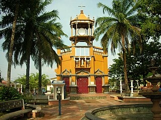
Cáceres is a town and municipality in the Colombian department of Antioquia.

Logrosán is a municipality within the province of Cáceres in Extremadura, Spain. It is the capital of the administrative and commercial sub-area of Don Benito-Villanueva. Logrosán was an important and growing community in the first half of the 20th century. The area was once home to a population of over 8,000 due to its large role in the Mining industry during the 19th and 20th centuries. It is currently administered by the City Council of Logrosán.
Peraleda del Zaucejo is a municipality in the province of Badajoz, Extremadura, Spain. According to the 2014 census, the municipality has a population of 562 inhabitants.
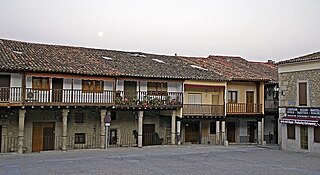
Casar de Cáceres is a town and municipality in the province of Cáceres, in the autonomous community of Extremadura. With 4532 inhabitants in 2017, it is the second most populous municipality in the Tajo-Salor Mancomunidad. In the municipality there are two population centers: Casar de Cáceres and La Perala. The capital of the municipality is located about 10 kilometers from the capital of Caceres, in the middle of Vía de la Plata.

Garrovillas de Alconétar is a municipality located in the province of Cáceres, Extremadura, Spain. According to the 2005 census (INE), the municipality has a population of 2372 inhabitants.

Losar de la Vera is a municipality located in the province of Cáceres, Extremadura, Spain. According to the 2009 Extremadura Social-economic Atlas, the municipality has a population of 2988 inhabitants: 1555 men and 1433 women. The size of the municipality is 82 hectares.
Peraleda de la Mata is a municipality located in the province of Cáceres, Extremadura, Spain. According to the 2014 census, the municipality has a population of 1420 inhabitants.

Coria is a municipality of Spain belonging to the province of Cáceres, Extremadura. In addition to the town of the same name, the municipality also comprises the settlements of Puebla de Argeme and Rincón del Obispo. With a population of has 12,531 inhabitants, Coria is the fourth most-populated municipality in the province.

Abertura is a municipality in the province of Cáceres and autonomous community of Extremadura, Spain. The municipality covers an area of 62.71 square kilometres (24.21 sq mi) and as of 2011 it had a population of 447 people.

Aceituna is a municipality in the province of Cáceres and autonomous community of Extremadura, Spain. The municipality covers an area of 620 square kilometres (240 sq mi) and as of 2011 had a population of 620 people.
Cuacos de Yuste is a municipality in the province of Cáceres and autonomous community of Extremadura, Spain. The municipality covers an area of 52.6 square kilometres (20.3 sq mi) and as of 2011 had a population of 902 people. It is best known for the Monastery of Yuste, where Charles V, Holy Roman Emperor, retired and died.
Navalvillar de Ibor is a municipality located in the province of Cáceres, in the autonomous community of Extremadura, Spain. The municipality covers an area of 54.5 square kilometres (21.0 sq mi) and as of 2011 had a population of 484 people.

Villar de Plasencia is a municipality located in the province of Cáceres, in the autonomous community of Extremadura, Spain. The municipality covers an area of 24.99 square kilometres (9.65 sq mi) and as of 2011 has a population of 243 people.

The Dolmen of Guadalperal, also known as the Treasure of Guadalperal and as the Spanish Stonehenge for its resemblance to the English Stonehenge, is a megalithic monument dating from around 5000 BC and are thus 2000 years older than the earliest phases of Stonehenge. in Peraleda de la Mata, a town in the region of Campo Arañuelo in eastern Extremadura, Spain. The monument is within the Valdecañas reservoir in the Tagus River and is only visible when the water level allows it.


