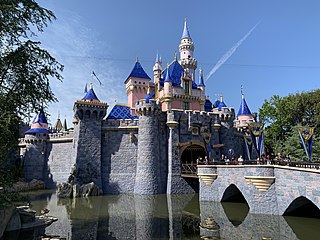
Anaheim is a city in northern Orange County, California, United States, part of the Greater Los Angeles area. As of the 2020 census, the city had a population of 346,824, making it the most populous city in Orange County, the tenth-most populous city in California, and the 55th-most populous city in the United States. The second largest city in Orange County in terms of land area, Anaheim is known for being the home of the Disneyland Resort, the Anaheim Convention Center, and two professional sports teams: the Los Angeles Angels of Major League Baseball (MLB) and the Anaheim Ducks of the National Hockey League (NHL). It also served as the home of the Los Angeles Rams of the National Football League (NFL) from 1980 through 1994.

The Santa Monica Mountains are a coastal mountain range in Southern California, next to the Pacific Ocean. It is part of the Transverse Ranges. The Santa Monica Mountains National Recreation Area encompasses this mountain range. Because of its proximity to densely populated regions, it is one of the most visited natural areas in California.

The San Gabriel Mountains comprise a mountain range located in northern Los Angeles County and western San Bernardino County, California, United States. The mountain range is part of the Transverse Ranges and lies between the Los Angeles Basin and the Mojave Desert, with Interstate 5 to the west and Interstate 15 to the east. The range lies in, and is surrounded by, the Angeles and San Bernardino National Forests, with the San Andreas Fault as its northern border.

State Route 91 (SR 91) is a major east–west state highway in the U.S. state of California that serves several regions of the Greater Los Angeles urban area. A freeway throughout its entire length, it officially runs from Vermont Avenue in Gardena, just west of the junction with the Harbor Freeway, east to Riverside at the junction with the Pomona and Moreno Valley freeways.
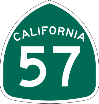
State Route 57 (SR 57), also known as the Orange Freeway for most of its length, is a north–south state highway in the Greater Los Angeles Area of the U.S. state of California. It connects the interchange of Interstate 5 (I-5) and SR 22 near downtown Orange, locally known as the Orange Crush, to the Glendora Curve interchange with I-210 and SR 210 in Glendora. The highway provides a route across several spurs of the Peninsular Ranges, linking the Los Angeles Basin with the Pomona Valley and San Gabriel Valley.

The Santa Ana River is the largest river entirely within Southern California in the United States. It rises in the San Bernardino Mountains and flows for most of its length through San Bernardino and Riverside counties, before cutting through the northern Santa Ana Mountains via Santa Ana Canyon and flowing southwest through urban Orange County to drain into the Pacific Ocean. The Santa Ana River is 96 miles (154 km) long, and its drainage basin is 2,650 square miles (6,900 km2) in size.
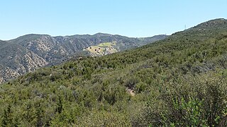
The Santa Ana Mountains are a short peninsular mountain range along the coast of Southern California in the United States. They extend for approximately 61 miles (98 km) southeast of the Los Angeles Basin largely along the border between Orange and Riverside counties.

The Berkeley Hills are a range of the Pacific Coast Ranges, and overlook the northeast side of the valley that encompasses San Francisco Bay. They were previously called the "Contra Costa Range/Hills", but with the establishment of Berkeley and the University of California, the current usage was applied by geographers and gazetteers.
Olive is an unincorporated parcel of about 32.67 acres (132,200 m2) entirely surrounded by the city of Orange, located along Lincoln Avenue, between Eisenhower Park and Orange Olive Road.

The San Joaquin Hills are a low mountain range of the Peninsular Ranges System, located in coastal Orange County, California.

Santa Ana Canyon, or the Santa Ana Narrows, is the water gap where the Santa Ana River passes between the Santa Ana Mountains and the Chino Hills, near the intersection of Orange, Riverside, and San Bernardino counties, California. It receives particularly strong Santa Ana winds in comparison to surrounding areas, hence the name. Originally, U.S. Route 91 ran through the canyon; however, it has long since been re-signed or upgraded along the entirety of its former right-of-way in the state. California State Route 91 is its primary successor.

Jamboree Road is a 15.8-mile (25.4 km) long major arterial road through Orange County, California, running through the cities of Newport Beach, Irvine, Tustin, and Orange.
Anaheim Hills is a planned community encompassing the eastern portions of the city of Anaheim, in Orange County, California.
Rancho Santiago de Santa Ana was a 63,414-acre (256.63 km2) Spanish land concession in present-day Orange County, California, given by Spanish Alta California Governor José Joaquín de Arrillaga in 1810 to Jose Antonio Yorba and his nephew Pablo Peralta. The grant extended eastward from the Santa Ana River to the Santa Ana Mountains, with a length of more than 22 miles (35 km).

Santiago Creek is a major watercourse in Orange County in the U.S. state of California. About 34 miles (55 km) long, it drains most of the northern Santa Ana Mountains and is a tributary to the Santa Ana River. It is one of the longest watercourses entirely within the county. The creek shares its name with Santiago Peak, at 5,687 ft (1,733 m) the highest point in Orange County, on whose slopes its headwaters rise.

San Diego Creek is a 16-mile (26 km) urban waterway flowing into Upper Newport Bay in Orange County, California in the United States. Its watershed covers 112.2 square miles (291 km2) in parts of eight cities, including Irvine, Tustin, and Costa Mesa. From its headwaters in Laguna Woods the creek flows northwest to its confluence with Peters Canyon Wash, where it turns abruptly southwest towards the bay. Most of the creek has been converted to a concrete flood control channel, but it also provides important aquatic and riparian habitat along its course and its tidal estuary.

Coyote Creek is a principal tributary of the San Gabriel River in northwest Orange County and southeast Los Angeles County, California. It drains a land area of roughly 41.3 square miles (107 km2) covering eight major cities, including Brea, Buena Park, Fullerton, Hawaiian Gardens, La Habra, Lakewood, La Palma, and Long Beach. Some major tributaries of the creek in the highly urbanized watershed include Brea Creek, Fullerton Creek, and Carbon Creek. The mostly-flat creek basin is separated by a series of low mountains, and is bounded by several small mountain ranges, including the Chino Hills, Puente Hills, and West Coyote Hills.
There are 34 routes assigned to the "S" zone of the California Route Marker Program, which designates county routes in California. The "S" zone includes county highways in Imperial, Orange, Riverside, San Diego, and Santa Barbara counties.

Carbon Canyon Dam is a dam at the northern edge of Orange County, California. The dam is approximately 4 miles (6.4 km) east of the city of Brea and approximately 12 miles (19 km) north of the city of Santa Ana. The drainage area above the dam is 19.3 square miles (50 km2) and is encompassed entirely within the Puente and Chino Hills. The Carbon Canyon Creek flows in a generally southwesterly direction onto the coastal Orange County Plain, joins Coyote Creek, and then flows into the San Gabriel River.

