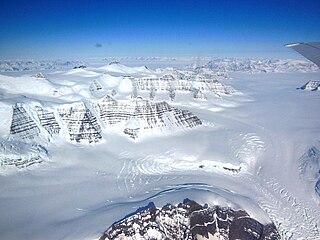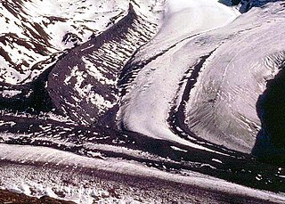

A periglacial lake is a lake bordering a glacier, usually found along the fringes of large ice sheets.


A periglacial lake is a lake bordering a glacier, usually found along the fringes of large ice sheets.
Periglaciation suggests an environment located on the margin of past glaciers. It has also been attributed to a climate with a tundra-like vegetation with a permanently frozen subsoil. [1] Usually, the term is taken in the latter sense, but periglacial is used in the former definition when discussing periglacial lakes.
Freeze and thaw cycles influence landscapes outside areas of past glaciation. [2] Therefore, periglacial environments are anywhere that freezing and thawing modify the landscape in a significant manner. The tundra climate or periglacial zone is just outside of glaciated areas. [3] The processes of erosion in these glacial-peripheral zones are markedly different than present processes, therefore their effects have been noted. [1] Areas that are too dry for glaciation to occur but that display characteristics of oversteepened slopes, solifluction slumps and cirques indicate the presence of a periglacial zone. [4] Chief actions in these zones include solifluction and frost-shattering processes, the effects of which can be seen in the south of the Bristol Channel.
Former periglacial lakes are known to have existed as early as the Cryogenian period, though many were also formed in the Pleistocene period. Environments that have supported a periglacial zone or tundra climate include Siberia, Canada, Greenland, and southern Africa. [5] The Pleistocene period is responsible for most of the known periglacial features in Britain. [1]
Several landforms are formed in glaciated areas as the ice sheet moves between advancing when additional ice is introduced to the environment and receding due to ablation. Some landforms could be considered cases of superimposed drainage. [6]

A glacier is a persistent body of dense ice that is constantly moving under its own weight. A glacier forms where the accumulation of snow exceeds its ablation over many years, often centuries. It acquires distinguishing features, such as crevasses and seracs, as it slowly flows and deforms under stresses induced by its weight. As it moves, it abrades rock and debris from its substrate to create landforms such as cirques, moraines, or fjords. Although a glacier may flow into a body of water, it forms only on land and is distinct from the much thinner sea ice and lake ice that form on the surface of bodies of water.
A drumlin, from the Irish word droimnín, first recorded in 1833, in the classical sense is an elongated hill in the shape of an inverted spoon or half-buried egg formed by glacial ice acting on underlying unconsolidated till or ground moraine. Assemblages of drumlins are referred to as fields or swarms; they can create a landscape which is often described as having a 'basket of eggs topography'.

A moraine is any accumulation of unconsolidated debris, sometimes referred to as glacial till, that occurs in both currently and formerly glaciated regions, and that has been previously carried along by a glacier or ice sheet. It may consist of partly rounded particles ranging in size from boulders down to gravel and sand, in a groundmass of finely-divided clayey material sometimes called glacial flour. Lateral moraines are those formed at the side of the ice flow, and terminal moraines were formed at the foot, marking the maximum advance of the glacier. Other types of moraine include ground moraines and medial moraines.

Geomorphology is the scientific study of the origin and evolution of topographic and bathymetric features generated by physical, chemical or biological processes operating at or near Earth's surface. Geomorphologists seek to understand why landscapes look the way they do, to understand landform and terrain history and dynamics and to predict changes through a combination of field observations, physical experiments and numerical modeling. Geomorphologists work within disciplines such as physical geography, geology, geodesy, engineering geology, archaeology, climatology, and geotechnical engineering. This broad base of interests contributes to many research styles and interests within the field.

Glaciology is the scientific study of glaciers, or, more generally, ice and natural phenomena that involve ice.

The Last Glacial Period (LGP), also known colloquially as the Last Ice Age or simply Ice Age, occurred from the end of the Eemian to the end of the Younger Dryas, encompassing the period c. 115,000 – c. 11,700 years ago.

The climatic snow line is the boundary between a snow-covered and snow-free surface. The actual snow line may adjust seasonally, and be either significantly higher in elevation, or lower. The permanent snow line is the level above which snow will lie all year.

A cirque is an amphitheatre-like valley formed by glacial erosion. Alternative names for this landform are corrie and cwm. A cirque may also be a similarly shaped landform arising from fluvial erosion.

Solifluction is a collective name for gradual processes in which a mass moves down a slope related to freeze-thaw activity. This is the standard modern meaning of solifluction, which differs from the original meaning given to it by Johan Gunnar Andersson in 1906.

Thermokarst is a type of terrain characterised by very irregular surfaces of marshy hollows and small hummocks formed as ice-rich permafrost thaws. The land surface type occurs in Arctic areas, and on a smaller scale in mountainous areas such as the Himalayas and the Swiss Alps.

Rock glaciers are distinctive geomorphological landforms, consisting either of angular rock debris frozen in interstitial ice, former "true" glaciers overlain by a layer of talus, or something in-between. Rock glaciers are normally found at high latitudes and/or elevations, and may extend outward and downslope from talus cones, glaciers or terminal moraines of glaciers.
Paraglacial means unstable conditions caused by a significant relaxation time in processes and geomorphic patterns following glacial climates. Rates of landscape change and sediment output from the system are typically elevated during paraglacial landscape response.

Matthias Kuhle was a German geographer and professor at the University of Göttingen. He edited the book series Geography International published by Shaker Verlag.

The Weichselian glaciation was the last glacial period and its associated glaciation in northern parts of Europe. In the Alpine region it corresponds to the Würm glaciation. It was characterized by a large ice sheet that spread out from the Scandinavian Mountains and extended as far as the east coast of Schleswig-Holstein, northern Poland and Northwest Russia. This glaciation is also known as the Weichselian ice age, Vistulian glaciation, Weichsel or, less commonly, the Weichsel glaciation, Weichselian cold period (Weichsel-Kaltzeit), Weichselian glacial (Weichsel-Glazial), Weichselian Stage or, rarely, the Weichselian complex (Weichsel-Komplex).

A blockfield, felsenmeer, boulder field or stone field is a surface covered by boulder- or block-sized rocks usually associated with a history of volcanic activity, alpine and subpolar climates and periglaciation. Blockfields differ from screes and talus slope in that blockfields do not apparently originate from mass wastings. They are believed to be formed by frost weathering below the surface. An alternative theory that modern blockfields may have originated from chemical weathering that occurred in the Neogene when the climate was relatively warmer. Following this thought the blockfields would then have been reworked by periglacial action.
Deglaciation is the transition from full glacial conditions during ice ages, to warm interglacials, characterized by global warming and sea level rise due to change in continental ice volume. Thus, it refers to the retreat of a glacier, an ice sheet or frozen surface layer, and the resulting exposure of the Earth's surface. The decline of the cryosphere due to ablation can occur on any scale from global to localized to a particular glacier. After the Last Glacial Maximum, the last deglaciation begun, which lasted until the early Holocene. Around much of Earth, deglaciation during the last 100 years has been accelerating as a result of climate change, partly brought on by anthropogenic changes to greenhouse gases.
Discrete debris accumulation (DDA) is a non-genetic term in mountain glacial geology to aid identification of non-lithified sediments on a valley or mountain slope or floor. It is intended that the debris accumulation is discrete such that it can be mapped, in the field and/or from aerial or satellite imagery. The origin or formative process may well not be known clearly or be changed by subsequent investigators it is advisable to have a non-genetic field reference so that discussion can then be used to ascertain, if possible, the origin. Mountain areas may currently have glaciers (glacierized) or have had glaciers (glaciated) or be subject to forms of periglacial activity. A moraine would be an easily identified DDA as would an esker. Although scree (talus) is generally easily identified and mapped, these deposits may be modified by ice, avalanches or downslope movement to create essentially new landforms. Many small slope failures and landslides can give the appearance of moraines or protalus ramparts on slopes. After mapping as a DDA, further investigation might draw light on the origin of the feature.

Periglaciation describes geomorphic processes that result from seasonal thawing and freezing, very often in areas of permafrost. The meltwater may refreeze in ice wedges and other structures. "Periglacial" originally suggested an environment located on the margin of past glaciers. However, freeze and thaw cycles influence landscapes also outside areas of past glaciation. Therefore, periglacial environments are anywhere when freezing and thawing modify the landscape in a significant manner.

The last glacial period and its associated glaciation is known in southern Chile as the Llanquihue glaciation. Its type area lies west of Llanquihue Lake where various drifts or end moraine systems belonging to the last glacial period have been identified. The glaciation is the last episode of existence of the Patagonian Ice Sheet. Around Nahuel Huapi Lake the equivalent glaciation is known as the Nahuel Huapi Drift.
Retrogressive thaw slumps (RTS), are a type of landslide that occur in the terrestrial Arctic's permafrost region of the circumpolar Northern Hemisphere when an ice-rich section thaws. RTSs develop quickly and can extend across several hectares modifying Arctic coastlines and permafrost terrain. They are the most active and dynamic feature of thermokarst—the collapse of the land surface as ground ice melts. They are thermokarst slope failures due to abrupt thawing of ice-rich permafrost or glaciated terrains. These horseshoe-shaped landslides contribute to the thawing of hectares of permafrost annually and are considered to be one of the most active and dynamic features of thermokarst—the "processes and landforms that involve collapse of the land surface as a result of the melting of ground ice." They are found in permafrost or glaciated regions of the Northern Hemisphere—the Tibetan Plateau, Siberia, from the Himalayas to northern Greenland, and in northern Canada's Northwest Territories (NWT), the Yukon Territories, Nunavut, and Nunavik and in the American state of Alaska. The largest RTS in the world is in Siberia—the Batagaika Crater, also called a "megaslump", is one-kilometre-long and 100 metres (330 ft) deep and it grows a 100 feet (30 m) annually. The land began to sink, and the Batagaika Crater began to form in the 1960s, following clear-cutting of a section of forested area.
{{cite journal}}: External link in |via=