Related Research Articles

Diogo Cão, also known as Diogo Cam, was a Portuguese mariner and one of the most notable explorers of the fifteenth century. He made two voyages along the west coast of Africa in the 1480s, exploring the Congo River and the coasts of present-day Angola and Namibia.

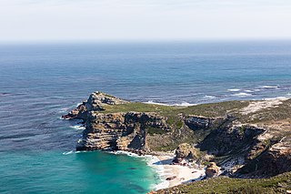
The Cape of Good Hope is a rocky headland on the Atlantic coast of the Cape Peninsula in South Africa.

The history of the Kingdom of Portugal from the Illustrious Generation of the early 15th century to the fall of the House of Aviz in the late 16th century has been named the "Portuguese golden age" and the "Portuguese Renaissance". During this period, Portugal was the first European power to begin building a colonial empire as during the Age of Exploration Portuguese sailors and explorers discovered an eastern route to India as well as several Atlantic archipelagos and colonized the African coast and Brazil. They also explored the Indian Ocean and established trading routes throughout most of southern Asia, sending the first direct European maritime trade and diplomatic missions to Ming China and to Japan, at the same time installing trading posts and the most important colony: Portuguese Macau. The Portuguese Renaissance produced a plethora of poets, historians, critics, theologians, and moralists. The Cancioneiro Geral by Garcia de Resende is taken to mark the transition from Old Portuguese to the modern Portuguese language.

Bartolomeu Dias was a Portuguese mariner and explorer. In 1488, he became the first European navigator to round the southern tip of Africa and to demonstrate that the most effective southward route for ships lies in the open ocean, well to the west of the African coast. His discoveries effectively established the sea route between Europe and Asia.

Cape Point is a promontory at the southeast corner of the Cape Peninsula, a mountainous and scenic landform that runs north-south for about thirty kilometres at the extreme southwestern tip of the African continent in South Africa. Table Mountain and the city of Cape Town are close to the northern extremity of the same peninsula. The cape is located at 34°21′26″S18°29′51″E, about 2.3 kilometres (1.4 mi) east and a little north of the Cape of Good Hope on the southwest corner. Although these two rocky capes are very well known, neither cape is actually the southernmost point of the mainland of Africa; that is Cape Agulhas, approximately 150 kilometres (93 mi) to the east-southeast.
Alvise Cadamosto (Portuguese pronunciation:[alˈvizɨkɐðaˈmoʃtu]; Italian pronunciation:[alˈvizeˌkadaˈmosto])(c. 1432 – 16 July 1483) was a Venetian explorer and slave trader, who was hired by the Portuguese prince Henry the Navigator and undertook two known journeys to West Africa in 1455 and 1456, accompanied by the Genoese captain Antoniotto Usodimare. Some have credited Cadamosto and his companions with the discovery of the Cape Verde Islands and the points along the Guinea coast from the Gambia River to the Geba River, the greatest leap in the Henrican discoveries since 1446. Cadamosto's accounts of his journeys, including his detailed observations of West African societies, have proven invaluable to historians.
Diogo Dias, also known as Diogo Gomes, was a 15th-century Portuguese explorer. He was the brother of Bartolomeu Dias and discovered some of the Cape Verde islands together with António Noli.
João Infante was a Portuguese explorer of the African coast. He accompanied Bartolomeu Dias in his journey around the Cape of Good Hope in 1487/1488 by leading a second caravel, the São Pantaleão.

The geography of North Africa has been reasonably well known among Europeans since classical antiquity in Greco-Roman geography. Northwest Africa was known as either Libya or Africa, while Egypt was considered part of Asia.
This is a historical timeline of Portugal's Second Dynasty.

A padrão is a stone pillar left by Portuguese maritime explorers in the 15th and 16th centuries to record significant landfalls and thereby establish primacy and possession. They were often placed on promontories and capes or at the mouths of major rivers. Early markers were simple wooden pillars or crosses but they deteriorated quickly in the tropical climate where they were often erected. Later, padrões were carved from stone in the form of a pillar surmounted by a cross and the royal coat of arms.

Portuguese maritime exploration resulted in the numerous territories and maritime routes recorded by the Portuguese as a result of their intensive maritime journeys during the 15th and 16th centuries. Portuguese sailors were at the vanguard of European exploration, chronicling and mapping the coasts of Africa and Asia, then known as the East Indies, and Canada and Brazil, in what came to be known as the Age of Discovery.

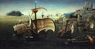
Santa Catarina do Monte Sinai was a higher-castled Portuguese carrack with 140 guns, launched down in 1520. Built in Kochi, India around 1512 it had two square rig masts and is depicted on a painting attributed to Joachim Patinir.
António de Saldanha was a Castilian-Portuguese 16th-century captain. He was the first European to set anchor in what is now called Table Bay, South Africa, and made the first recorded ascent of Table Mountain.

The Second Portuguese India Armada was assembled in 1500 on the order of King Manuel I of Portugal and placed under the command of Pedro Álvares Cabral. Cabral's armada famously discovered Brazil for the Portuguese crown along the way. By and large, the Second Armada's diplomatic mission to India failed, and provoked the opening of hostilities between the Kingdom of Portugal and the feudal city-state of Calicut. Nonetheless, it managed to establish a factory in the nearby Kingdom of Cochin, the first Portuguese factory in Asia.
The Fifth India Armada was assembled in 1503 on the order of King Manuel I of Portugal and placed under the command of Afonso de Albuquerque. It was Albuquerque's first trip to India. It was not a particularly successful armada - navigational mistakes scattered the fleet on the outward journey. Ships spent much time looking for each other and several ended up travelling alone.
Diogo Fernandes Pereira, sometimes called simply Diogo Fernandes, was a Portuguese 16th-century navigator, originally from Setúbal, Portugal. Diogo Fernandes was the first known European captain to visit the island of Socotra in 1503 and the discoverer of the Mascarenes archipelago in 1507. He may also have been the first European to sail east of Madagascar island.
Lançarote de Freitas, better known as Lançarote de Lagos or Lançarote da Ilha, was a 15th-century Portuguese explorer and slave raider from Lagos, Portugal. He was the leader of two large Portuguese slaving raids on the West African coast in 1444–1446.

The European-Asian sea route, commonly known as the sea route to India or the Cape Route, is a shipping route from the European coast of the Atlantic Ocean to Asia's coast of the Indian Ocean passing by the Cape of Good Hope and Cape Agulhas at the southern edge of Africa. The first recorded completion of the route was made in 1498 by Portuguese explorer Vasco da Gama, the admiral of the first Portuguese Armadas bound eastwards to make the discovery. The route was important during the Age of Sail, but became partly obsolete as the Suez Canal opened in 1869.
There are at least three statues of Bartolomeu Dias, the first European to sail around the southernmost tip of Africa. This exploration, in 1488, led to the discovery of a sea route from Europe to Asia.
References
- ↑ Ravenstein, E. G. (1900). "The Voyages of Diogo Cão and Bartholomeu Dias, 1482-88". The Geographical Journal. 16 (6): 625–655. doi:10.2307/1775267. hdl: 2027/mdp.39015050934820 . ISSN 0016-7398.