Petzen

Last updated
Petzen
Peca
Petzen Bergmassiv VoelkermarkterStausee.jpg
Petzen, seen from the northwest
Highest point
Elevation 2,126 m (6,975 ft) [1]
Prominence 882 m (2,894 ft) [2]
Isolation 18.4 km (11.4 mi)  OOjs UI icon edit-ltr-progressive.svg
Coordinates 46°30′N14°47′E / 46.500°N 14.783°E / 46.500; 14.783
Geography
Alps location map.png
Red triangle with thick white border.svg
Petzen
Location in the Alps
Austria relief location map.jpg
Red triangle with thick white border.svg
Petzen
Location in Austria
Slovenia relief map.png
Red triangle with thick white border.svg
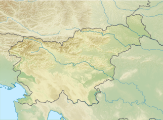
Petzen
Location in Slovenia
Location Austria / Slovenia
Parent range Karawanks

Petzen (German) or Peca (Slovene) is the highest mountain of the eastern Karawanks, [3] the second-highest mountain of the Northern Karawanks [4] and the most eastern two-thousand-metre mountain of Slovenia. [5] It is a mighty mountain with a characteristic shape of a tableland with rocky peaks protruding from it. [6] The mountain borders the Meža Valley and the Topla Valley to the south and east, and the Jaun Valley to the north, and is separated by the narrow valley of the Bela Creek from Hochobir. [7] Two thirds of the mountain lies in Austria, and one third in Slovenia. [7] The mountain reaches its highest elevation on the mountain crest [8] of the Kordež Head (Slovene: Kordeževa Glava, German: Kordeschkopf, 2,125 metres or 6,972 feet). [1] The border runs across it. [7]

The mountain is built of Triassic Wetterstein limestone and Wetterstein dolomite. [9] In the past, lead and zinc was mined on Peca, the shafts belonging to the Topla and Mežica mines. [10] The lead-zinc ore occurs in Middle to Upper Triassic carbonate rocks deposited in an anoxic supratidal marine environment, [11] similar to other Mississippi Valley-type lead-zinc ores. [12] In addition to the ore, several rare minerals were discovered underground in the mountain, such as wulfenite and calcite. [13] A mine on the mountain is accessible to mountain bikes. [14]

The lower slopes on the Slovenian side are forested, whereas the higher slopes are home to a variety of Alpine flora, including several species of flowers [5] [7]

A mountain hut was built at Little Peca (Slovene: Mala Peca; 1,665 metres or 5,463 feet) in 1928, which was burnt down during World War II, and rebuilt in 1957. [7] Since 1936, the chapel of Sts. Cyril and Methodius stands next to it. [15] The beginning of an abandoned pit, [16] named Matjaž Cave after King Matjaž, is situated in the vicinity, [17] which is a historical monument. [17] Inside it, there is a bronze statue of the sleeping king. The statue was designed in 1958 by the sculptor and mountaineer Marjan Keršič, [17] cast in bronze by the sculptor France Rotar, and placed in the cave in 1962. [18]

Related Research Articles

<span class="mw-page-title-main">Carinthia (Slovenia)</span> Traditional region of Slovenia

Carinthia, also Slovene Carinthia or Slovenian Carinthia, is a traditional region in northern Slovenia. The term refers to the small southeasternmost area of the former Duchy of Carinthia, which after World War I was allocated to the State of Slovenes, Croats and Serbs according to the 1919 Treaty of Saint-Germain. It has no distinct centre, but a local centre in each of the three central river valleys among the heavily forested mountains.

<span class="mw-page-title-main">Meža</span> River in Slovenia, Austria and Slovenia

The Meža (Slovene) or Mieß is a river in the Austrian state of Carinthia and in Slovenia, a right tributary of the Drava. It is 43 kilometers (27 mi) long, of which 42 kilometers (26 mi) are in Slovenia. Its catchment area is 551.7 square kilometers (213.0 sq mi), of which 543 square kilometers (210 sq mi) in Slovenia.

<span class="mw-page-title-main">Karawanks</span> Mountain range along the Austria–Slovenia border

The Karawanks or Karavankas or Karavanks are a mountain range of the Southern Limestone Alps on the border between Slovenia to the south and Austria to the north. With a total length of 120 kilometres (75 mi) in an east–west direction, the Karawanks chain is one of the longest ranges in Europe. It is traversed by important trade routes and has a great tourist significance. Geographically and geologically, it is divided into the higher Western Karawanks and the lower-lying Eastern Karawanks. It is traversed by the Periadriatic Seam, separating the Apulian tectonic plate from the Eurasian Plate.

<span class="mw-page-title-main">Idrija</span> Place in Inner Carniola, Slovenia

Idrija is a town in western Slovenia. It is the seat of the Municipality of Idrija.

<span class="mw-page-title-main">Mežica</span> Place in Carinthia, Slovenia

Mežica is a town in northern Slovenia. It is the seat of the Municipality of Mežica. It lies on the Meža River in the traditional Slovenian province of Carinthia) near the Austrian border. The town developed close to a lead and zinc mine under Mount Peca. Mining began in 1665 and ended in 1994. Today the mine is only open for tourist visits.

<span class="mw-page-title-main">Tarvisio</span> Comune in Friuli Venezia Giulia, Italy

Tarvisio is a comune (municipality) in the Regional decentralization entity of Udine, in the autonomous Friuli Venezia Giulia region of Italy.

<span class="mw-page-title-main">King Matjaž</span>

King Matjaž/Mátyás/Matijaš is a legendary king in Slovenia, Hungary, Croatia and in some other countries, based on pre-Christian traditions of Carantania and in course of centuries gradually linked to a real-life king, Matthias Corvinus of Hungary, who lived in the second half of the 15th century. He has also been linked to the leader of the peasant's army that fought against the Turks in the Battle of Kokovo in July 1478. A number of folk poems and stories about King Matjaž are known, the earliest ones originating in the western Slovene area of Tolmin from the 16th century. He is mainly represented as the king who is just and a defender of his people, and the bringer of the golden age of prosperity. It has been assumed that the legend was the basis for the name of the 1573 peasants' revolt leader Matija Gubec, actually named Ambrož Gubec.

<span class="mw-page-title-main">Vršič Pass</span> Mountain pass across the Julian Alps in Slovenia

The Vršič Pass, with an elevation of 1,611 metres (5,285 ft), is a high mountain pass across the Julian Alps in northwestern Slovenia. It is the highest pass in Slovenia, as well as the highest in the Eastern Julian Alps. It connects Upper Carniola with the Trenta Valley in the Slovene Littoral, and it is considered an excellent starting point for excursions to surrounding peaks. Over Vršič, there was an old trail, which was upgraded for military purposes as well as for logging and timber transportation in the early 20th century. The modern road, now known as the Russian Road, was built in 1915–17.

Resia is a comune (municipality) in the Regional decentralization entity of Udine, in the Friuli Venezia Giulia region of northeast Italy, bordering on the municipalities of Chiusaforte, Lusevera, Resiutta, and Venzone, and also on two of the Slovenian municipalities. Its residents speak an archaic dialect known as Resian, which is – according to most linguists – a transitional dialect between the Carinthian and Littoral dialects of Slovene. Although they maintain their own traditional system of family names, which are of Slavic origin, the people of Resia have either Italian or Italianized surnames, similarly to some areas in Venetian Slovenia.

<span class="mw-page-title-main">Karawanks Tunnel (motorway)</span> Motorway tunnel

The Karawanks Tunnel is a motorway tunnel crossing the Alpine Karawanks mountain range between Austria and Slovenia, with a total length of 7.864 km, 8.019 km enclosure between the portals. Its construction began in 1986 and it opened on 1 June 1991. It connects the Austrian Karawanken Autobahn (A11) from Villach with the A2 motorway leading to Kranj and Ljubljana in Slovenia, decongesting the historic Loibl/Ljubelj and Wurzen/Korensko sedlo mountain passes.

<span class="mw-page-title-main">Karawanks Tunnel (railway)</span> Railway tunnel in Austria and Slovenia

The Karawanks Tunnel is the fourth longest railway tunnel in Austria and the longest in Slovenia with a length of 7,976 metres (26,168 ft). It passes under Rožca Saddle between Rosenbach in southern Austria and Jesenice in northern Slovenia.

<span class="mw-page-title-main">Carbonate-hosted lead-zinc ore deposits</span>

Carbonate-hosted lead-zinc ore deposits are important and highly valuable concentrations of lead and zinc sulfide ores hosted within carbonate formations and which share a common genetic origin.

<span class="mw-page-title-main">Snežnik (plateau)</span> Mountain plateau in Slovenia

Snežnik is a wide karst limestone plateau with an area of about 85 km2 (33 sq mi) in the Dinaric Alps. It can also be viewed as a southern extension of the Julian Alps. The main part of the plateau is in Slovenia, while the southern part extends into Croatia and connects to the mountain region of Gorski Kotar.

<span class="mw-page-title-main">Emil Korytko</span> Polish political activist (1813–1839)

Emil Antoni Korytko was a Polish political activist in the period of the Great Emigration, who was exiled to Ljubljana, Carniola and became an important ethnographer, philologist and translator there. His legacy are collections of Slovene folk songs and vivid descriptions of Carniolan folk customs. He significantly contributed to the mutual dialogue between Polish and Slovene authors and readers.

The Brkini Hills is a hilly region in southwestern Slovenia.

<span class="mw-page-title-main">Lisca</span>

Lisca is a 948-metre (3,110 ft) hill in the eastern part of the Sava Hills in southeastern Slovenia, northwest of Sevnica, north of the Sava, and south of Gračnica Creek. It is the most frequently visited hiking destination in the Sava Hills.

<span class="mw-page-title-main">Žirovnica, Žirovnica</span> Place in Upper Carniola, Slovenia

Žirovnica is a settlement in northwestern Slovenia, in the Municipality of Žirovnica. It is located in the historic Upper Carniola region, on the southern slope of the Karawanks mountain range, close to the border with Austria.

<span class="mw-page-title-main">Municipality of Črna na Koroškem</span> Municipality of Slovenia

The Municipality of Črna na Koroškem is a municipality in northern Slovenia. The seat of the municipality is the town of Črna na Koroškem. It lies in the traditional Slovenian province of Carinthia, close to the border with Austria. Since 2005 it has been part of the larger Carinthia Statistical Region.

<span class="mw-page-title-main">Geopark Karawanken</span> Park in Austria and Slovenia

The Geopark Karawanken/Karavanke is located in the Karawanks mountain range in Austria and in Slovenia and comprises an area of 1067 km2. The crossborder geopark has numerous geological and other natural sights and became a member of the UNESCO Global Geoparks Network in 2013.

<span class="mw-page-title-main">Mežica Mine</span> Mine in Mežica, Slovenia

The Mežica Lead and Zinc Mine is one of the oldest mines in Europe, with its first documented mentions dating back to 1665. Located in the Mežica Valley in Slovenia, it played a significant role in the Slovenian mining history.

References

  1. 1 2 Dobnik, Jože. "Kordeževa glava" [Kordež Head]. Geopedia.si (in Slovenian). Sinergise, d. o. o., Geoedetic Administration of the Republic of Slovenia. Retrieved 12 March 2012.
  2. "Kordeschkogel -peakbagger". peakbagger.com. Retrieved 16 February 2015.
  3. Perko, Drago; Orožen Adamič, Milan (1998). "Vzhodne Karavanke" [Eastern Karawanks]. Slovenija: pokrajina in ljudje [Slovenia: The Landscape and the People]. p. 135. ISBN   978-86-11-15033-8.
  4. Štrucl, Ivo (1970). "Stratigrafske in tektonske razmere v vzhodnem delu severnih Karavank". Geologija: razprave in poročila [Geological Transactions and Reports]. Slovensko geološko društvo [Geological Society of Slovenia]. 13: 5. ISSN   0016-7789.
  5. 1 2 "Naravne znamenitosti: Peca". Karavanke.eu. Retrieved 12 March 2012.
  6. Tomšič, Žare (2007). "Mountains and Peaks". Petzenland.si. RRA Koroška [Regional Development Agency of Carinthia]. Archived from the original on 13 September 2012. Retrieved 12 March 2012.
  7. 1 2 3 4 5 Dobnik, Jože (2011) [2006]. "Pot kurirjev in vezistov NOB" [Path of Couriers and Operators of the National Liberation War]. Pespoti.si. Planinska zveza Slovenije [Mountaineering Association of Slovenia]. Geodetska uprava Republike Slovenije [Surveying and Mapping Authority of the Republic of Slovenia]. Društvo Domicilnega odbora kurirjev in vezistov NOV Slovenije [Society of the Domicile Board of the Couriers and Operators of the National Liberation War of Slovenia]. Točka Dom na Peci [The Veliki Snežnik Point]. Retrieved 12 March 2012.
  8. Rikanovič, Rada; Brenčič, Miha (2003). "Comparison of the CORINE Land Cover data and Agricultural Land Use Monitoring Data as a basis for groundwater vulnerability mapping in the Peca border region". Geologija: razprave in poročila [Geological Transactions and Reports]. Slovensko geološko društvo [Geological Society of Slovenia]. 46 (2): 440.
  9. Bole, Bernarda (2002). "Karbonatne kamnine Pece" [Carbonate Rocks of Mt. Peca]. Geologija (in Slovenian): 59–69. doi: 10.5474/geologija.2002.005 . ISSN   0016-7789. COBISS   887125.
  10. Javornik, Marjan (1999). "Topla". In Voglar, Dušan; Dermastja, Alenka (eds.). Enciklopedija Slovenije [Encyclopedia of Slovenia] (in Slovenian). Vol. 13. p. 288. ISBN   978-86-11-15364-3.
  11. Spangenberg, J. E.; Herlec, U. (1 August 2006). "Hydrocarbon Biomarkers in the Topla-Mezica Zinc-Lead Deposits, Northern Karavanke/Drau Range, Slovenia: Paleoenvironment at the Site of Ore Formation". Economic Geology. 101 (5): 997–1021. doi:10.2113/gsecongeo.101.5.997 . Retrieved 24 January 2021.
  12. Leach, D.L; Taylor, R.D.; Fey, D.L.; Diehl, S.F.; Saltus, R.W. (2010). A Deposit Model for Mississippi ValleyType Lead-Zinc Ores (PDF) (Report). U.S. Geological Survey. Retrieved 24 January 2021.
  13. "Minerali iz podzemlja Pece" [Minerals from the Peca Underground] (in Slovenian). Prirodoslovni muzej Slovenije [Natural History Museum of Slovenia]. Archived from the original on 9 December 2011. Retrieved 12 March 2012.
  14. "Cycling in the Mine". Podzemlje Pece: Tourist Mine and Museum. Retrieved 12 March 2012.
  15. "Peca: Mala Peca". Zaplana.net. Retrieved 12 March 2012.
  16. "Krkine planinske poti: Peca" [Krka's Mountain Paths]. Krka.si. Retrieved 12 March 2012.
  17. 1 2 3 "Peca - Matjaževa jama" [Peca: Matjaž Cave]. Registry of Immovable Cultural Heritage (in Slovenian). Ministry of Culture, Slovenia. Retrieved 12 March 2012.
  18. "Zgodovina" [History]. Pdmezica.si. Planinsko društvo Mežica [Mežica Mountaineering Club]. 1958 - 1969. Retrieved 12 March 2012.