Pagasae or Pagases, also Pagasa, was a town and polis (city-state) of Magnesia in ancient Thessaly, currently a suburb of Volos. It is situated at the northern extremity of the bay named after it.

Farsala, known in Antiquity as Pharsalos, is a city in southern Thessaly, in Greece. Farsala is located in the southern part of Larissa regional unit, and is one of its largest towns. Farsala is an economic and agricultural centre of the region. Cotton and livestock are the main agricultural products, and many inhabitants are employed in the production of textile. The area is mostly famous for being the birthplace of Achilles, a mythical ancient Greek hero and the sight of a major battle between Roman generals Gaius Julius Caesar and Gnaeus Pompeius in 48 BC.

The so-called Battle of Crocus Field was a battle in the Third Sacred War, fought between the armies of Phocis, under Onomarchos, and the combined Thessalian and Macedonian army under Philip II of Macedon. In the bloodiest battle recorded in Ancient Greek history, the Phocians were decisively defeated by Philip's forces. Philip's victory secured his appointment as ruler of Thessaly, marking an important step in the rise of Macedon to political ascendancy in Ancient Greece. Opinion amongst historians is divided as to the year of the battle; some favour 353 BC, and others 352 BC.
Trachis was a region in ancient Greece. Situated south of the river Spercheios, it was populated by the Malians. It was also a polis (city-state).
Heraclea (Herakleia) in Trachis, also called Heraclea Trachinia, was a colony founded by the Spartans in 426 BC, the sixth year of the Peloponnesian War. It was also a polis (city-state).

Oreus or Oreos, prior to the 5th century BC called Histiaea or Histiaia (Ἱστίαια), also Hestiaea or Hestiaia (Ἑστίαια), was a town near the north coast of ancient Euboea, situated upon the river Callas, at the foot of Mount Telethrium, and opposite Antron on the Thessalian coast. From this town the whole northern extremity of Euboea was named Histiaeotis According to some it was a colony from the Attic deme of Histiaea; according to others it was founded by the Thessalian Perrhaebi. Another foundation story had it that the name Histiaea is said to derive from the mythical figure Histiaea, the daughter of Hyrieus. It was one of the most ancient of the Euboean cities. It occurs in the Catalogue of Ships in the Iliad, where Homer gives it the epithet of πολυστάφυλος ; and the Periplus of Pseudo-Scylax mentions it as one of the four cities of Euboea. It was an important city in classical antiquity due to its strategic location at the entrance of the North Euboean Gulf, in the middle of a large and fertile plain.
The Thessalian League was a koinon or loose confederacy of feudal-like poleis and tribes in ancient Thessaly, located in the Thessalian plain in Greece. The seat of the Thessalian League was Larissa.

The Aleuadae were an ancient Thessalian family of Larissa, who claimed descent from the mythical Aleuas. The Aleuadae were the noblest and most powerful among all the families of Thessaly, whence Herodotus calls its members "rulers" or "kings" (βασιλεῖς).

Achaea Phthiotis or simply Phthiotis (Φθιῶτις) was a historical region of ancient Thessaly in ancient Greece.

Cranon or Crannon (Κραννών) was a town and polis (city-state) of Pelasgiotis, in ancient Thessaly, situated southwest of Larissa, and at the distance of 100 stadia from Gyrton, according to Strabo. Spelling differs among the sources: Κράννων and ῂ Κράννωνοϛ; Κραννών, Κράννουν, and Κράννουϛ. To the west it bounded with the territory of Atrax and to the east with that of Scotussa. To the south the ridges of the Revenia separated it from the valley of the river Enipeus.
Pelasgiotis was an elongated district of ancient Thessaly, extending from the Vale of Tempe in the north to the city of Pherae in the south. The Pelasgiotis included the following localities: Argos Pelasgikon, Argyra, Armenium, Atrax, Crannon, Cynoscephalae, Elateia, Gyrton, Mopsion, Larissa, Kondaia, Onchestos river and town, Phayttos, Pherae, Scotussa, and Sykourion. The demonym of the district's inhabitants is Pelasgiotae or Pelasgiotes.
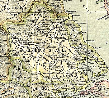
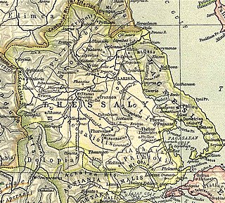
Thessaly or Thessalia was one of the traditional regions of Ancient Greece. During the Mycenaean period, Thessaly was known as Aeolia, a name that continued to be used for one of the major tribes of Greece, the Aeolians, and their dialect of Greek, Aeolic.
Histiaeotis or Hestiaeotis was a northwest district of ancient Thessaly, part of the Thessalian tetrarchy, roughly corresponding to modern Trikala regional unit. Anciently, it was inhabited by the Hestiaeotae (Ἑστιαιῶται), and the Peneius may be described in general as its southern boundary. It occupied the passes of Mount Olympus, and extended westward as far as Pindus. The demonym of the district's inhabitants is Histiaeotes. In epigraphy, the regional name occurs as Hestiōtai, ambassadors in Athens and Histiōtai in the Thessalian grain decree for Rome but most similarly written names are related to Histiaea, an Attic deme and a city in North Euboea. The epigraphical Aeolic Greek vocalism of Hestiaeotis is bizarre and idiomatic.

Iolcus is an ancient city, a modern village and a former municipality in Magnesia, Thessaly, Greece. Since the 2011 local government reform it is part of the municipality Volos, of which it is a municipal unit. It is located in central Magnesia, north of the Pagasitic Gulf. Its land area is 1.981 km². The municipal unit is divided into three communities, Agios Onoufrios, Anakasia and Ano Volos, with a total population of 2,138. The seat of the former municipality was the village of Ano Volos.
Velestino is a town in the Magnesia regional unit, Thessaly, Greece. It is the seat of the municipality Rigas Feraios.
Pharae was an ancient town of Messenia, situated upon a hill rising from the left bank of the river Nedon, and at a distance of a mile (1.5 km) from the Messenian Gulf. Strabo describes it as situated 5 stadia from the sea, and Pausanias 6. William Smith states that it is probable that the earth deposited at the mouth of the river Nedon has, in the course of centuries, encroached upon the sea. Pausanias distinguishes this city from the Achaean city of Pharae (Φαραὶ), 150 stadia from Patrae and 70 stadia from the coast. Pherae occupied the site of Kalamata, the modern capital of Messenia; and in antiquity also it seems to have been the chief town in the southern Messenian plain.
Cierium or Kierion was a town and polis (city-state) in the district of Thessaliotis in ancient Thessaly, which according to some ancient commentators, such as Stephanus of Byzantium was the successor to the Homeric Arne, the chief town of the Aeolian Boeotians in Thessaly, from which they emigrated to Boeotia.
Gyrton or Gyrtona or Gyrtone (Γυρτώνη) was a town and polis (city-state) of Perrhaebia in ancient Thessaly, situated in a fertile plain between the rivers Titaresius and Peneius. Strabo connects Gyrton with the mouth of the Peneius; but it is evident from the description of Livy, whose account has been derived from Polybius, that it stood in some part of those plains in which Phalanna, Atrax, and Larissa were situated. It was only one day's march from Phalanna to Gyrton. It was an ancient town even in Classical times, mentioned by Homer, and continued to be a place of importance till later times, when it is called opulent by Apollonius Rhodius. It was said to have been the original abode of the Phlegyae, and to have been founded by Gyrton, the brother of Phlegyas.
Meliboea or Meliboia was a town and polis (city-state) of Magnesia in ancient Thessaly, mentioned by Homer, in the Catalogue of Ships in the Iliad, as one of the places subject to Philoctetes. It was situated upon the sea coast, and is described by Livy as situated at the roots of Mount Ossa, and by Strabo as lying in the gulf between Mount Ossa and Mount Pelion.
Coroneia, or Coronea, was a town of ancient Boeotia, and a member of the Boeotian League. It is described by Strabo as situated upon a height near Mount Helicon; its territory was called Κορωνειακή. The town stood upon an insulated hill at the entrance of a valley leading southwards to Mt. Helicon, the principal summit of which is seen at the head of the valley. From this hill there was a fine view over the Lake Copais, and at its foot there was a broad plain extending as far as the marshes of the lake. On either side of the hill flowed two streams, one on the eastern or right hand side, called Coralius or Cuarius, and the other on the left, named Phalarus: a tributary of the latter was the Isomantus or Hoplias. Coroneia is said to have been founded by the Boeotians from Arne in Thessaly, after they had been driven out of their original homes by the Thessalians; and they appear to have called it Coroneia after the Thessalian town of this name. At the same time they built in the plain in front of the city a temple of Athena Itonica, also named after the one in Thessaly, and likewise gave to the river which flowed by the temple the name of Cuarius or Curalius, after the Thessalian river. In this temple was held the festival of the Pamboeotia, which was common to all the Boeotians. The Thessalian origin of Coroneia is also attested by Pausanias, who ascribes its foundation, as well as that of Haliartus, to Athamas and his descendants, who came from Thessaly.