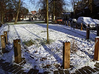
Chorlton-cum-Hardy is a suburban area of Manchester, England, three miles (4.8 km) southwest of the city centre. Chorlton ward had a population of 14,138 at the 2011 census, and Chorlton Park 15,147.

Rusholme is an area of Manchester, England, two miles south of the city centre. The population of the ward at the 2011 census was 13,643. Rusholme is bounded by Chorlton-on-Medlock to the north, Victoria Park and Longsight to the east, Fallowfield to the south and Moss Side to the west. It has a large student population, with several student halls and many students renting terraced houses, and suburban houses towards Victoria Park.

Newton Heath is an area of Manchester, England, 2.8 miles (4.5 km) north-east of Manchester city centre and with a population of 9,883.

Hulme is an inner city area and electoral ward of Manchester, England, immediately south of Manchester city centre. It has a significant industrial heritage.
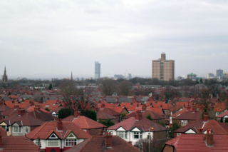
Burnage is an area of Manchester, England, 4 miles (6.4 km) south of the city centre and bisected by Kingsway. The population at the 2011 census was 15,227. It lies between Withington to the west, Levenshulme to the north, Heaton Chapel to the east and Didsbury and Heaton Mersey to the south.
Clayton is a suburb of Manchester, England, three miles east of the city centre on Ashton New Road.

Heaton Park is a public park in Manchester, England, covering an area of over 600 acres (242.8 ha). The park includes the grounds of a Grade I listed, neoclassical 18th century country house, Heaton Hall. The hall, remodelled by James Wyatt in 1772, is now only open to the public on an occasional basis as a museum and events venue. It is the biggest park in Greater Manchester, and also the largest municipal park in Europe.

Beswick is an inner city area in Manchester, England. It consists of the ancient township off Beswick, Manchester, which is in small land and in the ancient parish of Manchester and hundred of Salford.
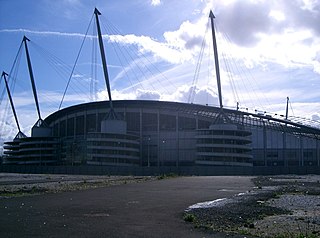
Bradford is a district of east Manchester, England, two miles north east of the city centre. The population at the 2011 census was 15,784. Historically in Lancashire, after the closure of its heavy industries Bradford was for many years an economically deprived area but has undergone regeneration with the building of the City of Manchester Stadium which hosted the 2002 Commonwealth Games and is now home to Manchester City F.C. Bradford is neighboured by Beswick to the south and the two areas are sometimes referred to as Bradford-with-Beswick. The River Medlock and the Ashton Canal run through Bradford.
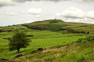
Rivington is a village and civil parish of the Borough of Chorley, Lancashire, England, occupying 2,538 acres. It is about 6 miles (9.7 km) southeast of Chorley and about 8+1⁄2 miles (13.7 km) northwest of Bolton. Rivington is a rural area consisting primarily of agricultural grazing land, moorland, with hill summits including Rivington Pike and Winter Hill within the West Pennine Moors. The area has a thriving tourist industry centred around reservoirs created to serve Liverpool in the Victorian era and Lever Park created as a public park by William Lever at the turn of the 20th century, with two converted barns, a replica of Liverpool Castle and open countryside. Rivington and Blackrod High School is located here. Rivington and its village had a population of 109 at the 2011 Census.

Birkenhead Park is a major public park located in the centre of Birkenhead, Merseyside, England. It was designed by Joseph Paxton and opened on 5 April 1847.
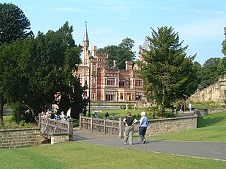
Saltwell Park is a Victorian park in Gateshead, Tyne and Wear, England. Opened in 1876, the park was designed by Edward Kemp and incorporates the mansion and associated grounds of the Saltwellgate estate owner, William Wailes, who sold his estate to Gateshead Council for £35,000. Upon opening, it became known as "The People's Park". The park was expanded in 1920 when the council purchased the adjacent gardens to the Saltwell Grove estate and added these to the park. This extended the park's total size to 55 acres (22 ha). Towards the end of the 20th century, the park had fallen into disrepair, but between 1999 and 2005, it was subject to a £9.6 million restoration project, funded collaboratively by the Heritage Lottery Fund and Gateshead Council and is now host to around 2 million visitors per year.

Cusworth Hall is an 18th-century Grade I listed country house in Cusworth, near Doncaster, South Yorkshire in the north of England. Set in the landscaped parklands of Cusworth Park, Cusworth Hall is a good example of a Georgian country house. It is now a country house museum.
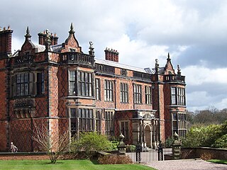
Arley Hall is a country house in the village of Arley, Cheshire, England, about 4 miles (6 km) south of Lymm and 5 miles (8 km) north of Northwich. It is home to the owner, Viscount Ashbrook, and his family. The house is a Grade II* listed building, as is its adjacent chapel. Formal gardens to the southwest of the hall are also listed as Grade II* on the National Register of Historic Parks and Gardens. In the grounds are more listed buildings, a cruck barn being listed as Grade I, and the other buildings as Grade II.

Clayton Vale is an area of green space in Clayton, Manchester, England, through which the River Medlock flows. Redeveloped in 1986, the land has a rich industrial and social history. Today the area is a natural habitat for wildlife and it has been designated a Local Nature Reserve.

Winterbourne Botanic Garden is a heritage site and botanic garden in Edgbaston, Birmingham, England. It is owned by the University of Birmingham.
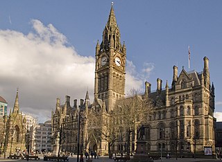
The architecture of Manchester demonstrates a rich variety of architectural styles. The city is a product of the Industrial Revolution and is known as the first modern, industrial city. Manchester is noted for its warehouses, railway viaducts, cotton mills and canals – remnants of its past when the city produced and traded goods. Manchester has minimal Georgian or medieval architecture to speak of and consequently has a vast array of 19th and early 20th-century architecture styles; examples include Palazzo, Neo-Gothic, Venetian Gothic, Edwardian baroque, Art Nouveau, Art Deco and the Neo-Classical.
Philips Park is an area of parkland situated within the Metropolitan Borough of Bury on the boundary of Whitefield and Prestwich, in Greater Manchester. The park consists of rich woodland and grassland habitat and is home to an assortment of wildlife. Two thirds of the site was once the Philips family estate, and the remainder, known as Waterdale, is Irwell Valley land reclaimed following the demolition of two bleach and dye works. The park is a local nature reserve.

Peel Park is a public urban park in Salford, Greater Manchester, England, located on the flood plain of the River Irwell below Salford Crescent and adjacent to the University of Salford. It was the first of three public parks to be opened on 22 August 1846, for the people of Manchester and Salford, paid for by public subscription. The park was the main public venue for the 1851 royal visit of Queen Victoria to Manchester and Salford and has been the subject of a number of paintings by the Salford artist, L.S. Lowry.
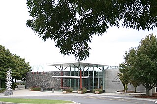
Auckland Botanic Gardens is a botanical garden in the New Zealand city of Auckland. It is located in the suburb of Manurewa, in the Manurewa Local Board Area. The garden covers 64 hectares, and holds more than 10,000 plants.


