Pico Rivera is a city located in southeastern Los Angeles County, California. The city is situated approximately 11 miles (18 km) southeast of downtown Los Angeles, on the eastern edge of the Los Angeles basin, and on the southern edge of the area known as the San Gabriel Valley. As of the 2020 United States census, the city has a population of 62,088. Pico Rivera is bordered by Montebello to the west, Downey to the south, Santa Fe Springs to the southeast, and Whittier to the east. Northrop Grumman's Advanced Systems Division developed the B-2 Spirit bomber here.

The Picos de Europa are a mountain range extending for about 20 km (12 mi), forming part of the Cantabrian Mountains in northern Spain. The range is situated in the Autonomous Communities of Asturias, Cantabria and Castile and León. The highest peak is Torre de Cerredo, at an elevation of 2650 m (8,690 ft).

La Ceiba is a municipality, the capital of the Honduran department of Atlántida and a port city on the northern coast of Honduras in Central America. It is located on the southern edge of the Caribbean, forming part of the south eastern boundary of the Gulf of Honduras. With an estimated population of 209,000 living in approximately 170 residential areas, it is the fourth most populous and third most important city in the country.

The Honduras national football team represents Honduras in men's international football. The team is governed by the Federación Nacional Autónoma de Fútbol de Honduras. They are nicknamed Los Catrachos, La Bicolor, or La H.

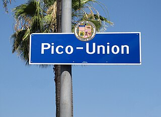
Pico-Union is a neighborhood in Central Los Angeles, California. The name "Pico-Union" refers to the neighborhood that surrounds the intersection of Pico Boulevard and Union Avenue. Located immediately west of Downtown Los Angeles, it is home to over 40,000 residents.
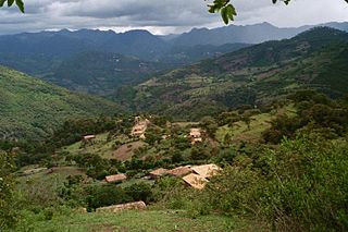
Morazán is a town, with a population of 22,240, and a municipality in the Honduran department of Yoro. This political division of 50,930 people is in the north, located between the city of Yoro and the municipality of El Negrito, north of the Pico Pijol National Park.

Pío Pico State Historic Park is the site of El Ranchito, also known as the Pío Pico Adobe or Pío Pico Mansion, the final home of Pío Pico, the last Governor of Alta California under Mexican rule and a pivotal figure in early California history. Located in Whittier, California, at 6003 Pioneer Blvd. near Whittier Blvd. and Interstate 605, it is California Historical Landmark No. 127, listed as "Casa de Governor Pío Pico". Just west of the park is the San Gabriel River. Across the river is the city that bears his name—Pico Rivera. The park consists of the adobe and about three acres of surrounding land.

The Cangrejal River or Río Cangrejal is a river that drains several mountain tributaries and borders the rainforest of Pico Bonito National Park near La Ceiba, Honduras. The river offers some of the best whitewater rafting opportunities in Central America.
Cerro Kamuk is a mountain in the Cordillera de Talamanca, in La Amistad International Park, in eastern Costa Rica, close to the border with Panama. It rises to 3,549 metres (11,644 ft) above sea level. It is one of the highest mountains in Central America. Indigenous peoples of the area include the Bribris and Cabecar. The area protected comprised four national parks clustered together that became La Amistad Biosphere Reserve. UNESCO declared it a natural World Heritage Site in 1983. It is part of the Mesoamerican Biological Corridor, UNESCO's project shared by eight Central American countries to help protect the remaining pristine mountain forest and wildlife of Central America.

Celaque National Park is a national park in Lempira Ocotepeque and Copán, western Honduras. It was established on 5 August 1987 and covers an area of 266.31 square kilometres. It includes Honduras’ tallest peak, called Cerro Las Minas or Pico Celaque, which reaches approximately 2,870 metres (9,416 ft) above mean sea level. It has an elevation ranging from 975 to 2,870 metres. Celaque's terrain is very rugged, two-thirds of the area has a slope greater than 60 degrees. The park is classified as a cloud forest with a mean precipitation of 1,600 mm at lower altitudes and a mean of 2,400 mm at higher altitudes. The word celaque is reputed to mean caja de aguas in the local, but now extinct, indigenous Lenca language. Celaque's nine rivers supplies water to 120 villages nearby including the district capital of Gracias. Celaque is high in biodiversity and is home to pumas, ocelots and Bolitoglossa celaque, an endangered plethodontid salamander found only in the mountains of Celaque.
Craugastor chrysozetetes is a possibly extinct species of frog in the family Craugastoridae. It is endemic to Honduras where it is only known from near its type locality on the Cerro Búfalo, Cordillera de Nombre de Dios, at the edge of the Pico Bonito National Park. Common name McCranie's robber frog has been coined for this species. However, James McCranie himself has argued that this name "should be rejected in favor of a name associated with the type locality instead of a name tied to one of the three authors who named this species".
Bolitoglossa porrasorum is a species of salamander in the family Plethodontidae. It is endemic to the mountains of north-central Honduras. Common name Pijol salamander has been proposed for this species in reference to its type locality, Pico Pijol. The specific name porrasorum honors of Jorge Porras Ziuniga and Jorge Porras Orellana, father and son, who provided friendship and assistance to the describers of this species.
Amphipteryx is a genus of damselflies, the only genus in the family Amphipterygidae. It is limited to Mesoamerica from Mexico to Honduras and Guatemala.

Cerro Las Minas is the highest mountain in Honduras. Cerro Las Minas is located in the rugged and relatively isolated Lempira Department in the western part of the country. A Honduran national park, the Celaque National Park, was established in 1987 for the mountain and some 266 square kilometres of surrounding territory.

Armenia Bonito - A "barrio" or "colonia" 11 kilometres (7 mi) west of downtown La Ceiba in the Atlántida Department in the country of Honduras in Central America. It is located in the northern part of Honduras within view of Caribbean Sea.

Pico Bonito National Park is a national park in Honduras. It was established on January 1, 1987 and covers an area of 564.30 km2 (217.88 sq mi). It has an altitude ranging between 60 and 2,480 meters.

The Central American dry forests ecoregion, of the tropical and subtropical dry broadleaf forests biome, is located in Central America.

The Central American Atlantic moist forests ecoregion covers the lowland coastal forests of Honduras, southeast Guatemala, and the eastern forests of Nicaragua. Half of the ecoregion is closed-canopy tropical broadleaf evergreen forest, with tree heights reaching 50 meters. This ecoregion has the largest single fragment of natural forest in Central America, with a size of 14,629 square kilometres (5,648 sq mi). The total area is 89,979 square kilometres (34,741 sq mi).


