
Kangchenjunga, also spelled Kanchenjunga, is the third highest mountain in the world. It rises with an elevation of 8,586 m (28,169 ft) in a section of the Himalayas called Kangchenjunga Himal delimited in the west by the Tamur River, in the north by the Lhonak Chu and Jongsang La, and in the east by the Teesta River. It lies between Nepal and Sikkim, India, with three of the five peaks directly on the border, and the remaining two in Nepal's Taplejung District.

The Pyrenees is a mountain range between Spain and France. Reaching a height of 3,404 metres (11,168 ft) altitude at the peak of Aneto, it extends for about 491 km (305 mi) from its union with Cantabrian Mountains to the Mediterranean Sea.

Annapurna is a massif in the Himalayas in north-central Nepal that includes one peak over 8,000 metres (26,000 ft), thirteen peaks over 7,000 metres (23,000 ft), and sixteen more over 6,000 metres (20,000 ft). The massif is 55 kilometres (34 mi) long, and is bounded by the Kali Gandaki Gorge on the west, the Marshyangdi River on the north and east, and by Pokhara Valley on the south. At the western end, the massif encloses a high basin called the Annapurna Sanctuary. The highest peak of the massif, Annapurna I Main, is the tenth highest mountain in the world at 8,091 metres (26,545 ft) above sea level. Maurice Herzog led a French expedition to its summit through the north face in 1950, making it the first of the eight-thousanders to be climbed and the only 8,000 meter-peak to be conquered on the first try.

Aneto is the highest mountain in the Pyrenees and in Aragon, and Spain's third-highest mountain, reaching a height of 3,404 metres. It stands in the Spanish province of Huesca, the northernmost of the three Aragonese provinces, 6 kilometres south of the France–Spain border. It forms the southernmost part of the Maladeta massif.

The Sangre de Cristo Mountains are the southernmost subrange of the Rocky Mountains. They are located in southern Colorado and northern New Mexico in the United States. The mountains run from Poncha Pass in South-Central Colorado, trending southeast and south, ending at Glorieta Pass, southeast of Santa Fe, New Mexico. The mountains contain a number of fourteen thousand foot peaks in the Colorado portion, as well as all the peaks in New Mexico which are over thirteen thousand feet.

Mount Nebo is the southernmost and highest mountain in the Wasatch Range of Utah, in the United States. Named after the biblical Mount Nebo overlooking Israel, which is said to be the place of Moses' death, it is the centerpiece of the Mount Nebo Wilderness, inside the Uinta National Forest.

Crestone Peak is the seventh-highest summit of the Rocky Mountains of North America and the U.S. state of Colorado. The prominent 14,300-foot (4,359 m) fourteener is the highest summit of the Crestones and the second-highest summit in the Sangre de Cristo Range after Blanca Peak. The summit is located in the Sangre de Cristo Wilderness of Rio Grande National Forest, 5.0 miles (8.1 km) east by south of the Town of Crestone in Saguache County, Colorado, United States.

Illimani (Aymara) is the highest mountain in the Cordillera Real of western Bolivia. It lies near the cities of El Alto and La Paz at the eastern edge of the Altiplano. It is the second highest peak in Bolivia, after Nevado Sajama, and the eighteenth highest peak in South America. The snow line lies at about 4,570 metres (15,000 ft) above sea level, and glaciers are found on the northern face at 4,983 m (16,350 ft). The mountain has four main peaks; the highest is the south summit, Nevado Illimani, which is a popular ascent for mountain climbers.

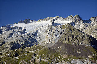
The Grand Combin is a mountain massif in the western Pennine Alps in the canton of Valais. With its 4,314 metres (14,154 ft) highest summit, the Combin de Grafeneire, it is one of the highest peaks in the Alps and the second most prominent of the Pennine Alps. The Grand Combin is also a large glaciated massif consisting of several summits, among which three are above 4000 metres. The highest part of the massif is wholly in Switzerland, although the border with Italy lies a few kilometres south.

The Barre des Écrins is a mountain in the French Alps with a peak at 4102m altitude. It is the highest peak of the Massif des Écrins and the Dauphiné Alps and the most southerly alpine peak in Europe that is higher than 4,000 m. It is the only 4,000 m mountain in France that lies outside the Mont Blanc Massif. Before the annexation of Savoy in 1860 it was the highest mountain in France.

Khunyang Chhish or Kunyang Chhish is the second-highest mountain in the Hispar Muztagh, a subrange of the Karakoram mountains in Pakistan. Alternate variations of the name include Kunyang Kish and Khiangyang Kish, among others. Its height, also sometimes given as 7,823 metres (25,666 ft), is ranked 21st in the world and 8th in Pakistan.
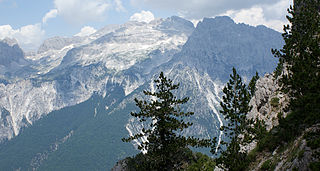
Jezerca Peak is the highest peak in the entire Dinaric Alps, the second highest in Albania and the sixth highest in the Balkans, standing at 2,694 m (8,839 ft) above sea level. It is one of the toughest if not one the most dangerous climbs in the Albanian Alps. However, Maja Jezercë is the 28th most prominent mountain peak in the European continent.

Rimo I is the main summit of the Rimo massif with an elevation of 7,385 metres (24,229 ft). It lies in the northern part of the remote Rimo Muztagh, a subrange of the Karakoram range. It is located about 20 km northeast of the snout of the Siachen Glacier and is the world's 71st highest mountain. Rimo means "striped mountain". The Rimo Glacier, originating here, drains to the Shyok river.

West Spanish Peak is a high and prominent mountain summit that is the higher of the two Spanish Peaks in the Rocky Mountains of North America. The prominent 13,631-foot (4,155 m) peak is located in the Spanish Peaks Wilderness of San Isabel National Forest, 9.1 miles (14.7 km) south of the Town of La Veta, Colorado, United States, on the drainage divide between Huerfano and Las Animas counties. The summit of West Spanish Peak is the highest point in Las Animas County, Colorado.

The Balaitús (Spanish) or Pic du Balaïtous (French) is a granitic massif of the Pyrenees, located right on the border between Spain and France.
Maladeta is a mountain in the Pyrenees, close to the highest peak in the range, Aneto. It is located in the Natural Park of Posets-Maladeta in the town of Benasque in Province of Huesca, Aragon, Spain. Its northern slope contains the 91-acre (37 ha) Maladeta Glacier, which is divided into the 15-acre (6 ha) Western Maladeta and the 77-acre (31 ha) Eastern Maladeta.

Lingtren, 6,749 metres (22,142 ft), is a mountain in the Mahalangur Himal area of Himalaya, about 8 kilometres (5.0 mi) distant in a direct line from Mount Everest. It lies on the international border between Nepal and the Tibet Autonomous Region of China and it was first climbed in 1935. A mountain nearby to the west was originally named Lingtrennup but is now more commonly called Xi Lingchain.

The Große Bischofsmütze is the highest peak in the Gosaukamm range of the Dachstein Mountains, Austria.

