
Bucks County is a county in the Commonwealth of Pennsylvania. As of the 2020 census, the population was 646,538, making it the fourth-most populous county in Pennsylvania. Its county seat is Doylestown. The county is named after the English county of Buckinghamshire.

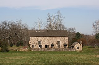
Buckingham Township is a township in Bucks County, Pennsylvania, United States. The population was 20,075 at the 2010 census. Buckingham takes its name from Buckingham in Buckinghamshire, England. Buckingham Township was once known as Greenville and was once the historic county seat of the English Bucks County.
Solebury Township is a township in Bucks County, Pennsylvania, United States. The population was 8,709 at the 2020 census.
Upper Makefield Township is a township in Bucks County, Pennsylvania, United States. The population was 8,190 at the 2010 census. It has the eighth highest per capita income among Pennsylvania townships. Its multimillion-dollar homes, top-notch public schools and easy commute to New York City and Princeton and has led to its ranking as Best Place to Live in the Suburbs in Philadelphia Magazine's Best Places to Live list. Additionally, it has been listed as the Philadelphia area's second-most expensive suburb and the 287th richest neighborhood in the United States, with a mean household income of $306,081. The area has also been listed an alternative to the Hamptons for the summer by New York Magazine.

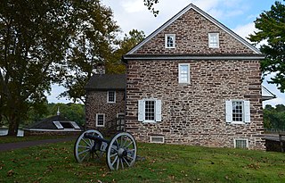
Pennsylvania Route 32 is a scenic two-lane highway that runs along the west side of the Delaware River in Bucks County, Pennsylvania. Signed north-south, it runs from U.S. Route 1 in Falls Township outside of Morrisville northwest to PA 611 in the village of Kintnersville in Nockamixon Township. PA 32 passes through Washington Crossing Historic Park, a Revolutionary War-themed historical park on the site of George Washington's crossing on the night of December 25–26, 1776. It also passes through the boroughs of Morrisville, Yardley, and New Hope.

Pennsylvania Route 263 (PA 263) is a north–south state highway located in southeast Pennsylvania. The southern terminus of the route is at PA 611 in Willow Grove, Montgomery County. The northern terminus is at the Centre Bridge–Stockton Bridge over the Delaware River in Centre Bridge, Bucks County, where the road continues into Stockton, New Jersey, as Bridge Street to an intersection with Route 29. PA 263 follows the routing of Old York Road, a historic road that connected Philadelphia to New York City, and carries the name York Road from the southern terminus to Lahaska and Upper York Road north of there. From Willow Grove to Buckingham, PA 263 runs mostly through suburban areas as a four-lane road, passing through Hatboro, Warminster, and Jamison. The route forms a concurrency with U.S. Route 202 (US 202) in Buckingham and narrows to a two-lane road, splitting with that route in Lahaska. From here, the route continues through rural areas to Centre Bridge.

U.S. Route 202 is a US Highway running from New Castle, Delaware, northeast to Bangor, Maine. The route runs through the southeastern part of the U.S. state of Pennsylvania, passing through the western and northern suburbs of Philadelphia in the Delaware Valley metropolitan area. US 202 serves largely as a toll-free bypass around the city, avoiding the busy traffic and congestion on Interstate 95 (I-95). It is signed north–south and follows a general southwest–northeast direction through the state, serving West Chester, King of Prussia, Bridgeport, Norristown, Montgomeryville, Doylestown, and New Hope. US 202 enters Pennsylvania from Delaware and heads north as a divided highway, where it becomes concurrent with US 322 at an intersection with US 1 in Painters Crossing. The two routes run north and become a freeway that bypasses West Chester to the east, with US 322 splitting from US 202. US 202 continues north and east along the freeway to King of Prussia, where it reverts to an at-grade divided highway following an interchange with I-76. The route becomes a one-way pair as it passes through Bridgeport and Norristown before both directions rejoin and the road continues northeast. US 202 follows an expressway-grade parkway between Montgomeryville and Doylestown prior to bypassing Doylestown to the south along a freeway. The route continues northeast as an at-grade road to New Hope, where it turns into a freeway again before it crosses the Delaware River on the New Hope–Lambertville Toll Bridge into New Jersey.
Lahaska Creek is a tributary of Mill Creek in Wrightstown Township, Bucks County, Pennsylvania. The Geographic Name Information System I.D. is 1178763, U.S. Department of the Interior Geological Survey I.D. is 02632.
Mill Creek is one of the three tributaries of the Neshaminy Creek bearing the name and one of six Mill Creeks in Bucks County, Pennsylvania. Rising in Doylestown Township, Mill Creek runs about 2 miles (3.2 km) to its confluence at Neshaminy Creek's 36.40 river mile.
Cooks Run is a tributary of the Neshaminy Creek. Rising in Doylestown Township, Bucks County, Pennsylvania, it runs about 2 miles (3.2 km) to its confluence with the Neshaminy Creek.
West Branch Neshaminy Creek is one of two branches of the Neshaminy Creek, the other being the North Branch, part of the Delaware River watershed. It is located in Bucks and Montgomery Counties in Pennsylvania.
Dyers Creek is a tributary of the Delaware River wholly contained within Lower Makefield Township, Bucks County, Pennsylvania.
Houghs Creek is a tributary of the Delaware River in Bucks County, Pennsylvania, contained wholly within Upper Makefield Township.
Jericho Creek is a tributary of the Delaware River, rising in Wrightstown Township, Bucks County, Pennsylvania, and passing into Upper Makefield Township where it meets its confluence with the Delaware.
Curls Run is a tributary of Pidcock Creek in Bucks County, Pennsylvania, part of the Delaware River drainage basin.
Dark Hollow Run is a tributary of the Delaware River contained wholly within Solebury Township, Bucks County, Pennsylvania, meeting with the Delaware south of New Hope.

Aquetong Creek is a tributary of the Delaware River in Solebury Township and New Hope, Bucks County, Pennsylvania. Rising from the Aquetong Spring, now known as Ingham Spring, just south of the intersection of U.S. Route 202, Lower Mountain Road, and Ingham Road, it runs about 10.75 miles (17.30 km) to its confluence with the Delaware.
Cuttalosa Creek is a tributary of the Delaware River in Bucks County, Pennsylvania.
Paunnacussing Creek is a tributary of the Delaware River contained wholly within Bucks County, Pennsylvania in the United States. It rises from a pond north of Mechanicsville, in Buckingham Township and drains into the Delaware at Bull Island just upstream of Lumberville in Solebury Township.
Core Creek is a tributary of the Neshaminy Creek in Bucks County, Pennsylvania. Rising in Lower Makefield Township, it flows in the Stockton Formation until it meets its confluence with the Neshaminy in Middletown Township. At one time it powered seven mills along its length.

