
Mila Doce is a census-designated place (CDP) in Hidalgo County, Texas. The population was 6,222 at the 2010 United States Census. It is part of the McAllen–Edinburg–Mission Metropolitan Statistical Area.

Desoto is an unincorporated community in Delaware Township, Delaware County, Indiana.

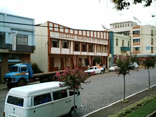
Couto de Magalhães is a municipality located in the Brazilian state of Tocantins. Its population was 4,887 (2007) and its area is 1,586 km² (612.4 mi²), a density of 3.07 people/km². It is located 150 m (492.1 ft) above sea level. The demonym is Coutense.
Aczo District is one of six districts of the province Antonio Raymondi in Peru.
La Unión District is one of nine districts found in the province Dos de Mayo in Peru.
San Francisco de Cayrán District is one of twelve districts of the province Huánuco in Peru.
Anra District is one of sixteen districts of the province Huari in Peru.
Huacachi District is one of sixteen districts of the province Huari Province in the Ancash Region of Peru.
Huacchis District is one of sixteen districts of the province Huari in Peru.
Paucas District is one of sixteen districts of the province Huari in Peru.
Ponto District is one of sixteen districts of the province Huari in Peru.
Rapayan District is one of sixteen districts of the province Huari in Peru.
Uco District is one of sixteen districts of the province Huari in Peru.

Felício dos Santos is a Brazilian municipality located in the center-north of the state of Minas Gerais. Its population as of 2007 was 5,685 living in a total area of 358 km². The city belongs to the statistical mesoregion of Jequitinhonha and to the statistical microregion of Diamantina. It became a municipality in 1953.

Comus is an unincorporated community in Montgomery County, Maryland, United States. Its elevation is 591 feet (180 m). The mostly rural community is located about 39.7 miles (63.9 km) by car from Washington D.C.

Błuskajmy Wielkie is a village in the administrative district of Gmina Korsze, within Kętrzyn County, Warmian-Masurian Voivodeship, in northern Poland. It lies approximately 9 kilometres (6 mi) north of Korsze, 26 km (16 mi) north-west of Kętrzyn, and 65 km (40 mi) north-east of the regional capital Olsztyn.

Watkins is an unincorporated community in Mill Creek Township, Union County, Ohio, United States. It is located at 40°12′45″N83°14′49″W, along Watkins Road, between U.S. Route 33 and U.S. Route 42, about five miles east of Marysville.
Tangará is a municipality in the state of Santa Catarina in the South region of Brazil.
Barras is a municipality in the state of Piauí in the Northeast region of Brazil.

Pukaqucha is a mountain in the Andes of Peru, about 5,100 metres (16,732 ft) high, at a small lake of the same name. The mountain is located in the Junín Region, Yauli Province, in the districts of Marcapomacocha and Morococha, and in the Lima Region, Huarochirí Province, Chicla District. It lies near the Antikuna pass, northwest of Yuraqqucha and northeast of Inka Kancha and Sillaqaqa.


