Hietalahti is an unofficial district in the city of Helsinki, Finland.

District #3 is one of six districts located in Grand Bassa County, Liberia. The city of Buchanan, capital of Grand Bassa County, is located in the district.

Virginia's 8th congressional district is a United States congressional district in the Commonwealth of Virginia. It comprises all of Arlington County, portions of Fairfax County and all of the independent cities of Alexandria and Falls Church.

Spring Creek is an unincorporated community in El Dorado County, California. It lies at an elevation of 6339 feet.

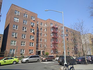
Bogardus Place is located in the Inwood section of New York City borough of Manhattan. The one-block street was opened in 1912, and runs 642 feet (196 m) between Hillside Avenue and Ellwood Street, and is named for the family who previously owned much of the land that forms both Fort Tryon Park, and the Fort Tryon section.
Alfoz de Quintanadueñas is a municipality located in the province of Burgos, Castile and León, Spain. According to the 2004 census (INE), the municipality has a population of 1,300 inhabitants.

Clondrohid is a Civil Parish in County Cork, Ireland, four miles (6 km) north of Macroom. Its population is estimated at around 900.
Sabandía District is one of the twenty-nine districts of the Arequipa Province in Peru.

Marca District is one of ten districts of the province Recuay in Peru.
KBHC is a radio station serving the Texarkana area with a Hispanic format. The station is currently under ownership of Arklatex Radio, Inc.

Turze is a settlement in the administrative district of Gmina Czaplinek, within Drawsko County, West Pomeranian Voivodeship, in north-western Poland. It lies approximately 15 kilometres (9 mi) south-east of Czaplinek, 42 km (26 mi) east of Drawsko Pomorskie, and 123 km (76 mi) east of the regional capital Szczecin.

Imperial Gables is an unincorporated community in Imperial County, California. It is located 12.5 miles (20 km) northeast of Glamis, at an elevation of 1283 feet.

Blackrock is an unincorporated community in Inyo County, California. It lies at an elevation of 3829 feet and is located at 36°55′45″N118°14′00″W.
Skelly is a former settlement in Humboldt County, California. It was located 3.5 miles (5.6 km) south of Holmes. It is now known as Larabee.
Vir-Mar Beach is an unincorporated community in Northumberland County, in the U.S. state of Virginia.
ROKS Sokcho (PCC-778) is a South Korean Pohang-class corvette of the Republic of Korea Navy (ROKN). It was in the vicinity at the time of the sinking of the ROKS Cheonan and is reported to have fired shots at a possible target that it identified at that time.
Atholton is an unincorporated community in Howard County, Maryland, United States. A postal office operated from May 26, 1897 to November 1900 and again from 1903 to July 1917.
Horatio is an unincorporated community in Jefferson County, in the U.S. state of Pennsylvania.
Keener Cave or Keener is an extinct town in southern Wayne County, in the U.S. state of Missouri. The GNIS classifies it as a populated place.

Circum Peak is a mountain rising to 198 m (650 ft) in the southeast part of Weddell Island in the Falkland Islands. It is located at 51°55′45″S60°55′27″W, which is 2.12 km (1.32 mi) southeast of Mount Weddell, and surmounts New Year Cove to the southeast and Gull Harbour to the northeast.


