The Ilchester Cheese Company is a cheese company based in Ilchester, Somerset. The Ilchester brands are part of Norseland, a subsidiary of Norwegian dairy company Tine SA. Ilchester do not actually manufacture any cheese from scratch, but specialise in blending a variety of British cheeses with other ingredients, such as beer and fruit. Notable Ilchester cheeses include Applewood, a smoke-flavoured Cheddar cheese, and Five Counties, which is a sandwich of five layers of different English cheeses.
Millwall Junction was a railway station in Poplar, east London, on the London and Blackwall Railway (LBR). Despite the name, it was not in Millwall, but rather it marked where the LBR southern branch to Millwall and North Greenwich, which served the West India Docks, branched off the main line. It was between West India Docks station and Poplar station, 2 miles 64 chains (4.5 km) down-line from Fenchurch Street, with South Dock the next stop on the Millwall branch.

The Indian Harbor Yacht Club is a U.S. boating organization, based at 710 Steamboat Road in Greenwich, CT, with access to Long Island Sound. The club is based mainly around personally owned yachts and pleasure boats, but also has a long history of competitive races.

Bridge of Muchalls is an entirely residential hamlet in Aberdeenshire, Scotland by the North Sea. It is on the A90 dual carriageway about three miles north of Stonehaven and to the south of Muchalls Castle.
Rock Springs Conservation Area is a 1,300 acre (5 km²) park located 4 miles (6.5 km) southwest of Decatur, Illinois. Centering on the Rock Spring Nature Center, a small environmental-education museum and community center, it is the largest parcel of parkland, in terms of surface area, in Macon County.

Svrzo's House is an old house in Sarajevo, Bosnia and Herzegovina that was established when the Ottoman Empire ruled the area. It is a branch of the Museum of Sarajevo. It is typical in that it has living quarters for the men, the women, and the servants. The house is in extremely well preserved condition, which is noteworthy in that the house is built completely from wood; a construction method not commonly used in the region in modern times. It is open to the public for self-guided tours and has brochures and information in multiple languages.

Caujul District is one of six districts of the province Oyón in Peru.

Oyón District is one of six districts of the province Oyón in Peru.
Pachangara District is one of six districts of the province Oyón in Peru.
Checras District is one of twelve districts of the province Huaura in Peru.
Paccho District is one of twelve districts of the province Huaura in Peru.
Santa Leonor District is one of twelve districts of the province Huaura in Peru.
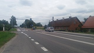
Ludwinowo is a village in the administrative district of Gmina Raczki, within Suwałki County, Podlaskie Voivodeship, in north-eastern Poland.

Górka is a village in the administrative district of Gmina Ostróda, within Ostróda County, Warmian-Masurian Voivodeship, in northern Poland.
Cruzmaltina is a municipality in the state of Paraná in the Southern Region of Brazil.
Dunkassa is a town and arrondissement in the Borgou Department of Benin. It is an administrative division under the jurisdiction of the commune of Kalalè. According to the population census conducted by the Institut National de la Statistique Benin on February 15, 2002, the arrondissement had a total population of 17,236.
Yuraq Mach'ay is an archaeological site with rock paintings in Peru. It lies in the Pasco Region, Daniel Alcides Carrión Province, Chacayan District. Yuraq Mach'ay is situated at a height of 3,991 metres (13,094 ft) on the slope of Pukara, north of the city of Cerro de Pasco.
Markapukyu is an archaeological site in Peru. It is situated in the Pasco Region, Pasco Province, Yarusyacán District, at a height of 3,787 metres (12,425 ft).
Qaqapatan (Quechua) is an archaeological site with rock paintings in Peru. It lies in the Pasco Region, Pasco Province, Yarusyacán District, at a height of 3,787 metres (12,425 ft). Qaqapatan is situated at a height of 3,782 metres (12,408 ft) at the foot of the mountain Qayakuna in the village Quchaq (Cochac), north of the town Cerro de Pasco.

NGC 4293 is a lenticular galaxy in the northern constellation of Coma Berenices. It was discovered by English astronomer William Herschel on March 14, 1784, who described it as "large, extended, resolvable, 6 or 7′ long". This galaxy is positioned to the north-northwest of the star 11 Comae Berenices and is a member of the Virgo Cluster of galaxies. It is assumed to lie at the same distance as the Virgo Cluster itself: around 54 million light years away. The galaxy spans an apparent area of 5.3 × 3.1 arc minutes.


