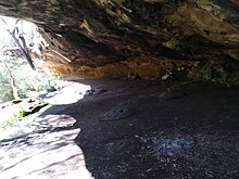
The Brisbane Water National Park is a protected national park in the Central Coast region of New South Wales, in eastern Australia. The 11,506-hectare (28,430-acre) national park is situated 70 kilometres (43 mi) north of Sydney, 10 kilometres (6.2 mi) west of Woy Woy, and 12 kilometres (7.5 mi) southwest of Gosford.

The Main North Line is a major railway in New South Wales, Australia. It runs through the Central Coast, Hunter and New England regions. The line was the original main line between Sydney and Brisbane, however this required a change of gauge at Wallangarra. As of 1988, the line closed progressively north of Armidale with services gradually withdrawn till 2004, with the main route between Sydney and Brisbane now the North Coast line.
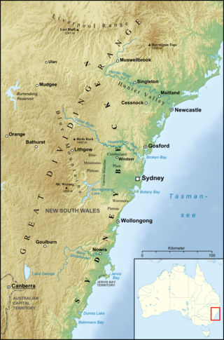
The Sydney Basin is an interim Australian bioregion and is both a structural entity and a depositional area, now preserved on the east coast of New South Wales, Australia and with some of its eastern side now subsided beneath the Tasman Sea. The basin is named for the city of Sydney, on which it is centred.
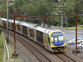
The Central Coast & Newcastle Line is a NSW TrainLink passenger train service that runs along the Main North railway line in New South Wales, connecting the state's two largest cities, Sydney and Newcastle. The service runs from Central through to Broadmeadow on the Main North railway line to Newcastle Interchange on the Newcastle railway line, and services the Hawkesbury River region, the Central Coast and the city of Newcastle.

Hawkesbury River railway station is a heritage-listed railway station located on the Main North and Central Coast–Newcastle lines in Brooklyn in the Hornsby Shire local government area of New South Wales, Australia. The station serves the town of Brooklyn and is located on the southern bank of the Hawkesbury River. It was designed and build by the Department of Railways New South Wales. It is also known as Hawkesbury River Railway Station group and Brooklyn Station. The property was added to the New South Wales State Heritage Register on 2 April 1999.
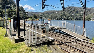
Wondabyne railway station is located on the Main Northern line in New South Wales, Australia. It serves the southern Central Coast area known as Wondabyne and opened on 1 May 1889. It is the only station in Australia that does not have road access.

The Pacific Motorway is a 127-kilometre motorway linking Sydney to Newcastle via the Central Coast and Hunter regions of New South Wales. Formerly known but still commonly referred to by both the public and the government as the F3 Freeway, Sydney–Newcastle Freeway, and Sydney–Newcastle Expressway, it is part of the AusLink road corridor between Sydney and Brisbane. The name "F3 Freeway" reflects its former route allocation before it was decommissioned and replaced by the rollout of alphanumeric signposts.

The Berowra Creek, a watercourse that is part of the Hawkesbury-Nepean catchment, is located to the north of the Sydney central business district in the Hornsby Shire of New South Wales, Australia.

The Hawkesbury River railway bridge is a heritage-listed railway bridge in New South Wales, Australia that carries the Main North railway line across the Hawkesbury River. It is located just north of the town of Brooklyn on the northern outskirts of Sydney. The railway bridge was to be the last link in a railway network that linked the state capitals Adelaide, Melbourne, Sydney and Brisbane and was a major engineering feat at the time. The original railway bridge was built in 1889 and replaced by the current bridge in 1946. The 1946 bridge was added to the New South Wales State Heritage Register on 2 April 1999.
Cogra Bay is a suburb of the Central Coast region of New South Wales, Australia, located on the north bank of the Hawkesbury River 51 kilometres (32 mi) north of Sydney. It is part of the Central Coast Council local government area.
Marlow is a suburb of the Central Coast region of New South Wales, Australia on the north bank of the Hawkesbury River 58 kilometres (36 mi) north of Sydney. It is part of the Central Coast Council local government area.

Mooney Mooney is a suburb of the Central Coast region of New South Wales, Australia, at the end of a peninsula extending southwards into the Hawkesbury River estuary situated 48 kilometres (30 mi) north of Sydney. It is where the Pacific Motorway and Pacific Highway cross from the Central Coast into Sydney's metropolitan area at Brooklyn in the Hornsby Shire.
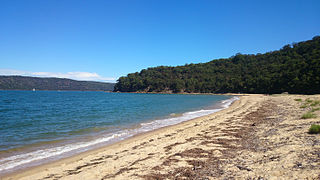
Patonga is a suburb of the Central Coast region of New South Wales, Australia, located on the north bank of the Hawkesbury River, southwest of Woy Woy. It is part of the Central Coast Council local government area.

St Huberts Island is a canal estate and suburb of the Central Coast region of New South Wales, Australia connected to the mainland at Daleys Point. It is part of the Central Coast Council local government area.

Wondabyne is a road-inaccessible suburb located in the Central Coast region of New South Wales, Australia, and is part of the Central Coast Council local government area. The river that surrounds Wondabyne is called "Mullet Creek".

The Mooney Mooney Creek, a perennial river that is part of the Hawkesbury-Nepean catchment, is located in the Central Coast region of New South Wales, Australia.

The Mooney Mooney Bridge, officially the Mooney Mooney Creek Bridge, and popularly known as The NSW Big Dipper Bridge, is a twin cantilever bridge that carries the Pacific Motorway (M1) across Mooney Mooney Creek, located near Mooney Mooney in the Brisbane Water National Park on the Central Coast of New South Wales, Australia. The concrete box girder bridge was opened on 14 December 1986 by the Prime Minister of Australia, Bob Hawke, and is owned and maintained by Transport for NSW, an agency of the Government of New South Wales.

The Peats Ferry Bridge is a steel truss bridge that carries the Pacific Highway (B83) across the Hawkesbury River, between Kangaroo Point and Mooney Mooney Point, located 40 kilometres (25 mi) north of Sydney in New South Wales, Australia. The bridge carries the Hornsby to Kariong section of highway, while the adjacent Brooklyn Bridge carries the Pacific Motorway (M1).

The Woy Woy railway tunnel is a heritage-listed railway tunnel located between Wondabyne and Woy Woy stations on the Main Northern railway line in New South Wales, Australia. The dual-track 1.69-kilometre tunnel was opened on 16 January 1888. It was added to the New South Wales State Heritage Register on 28 June 2013.
