
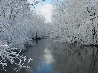
The Au Sable River in Michigan, United States runs approximately 138 miles (222 km) through the northern Lower Peninsula, through the towns of Grayling and Mio, and enters Lake Huron at Au Sable. It is considered one of the best brown trout fisheries east of the Rockies and has been designated a blue ribbon trout stream by the Michigan Department of Natural Resources. In French, au sable literally means "at the sand." A 1795 map calls it the Beauais River.

Frederic Township is a civil township of Crawford County in the U.S. state of Michigan. The population was 1,341 at the 2010 census.

The Manistee National Forest is a national forest located in the Lower Peninsula of Michigan. It has a total area of 540,187 acres (2,190 km2). It was established in 1938, and combined with the Huron National Forest in 1945 for administrative purposes, creating the Huron-Manistee National Forests. However, they are two separate forest units, as they are not connected. The area is popular for hiking, fishing, camping, boating, snowmobiling, cross-country skiing and hunting. The North Country Trail passes through it, and connects with the 11-mile Manistee River Trail to form a 23-mile loop. The highest point in the lower peninsula, Briar Hill, is located here. The Manistee National Forest is not one continuous mass, but is a "mosaic" broken by private property and towns. The headquarters for the forest is in Cadillac, Michigan.
The Paw Paw River is located in the U.S. state of Michigan in the southwest portion of the lower peninsula. It is formed by the confluence of the north and south branches at 42°15′17″N85°55′36″W in Waverly Township in the northeast of Van Buren County. It flows approximately 61.8 miles (99.5 km) through Van Buren County and Berrien County until joining the St. Joseph River just above its mouth on Lake Michigan at Benton Harbor.

Pine River may refer to any of the following streams in the U.S. state of Michigan:
- Pine River. The main branch forms with the confluence of the East and West Branches of the Pine River at 44°29′38″N83°23′16″W in Alcona County. The South Branch joins approximately 1.5 miles (2.4 km) to the south and flows into Iosco County, where it empties into Van Etten Lake at 44°29′38″N83°23′16″W northwest of Oscoda.
- Pine River. The main branch is formed by the confluence of the North and Middle Branches northeast of Standish and flows into the Saginaw Bay of Lake Huron at 43°58′32″N83°51′16″W. The South Branch Pine River joins the main stream at 43°59′08″N83°53′17″W.
- Pine River is a short waterway, which along with Round Lake, connects Lake Charlevoix with Lake Michigan at Charlevoix.
- Pine River rises in Chippewa County and flows south through Mackinac County into the St. Martin Bay of Lake Huron at 46°03′09″N84°39′22″W The North Pine River, also known as the North Branch Pine River, joins at 46°12′20″N84°36′17″W. Another tributary, Hemlock Creek, is also known as Pine River.
- Pine River, also known as the South Branch Manistee River, rises in southeast Wexford County, flows southwest across northwest Osceola County, then west and north through the northeast corner of Lake County and back into southwest Wexford County, emptying into the Tippy Dam Pond on the Manistee River at 44°13′37″N85°54′27″W. The main stream is formed from the confluence of the East Branch Pine River with the North Branch Pine River at 44°06′02″N85°31′40″W. Another tributary, the Spaulding Creek, is also known as the Little Pine River
- Pine River, in Marquette County, is a very short stream draining Pine Lake into Lake Superior at 46°53′27″N87°52′13″W, north of the Huron Mountains.
- Pine River rises in from Pine Lake in eastern Mecosta County, flows mostly south and east through Isabella County, then south along eastern edge of Montcalm County, then east and north through Gratiot County and Midland County, emptying into the Chippewa River at 43°36′06″N84°17′33″W, just about two miles before it joins the Tittabawassee River near Midland. The South Branch Pine River joins the main stream at 43°30′37″N85°00′02″W Another tributary, Miller Creek, is also sometimes known as Pine River or the West Branch Pine River. The North Branch Pine River joins the main stream at 43°26′03″N84°50′18″W.
- Pine River empties into the St. Clair River at 42°49′13″N82°29′08″W on the south side of St. Clair. The South Branch Pine River joins the main stream at 42°58′11″N82°37′10″W. Another tributary, Quakenbush Drain, is also sometimes known as Pine River.
- Pine Creek empties into Lake Superior and is also known as the Pine River.

The Yellow Dog River flows through Marquette County in the Upper Peninsula of the U.S. state of Michigan. It is 31.6 miles (50.9 km) in length, with about 85 miles (137 km) of tributaries. The main branch begins at the outflow from Bulldog Lake in the Ottawa National Forest on the boundary between Baraga and Marquette counties. The river's mouth is on Lake Independence, near Big Bay, Michigan, and is part of the Lake Superior watershed.

The White River is a 23.6-mile-long (38.0 km) river located on the western side of the Lower Peninsula of the U.S. state of Michigan. The White River rises from the extensive Oxford Swamp in north central Newaygo County and flows out into an upland area. The rural town of Hesperia borders the river here.

The Cass River is a 61.5-mile-long (99.0 km) river in the Thumb region of the U.S. state of Michigan. It drains large portions of Sanilac and Tuscola counties and smaller portions of Genesee, Huron, Lapeer, and Saginaw counties.

The Mulberry River is a 70-mile-long (110 km) tributary of the Arkansas River in northwestern Arkansas in the United States. Via the Arkansas River, it is part of the watershed of the Mississippi River. It has been designated a National Wild and Scenic River. The drainage basin of the Mulberry River has an area of 373 square miles (970 km2) and the annual average mean flow of the river near its mouth is 557 cubic feet per second.

Big Run is a 4.4-mile-long (7.1 km) tributary stream of the South Branch Potomac River, belonging to the Potomac River and Chesapeake Bay watersheds. Big Run flows through the city of Romney and the campus of the West Virginia Schools for the Deaf and Blind in Hampshire County, West Virginia. The stream is known by local residents as Town Run and Town Creek.
Carp River is a 40.2-mile-long (64.7 km) river in Chippewa and Mackinac counties in the U.S. state of Michigan. 21.7 miles (34.9 km) of the river were added to the National Wild and Scenic Rivers System in 1992.

The Ontonagon River is a river flowing to Lake Superior on the western Upper Peninsula of Michigan in the United States. The main stem of the river is 25 miles (40 km) long and is formed by a confluence of several longer branches, portions of which have been collectively designated as a National Wild and Scenic River. Several waterfalls occur on the river including Agate Falls and Bond Falls.
The Tittabawassee River is a stream that flows in a generally southeasterly direction through the Lower Peninsula of the U.S. state of Michigan. The river begins at Secord Lake in Clement Township, at the confluence of the East Branch and the Middle Branch. From there it flows through Gladwin, Midland and Saginaw counties where, as a major tributary of the Saginaw River, it flows into it at Saginaw. Its tributaries include the Chippewa, Pine, Molasses, Sugar, and Tobacco rivers.
The Whitefish River is an 11.9-mile-long (19.2 km) river on the Upper Peninsula of the U.S. state of Michigan. The mouth of the river is in Delta County at 45°54′34″N86°58′01″W on the Little Bay De Noc of Lake Michigan. The main branch of the river is formed by the confluence of the east and west branches at 46°03′25″N86°52′17″W.
The North Fork John Day River is a 107-mile (172 km) tributary of the John Day River in the U.S. state of Oregon. It begins in Grant County about 20 miles (32 km) northwest of Baker City near the crest of the Blue Mountains. It flows generally west to the community of Dale on U.S. Route 395, then southwest through the city of Monument to the unincorporated community of Kimberly, where it meets the main stem of the John Day River.

Indian River is a 59.1-mile-long (95.1 km) tributary of the Manistique River on the Upper Peninsula of Michigan in the United States. It rises out of Hovey Lake at 46°17′36″N86°42′20″W on Hiawatha National Forest land in Alger County and flows south and east through a lake district and on through Schoolcraft County. The river flows into the 8,659 acre (35 km²) Indian Lake at 46°17′36″N86°42′20″W and flows out at 45°59′30″N86°17′15″W. It then flows east and south about 2.5 miles where it merges with the Manistique River, which then flows through Manistique and into Lake Michigan at 45°56′56″N86°14′45″W.
Sturgeon River is a 106-mile-long (171 km) river in Baraga County and Houghton counties in the U.S. state of Michigan. 25.0 miles (40.2 km) of the river were added to the National Wild and Scenic Rivers System in 1992.

Indian Creek is a major stream in the northern Sierra Nevada of Plumas County, California and is part of the Feather River system. The creek is 47 miles (76 km) long, flowing through a series of small towns and farming valleys in a rural, mountainous area.


