Ji-Paraná is the second most populous municipality in the Brazilian state of Rondônia, with a population of 130,009, and the 16th most populous city of the Brazilian North Region, the 210th most populous city of Brazil, and the 113th of the Brazilian interior. It has an area of 6,897 km2. The city is divided by the Ji-Paraná River.

Linhares is a municipality in the state of Espírito Santo, Brazil, 135 kilometres (84 mi) north of the state capital, Vitória. It is the largest municipality by area in the state, at 9,501.6 km2, and has a population of 176,688 people as of 2020.

Macaé is a municipality located in the Brazilian state of Rio de Janeiro, 180 km northeast of the state capital. It is the birthplace of the 13th president of Brazil, Washington Luís.

Conceição da Barra is a Brazilian municipality in the state of Espírito Santo. The city is the northernmost coastal city of the state. Its population was 31,273 (2020) and its area is 1,188.044 km².

Jaguaré is a municipality located in the Brazilian state of Espírito Santo. Its population was 31,039 (2020) and its area is 660 km2.

Santa Teresa is a municipality located in the Brazilian state of Espírito Santo. Its population was 23,724 (2020) and its area is 695 km2.

Sooretama is a municipality located in the Brazilian state of Espírito Santo. Its population was 30,680 (2020) and its area is 587 km2 (227 sq mi).

Vila Valério is a municipality located in the Brazilian state of Espírito Santo. Its population was 14,073 (2020) and its area is 464 km2.

Angra dos Reis is a municipality located in the southern part of the Brazilian state of Rio de Janeiro. The city is located by the sea and includes in its territory many offshore islands, the largest being Ilha Grande.

Amapá ( ) is a municipality located in the easternmost portion of the homonymous state of Amapá in Brazil. Its population is 9,187 and its area is 9,169 square kilometres (3,540 sq mi).
Quebrangulo is a municipality located in the Brazilian state of Alagoas. Its population was 11,248 (2020) and its area is 300 km2.
Pirambu is a municipality located in the Brazilian state of Sergipe. Its population was 9,359 (2020) and its area is 218 km2.

Casimiro de Abreu is a municipality located in the Brazilian state of Rio de Janeiro. Its population was 46,110 (2022) and its area is 462 km2.
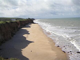
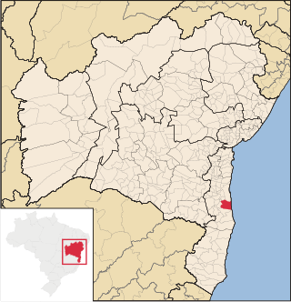
Mucuri is a city in the state of Bahia in Brazil. The estimated population in 2020 is 42,251 inhabitants. It is the southernmost city in Bahia as well as Brazil's Northeast region, and the only one from that state to border Espírito Santo.
Córrego do Veado Biological Reserve is a biological reserve in the municipality of Pinheiros, Espírito Santo, Brazil.
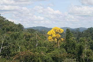
Córrego Grande Biological Reserve is a biological reserve spanning the boundary of Bahia and Espírito Santo, Brazil.
Almeirim is a city on the Amazon and the northernmost municipality in the Brazilian state of Pará. It is also the fourth largest municipality in that state and the eighth largest in Brazil. The municipality is crossed by the Equator.
The Veado River is a river of Espírito Santo state in eastern Brazil. It is a tributary of the Santo Antônio River which in turn joins the Itaúnas River.
Una is a city in Bahia, Brazil. Its population in 2020 was 18,544 inhabitants. It is located about 36 mi (58 km) south from Ilheus.

Bombinhas is a municipality in the state of Santa Catarina in the South region of Brazil. It is the smallest municipality of that state in terms of area.