Humayun Ahmed was a Bangladeshi novelist, dramatist, screenwriter, filmmaker, songwriter, scholar, and professor. His breakthrough was his debut novel Nondito Noroke published in 1972. He wrote over 200 fiction and non-fiction books, many of which were bestsellers in Bangladesh. His books were the top sellers at the Ekushey Book Fair during the 1990s and 2000s.

Gazipur is a district in central Bangladesh, part of the Dhaka Division. It has an area of 1741.53 km2. It is the home district of Tajuddin Ahmad, the first Prime Minister of Bangladesh and has been a prominent centre of battles and movements throughout history. Gazipur is home to the Bishwa Ijtema, the second-largest annual Muslim gathering in the world with over 5 million attendees. There are many facilities available in this district as it contains numerous universities, colleges, the Bangabandhu Sheikh Mujib Safari Park, Bhawal National Park as well as the country's only business park - the Bangabandhu Hi-Tech City.
Muladi is an Upazila of Barishal District in the Division of Barishal, Bangladesh.
Doshmina is an upazila of Patuakhali District in the Division of Barisal, Bangladesh.

Ramganj is an upazila of Lakshmipur District in the Division of Chittagong, Bangladesh. The seat lies at Ramganj town, which is 121 kilometres (75 mi) by road southeast of Dhaka.
Companiganj is an upazila of Noakhali District. The area is famed for water buffalo doi (curd).
Gazipur Sadar is an upazila (sub-district) of the Gazipur District in central Bangladesh, part of the Dhaka Division.
Kapasia is an upazila (sub-district) of Gazipur District in central Bangladesh, part of the Dhaka Division. It is located at 24.1000°N 90.5708°E, and is best known as the home upazila of Tajuddin Ahmad, the first Prime Minister of Bangladesh. The modern-day upazila was a part of the historic Bhawal Estate and falls within its boundary.
Kaliganj is an upazila (sub-district) of Gazipur District in central Bangladesh, part of the Dhaka Division.
Tungipara is an upazila of Gopalganj District in the Division of Dhaka, Bangladesh. It is the birthplace of Bangabandhu Sheikh Mujibur Rahman, the founder of independent Bangladesh and his grave is also here. In 1995 it became an Upazila.

Pakundia is an upazila (subdistrict) in Kishoreganj District, Dhaka Division, Bangladesh. Its total land area is 180.52 square kilometres. It has a population of 237,218 residents. It was formed in 1922 as a thana. On the 14th of September 1983, it was turned into an upazila.
Gafargaon is an upazila of Mymensingh District in the Division of Mymensingh, Bangladesh.
Nandail is an upazila of Mymensingh District in the division of Mymensingh, Bangladesh, and roughly 46 kilometers from Mymensingh City.
Narayanganj Sadar is an upazila of Narayanganj District in the Division of Dhaka, Bangladesh.
Sherpur Upazila is an upazila of Bogra District in the Division of Rajshahi, Bangladesh. Sherpur Thana was established in 1962 and was converted into an upazila in 1983. It is named after its administrative center, the town of Sherpur. It is said that there once lived Sher family in the vicinity, from which the name "Sherpur" evolved.
Mithapukur is an upazila of Rangpur District in the division of Rangpur, Bangladesh. The upazila is situated in the middle of Rangpur, surrounded by Rangpur Sadar to the north, Pirganj to the south, Badarganj and Phulbari to the west and Pirgachha and Sundarganj to the east. Mithapukur is famous for being the birthplace of Begum Rokeya Sakhawat Hossain and its sweet mango Harivanga.
Shahjadpur is an upazila or sub-district of Sirajganj District in Rajshahi Division of Bangladesh.

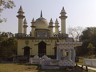
Furfura Sharif is a village in Jangipara community development block of Srirampore subdivision in Hooghly District in the state of West Bengal, India. It is a holy place for some Bengali Muslims. Before the afternoon prayers, people queue up at the mazar (shrine) of Mohammad Abu Bakr Siddique (1846-1939), a prominent pir of the town. People say it is the second most prominent mazar in the country after Ajmer Sharif Dargah in Rajasthan.
Dilalpur is a union parishad under Bajitpur Upazila of Kishoreganj District in the Dhaka Division of central Bangladesh.

Gunabati Unionpronunciation (help·info)(Bengali: গুণবতী) is a union, situated at Chauddagram, Cumilla. It lies along the bank of the Dakatiya River. It covered an area of 20.40 km2, and had a population of 36,789.


