Pittsburgh and Butler Street Railway

Last updated

Pittsburgh and Butler Street Railway
Pittsburgh and Butler Street Railway.png
Overview
Headquarters Pittsburgh, Pennsylvania
LocaleWestern Pennsylvania:
Dates of operation19071917
Successor Pittsburgh, Mars and Butler Railway
Technical
Track gauge Pennsylvania Trolley Gauge,
5 ft 2 12 in (1,588 mm)
Pittsburgh, Mars and Butler
BSicon uexKBHFa.svg
New Castle
BSicon uexLSTR.svg
BSicon uexHST.svg
Cascade Park
BSicon uexHST.svg
W.A.R.R. Depot
BSicon uexHST.svg
E. New Castle
BSicon uexHST.svg
Rozzi
BSicon uexHST.svg
Wilkinson
BSicon uexHST.svg
Gardner
BSicon uexHST.svg
Weir
BSicon uexHST.svg
Shenango
BSicon uexHST.svg
Rose
BSicon uexHST.svg
Energy
BSicon uexHST.svg
Cox
BSicon uexHST.svg
Baldwin
BSicon uexHST.svg
Moravia
BSicon uexHST.svg
Springs
BSicon uexHST.svg
Marquis
BSicon uexHST.svg
Smiley
BSicon uexHST.svg
Wayne
BSicon uexHST.svg
Slippery Rock
BSicon uexHST.svg
Wilson
BSicon uexHST.svg
Hazel Dell
BSicon uexSTR+l.svg
BSicon uexBHFABZgr+r.svg
Elwood Junction
BSicon uexSTR.svg
BSicon uexLSTR.svg
BSicon uexSTR.svg
BSicon uexHST.svg
Wurtemburg
BSicon uexSTR.svg
BSicon uexHST.svg
Knox
BSicon uexSTR.svg
BSicon uexHST.svg
Frisco
BSicon uexSTR.svg
BSicon uexHST.svg
Hazen
BSicon uexSTR.svg
BSicon uexHST.svg
N. Sewickley
BSicon uexSTR.svg
BSicon uexHST.svg
Elwood Country Club
BSicon uexSTR.svg
BSicon uexHST.svg
Jackson
BSicon uexSTR.svg
BSicon uexHST.svg
Rustick Park
BSicon uexSTR.svg
BSicon uexHST.svg
Willow Grove
BSicon uexSTR.svg
BSicon uexHST.svg
River View
BSicon uexSTR.svg
BSicon uexHST.svg
Marion
BSicon uexSTR.svg
BSicon uexHST.svg
Eckert
BSicon uexSTR.svg
BSicon uexHST.svg
Goemring
BSicon uexSTR.svg
BSicon uexHST.svg
Fombell
BSicon uexSTR.svg
BSicon uexHST.svg
Spruce Hill
BSicon uexSTR.svg
BSicon uexHST.svg
Pine Run
BSicon uexSTR.svg
BSicon uexHST.svg
Pflugh
BSicon uexSTR.svg
BSicon uexHST.svg
Ben Venue
BSicon uexSTR.svg
BSicon uexHST.svg
Valley
BSicon uexSTR.svg
BSicon uexHST.svg
Allen
BSicon uexSTR.svg
BSicon uexHST.svg
Lockwood
BSicon uexSTR.svg
BSicon uexBHF.svg
Zelienople
BSicon uexSTR.svg
BSicon uexHST.svg
Harmony Jct.
BSicon uexSTR.svg
BSicon uexHST.svg
Knights Pythias
BSicon uexSTR.svg
BSicon uexHST.svg
Nurseries
BSicon uexSTR.svg
BSicon uexHST.svg
Ziegler
BSicon uexHST.svg
BSicon uexSTR.svg
Burnstown
BSicon uexBHF.svg
BSicon uexSTR.svg
Elwood
BSicon uexLSTR.svg
BSicon uexSTR.svg
BSicon uexHST.svg
BSicon uexSTR.svg
Church
BSicon uexHST.svg
BSicon uexSTR.svg
Park Gate
BSicon uexHST.svg
BSicon uexSTR.svg
Hartman
BSicon uexHST.svg
BSicon uexSTR.svg
Belton
BSicon uexHST.svg
BSicon uexSTR.svg
Toll House
BSicon uexHST.svg
BSicon uexSTR.svg
Hoyt Dale
BSicon uexHST.svg
BSicon uexSTR.svg
Koppel
BSicon uexHST.svg
BSicon uexSTR.svg
Koppel Sub. Sta.
BSicon uexHST.svg
BSicon uexSTR.svg
So. Koppel
BSicon uexHST.svg
BSicon uexSTR.svg
Homewood
BSicon uexHST.svg
BSicon uexSTR.svg
Horne
BSicon uexHST.svg
BSicon uexSTR.svg
Grimm
BSicon uexHST.svg
BSicon uexSTR.svg
Morado
BSicon uexKBHFe.svg
BSicon uexSTR.svg
Beaver Falls
BSicon uexSTR+l.svg
BSicon uexSTRr.svg
BSicon uexKBHFa.svg
Butler
BSicon uexSTR.svg
BSicon uexSTR+l.svg
BSicon uexABZgr.svg
BSicon uexSTR.svg
BSicon uexLSTR.svg
BSicon uexSTR.svg
BSicon uexSTR.svg
BSicon uexHST.svg
BSicon uexSTR.svg
Pierce
BSicon uexSTR.svg
BSicon uexHST.svg
BSicon uexSTR.svg
Lyndora
BSicon uexSTR.svg
BSicon uexHST.svg
BSicon uexSTR.svg
Highfield
BSicon uexSTR.svg
BSicon uexHST.svg
BSicon uexSTR.svg
Duffey
BSicon uexSTR.svg
BSicon uexHST.svg
BSicon uexSTR.svg
Eberhart
BSicon uexSTR.svg
BSicon uexHST.svg
BSicon uexSTR.svg
Woodlawn
BSicon uexSTR.svg
BSicon uexHST.svg
BSicon uexSTR.svg
Miller
BSicon uexSTR.svg
BSicon uexHST.svg
BSicon uexSTR.svg
Meridian
BSicon uexSTR.svg
BSicon uexHST.svg
BSicon uexSTR.svg
Cupps
BSicon uexSTR.svg
BSicon uexHST.svg
BSicon uexSTR.svg
Reiber
BSicon uexSTR.svg
BSicon uexHST.svg
BSicon uexSTR.svg
Walker
BSicon uexSTR.svg
BSicon uexHST.svg
BSicon uexSTR.svg
Graham
BSicon uexSTR.svg
BSicon uexHST.svg
BSicon uexSTR.svg
Connoquenessing
BSicon uexSTR.svg
BSicon uexHST.svg
BSicon uexSTR.svg
Forward
BSicon uexSTR.svg
BSicon uexHST.svg
BSicon uexSTR.svg
Buhl
BSicon uexSTR.svg
BSicon uexHST.svg
BSicon uexSTR.svg
Ash
BSicon uexSTR.svg
BSicon uexHST.svg
BSicon uexSTR.svg
Stamm
BSicon uexSTR.svg
BSicon uexHST.svg
BSicon uexSTR.svg
Dambach
BSicon uexSTR.svg
BSicon uexHST.svg
BSicon uexSTR.svg
Walden
BSicon uexABZg+l.svg
BSicon uexSTRr.svg
BSicon uexLSTR.svg
BSicon uexSTR.svg
BSicon uexHST.svg
Bredanville
BSicon uexSTR.svg
BSicon uexHST.svg
Kummer
BSicon uexSTR.svg
BSicon uexHST.svg
Leibler
BSicon uexSTR.svg
BSicon uexHST.svg
Odell
BSicon uexSTR.svg
BSicon uexHST.svg
Phillips
BSicon uexSTR.svg
BSicon uexHST.svg
McCalmont
BSicon uexSTR.svg
BSicon uexHST.svg
Renfrew
BSicon uexSTR.svg
BSicon uexHST.svg
Thorne Creek
BSicon uexSTR.svg
BSicon uexHST.svg
McBride
BSicon uexSTR.svg
BSicon uexHST.svg
Brown
BSicon uexSTR.svg
BSicon uexHST.svg
Yingling
BSicon uexSTR.svg
BSicon uexHST.svg
Butler C. Club
BSicon uexSTR.svg
BSicon uexHST.svg
Nixon
BSicon uexSTR.svg
BSicon uexHST.svg
Duffey
BSicon uexSTR.svg
BSicon uexHST.svg
Star
BSicon uexSTR.svg
BSicon uexHST.svg
Conabee
BSicon uexSTR.svg
BSicon uexHST.svg
Adams
BSicon uexSTR.svg
BSicon uexHST.svg
Hughes
BSicon uexSTR.svg
BSicon uexHST.svg
Lloyd
BSicon uexSTR.svg
BSicon uexHST.svg
Hayes
BSicon uexSTR.svg
BSicon uexHST.svg
Pershing
BSicon uexSTR.svg
BSicon uexHST.svg
Rosebaugh
BSicon uexSTR.svg
BSicon uexHST.svg
McCandless
BSicon uexSTR.svg
BSicon uexHST.svg
Humes
BSicon uexSTR.svg
BSicon uexHST.svg
Hutchman
BSicon uexSTR.svg
BSicon uexHST.svg
Cashdollar
BSicon uexSTR.svg
BSicon uexHST.svg
Ludwig
BSicon uexBHF.svg
BSicon uexSTR.svg
Evans City
BSicon uexSTR.svg
BSicon uexBHF.svg
Mars
BSicon uexLSTR.svg
BSicon uexSTR.svg
BSicon uexHST.svg
BSicon uexSTR.svg
May
BSicon uexHST.svg
BSicon uexSTR.svg
Irwin
BSicon uexHST.svg
BSicon uexSTR.svg
Marburger
BSicon uexHST.svg
BSicon uexSTR.svg
Callery
BSicon uexHST.svg
BSicon uexSTR.svg
Kaufman
BSicon uexHST.svg
BSicon uexSTR.svg
Kiser
BSicon uexHST.svg
BSicon uexSTR.svg
Burke
BSicon uexHST.svg
BSicon uexSTR.svg
West
BSicon uexHST.svg
BSicon uexSTR.svg
Plains Church
BSicon uexHST.svg
BSicon uexSTR.svg
Frankilin Rd.
BSicon uexHST.svg
BSicon uexSTR.svg
Rowan
BSicon uexHST.svg
BSicon uexSTR.svg
Criders
BSicon uexHST.svg
BSicon uexSTR.svg
Dutihl
BSicon uexHST.svg
BSicon uexSTR.svg
Thornhill
BSicon uexHST.svg
BSicon uexSTR.svg
School
BSicon uexHST.svg
BSicon uexSTR.svg
Robinson
BSicon uexHST.svg
BSicon uexSTR.svg
Fowler
BSicon uexHST.svg
BSicon uexSTR.svg
Warrendale
BSicon uexHST.svg
BSicon uexSTR.svg
Wheatland
BSicon uexHST.svg
BSicon uexSTR.svg
Bradford Woods
BSicon uexHST.svg
BSicon uexSTR.svg
Burmar
BSicon uexHST.svg
BSicon uexSTR.svg
Brennan
BSicon uexHST.svg
BSicon uexSTR.svg
Wexford
BSicon uexHST.svg
BSicon uexSTR.svg
Crystal Springs
BSicon uexHST.svg
BSicon uexSTR.svg
Richards
BSicon uexHST.svg
BSicon uexSTR.svg
Biening
BSicon uexHST.svg
BSicon uexSTR.svg
Pine Creek
BSicon uexHST.svg
BSicon uexSTR.svg
Ingomar
BSicon uexHST.svg
BSicon uexSTR.svg
Glen Manor
BSicon uexHST.svg
BSicon uexSTR.svg
Willoughby
BSicon uexHST.svg
BSicon uexSTR.svg
Peets
BSicon uexHST.svg
BSicon uexSTR.svg
Brants
BSicon uexHST.svg
BSicon uexSTR.svg
Highland
BSicon uexHST.svg
BSicon uexSTR.svg
Perrymont
BSicon uexHST.svg
BSicon uexSTR.svg
Kaylor
BSicon uexHST.svg
BSicon uexSTR.svg
Pines
BSicon uexHST.svg
BSicon uexSTR.svg
Keown
BSicon uexHST.svg
BSicon uexSTR.svg
Mellwood
BSicon uexHST.svg
BSicon uexSTR.svg
North Ivory
BSicon uexHST.svg
BSicon uexSTR.svg
Heim
BSicon uexHST.svg
BSicon uexSTR.svg
Evergreen
BSicon uexHST.svg
BSicon uexSTR.svg
McCutcheon
BSicon uexHST.svg
BSicon uexSTR.svg
Brookview
BSicon uexHST.svg
BSicon uexSTR.svg
Brooks
BSicon uexHST.svg
BSicon uexSTR.svg
Myers
BSicon uexHST.svg
BSicon uexSTR.svg
Eakin
BSicon uexHST.svg
BSicon uexSTR.svg
Belper
BSicon uexHST.svg
BSicon uexSTR.svg
Ross
BSicon uexHST.svg
BSicon uexSTR.svg
Ivory
BSicon uexSTR.svg
BSicon uexLSTR.svg
BSicon uexSTR.svg
BSicon uexHST.svg
Brickworks
BSicon uexSTR.svg
BSicon uexHST.svg
Dight
BSicon uexSTR.svg
BSicon uexHST.svg
Downieville
BSicon uexSTR.svg
BSicon uexHST.svg
Valencia
BSicon uexSTR.svg
BSicon uexHST.svg
Arcadia
BSicon uexSTR.svg
BSicon uexHST.svg
State Road
BSicon uexSTR.svg
BSicon uexHST.svg
Bakerstown
BSicon uexSTR.svg
BSicon uexHST.svg
St. Barnabas
BSicon uexSTR.svg
BSicon uexHST.svg
McKelvey
BSicon uexSTR.svg
BSicon uexHST.svg
Dickey
BSicon uexSTR.svg
BSicon uexHST.svg
Gibsonia
BSicon uexSTR.svg
BSicon uexHST.svg
Richland Hts.
BSicon uexSTR.svg
BSicon uexHST.svg
Gemsys Hts.
BSicon uexSTR.svg
BSicon uexHST.svg
Smith
BSicon uexSTR.svg
BSicon uexHST.svg
Hardies
BSicon uexSTR.svg
BSicon uexHST.svg
Hampton
BSicon uexSTR.svg
BSicon uexHST.svg
Poff
BSicon uexSTR.svg
BSicon uexHST.svg
Bardona
BSicon uexSTR.svg
BSicon uexHST.svg
Wickline
BSicon uexSTR.svg
BSicon uexHST.svg
Health Farm
BSicon uexSTR.svg
BSicon uexHST.svg
Wildwood
BSicon uexSTR.svg
BSicon uexHST.svg
Sample
BSicon uexSTR.svg
BSicon uexHST.svg
W. Hoffman
BSicon uexSTR.svg
BSicon uexHST.svg
McCune
BSicon uexSTR.svg
BSicon uexHST.svg
Furgason
BSicon uexSTR.svg
BSicon uexHST.svg
Allison Park
BSicon uexSTR.svg
BSicon uexHST.svg
Elfinwild
BSicon uexSTR.svg
BSicon uexHST.svg
Mt. Royal
BSicon uexSTR.svg
BSicon uexHST.svg
Vilsack
BSicon uexSTR.svg
BSicon uexHST.svg
Stock Farm
BSicon uexSTR.svg
BSicon uexHST.svg
Glenshaw
BSicon uexSTR.svg
BSicon uexHST.svg
Under Cliff
BSicon uexSTR.svg
BSicon uexHST.svg
Braun
BSicon uexSTR.svg
BSicon uexHST.svg
Broadway
BSicon uexSTR.svg
BSicon uexHST.svg
Gibson
BSicon uexSTR.svg
BSicon uexHST.svg
Shaler Hts.
BSicon uexSTR.svg
BSicon uexHST.svg
Etna
BSicon uexSTRl.svg
BSicon uexBHFq.svg
BSicon uexSTRr.svg
Pittsburgh (Liberty and Market)

The Pittsburgh and Butler Street Railway, commonly called the Butler Short Line, was a broad gauge [1] interurban streetcar line connecting Pittsburgh, Pennsylvania, United States to Butler via Mars.

Contents

History

The Pittsburgh and Butler Street Railway was opened in 1907 between Pittsburgh and Butler [2] traveling via Etna, Glenshaw, Allison Park, and Mars. In 1914 the railway converted from AC to 1200V DC which reduced power consumption by 15% and reduced the weight of each car by 6 tons. [1]

In 1917 the railway amalgamated with the Pittsburgh, Harmony, Butler and New Castle Railway , who operated the Harmony Line between Pittsburgh and New Castle, the new company being named the Pittsburgh, Mars and Butler Railway. [3]

In April 1931 the company went into receivership. The Butler Short Line was closed on April 22, 1931 [4] as it was in poor condition, services being absorbed into the existing PA 8 bus service. The stub of the Butler Short Line continued to be used by Pittsburgh Railways as the 2 Etna service until closure in 1952. [5]

Route

Leaving Butler going south along South Chestnut Street the railway crossed the rails of the Baltimore and Ohio Railroad (B&O) and the Bessemer and Lake Erie Railroad (B&LE), before turning west down the valley of the Connoquenessing Creek through Bredinville. [6] Running parallel to the B&LE through Odell and then east into Thorn Creek past Renfrew Station, the line then headed south, climbing out of Thorn Creek valley alongside Three Degree Road, where the Butler Country Club had a stop of their own. When Butler County Airport was constructed Three Degree Road was diverted to use the old track bed, now forming the eastern perimeter road of the airport.

The line continued south, descending into the valley of Breakneck Creek and passing through Mars. [7] It continued south along the valley, through Downieville and Valencia to Etna, where it joined the local Pittsburgh Railways route to downtown.

Incidents

Two cars collided on March 27, 1909 after one was delayed by a derailment on the grade crossing of the Baltimore and Ohio Railroad near Mars. The crash occurred near Bryant Station and three people died at the scene, all employees of the railway. [8]

Related Research Articles

Butler, Pennsylvania City in Pennsylvania, United States

Butler is a city and the county seat of Butler County in the U.S. state of Pennsylvania. It is located 35 miles (56 km) north of Pittsburgh and part of the Greater Pittsburgh Region. As of the 2010 census, the city population was 13,757. Butler was named the 7th best small town in America by Smithsonian magazine in May 2012.

Mars, Pennsylvania Borough in Pennsylvania, United States

Mars is a borough in Butler County, Pennsylvania, United States. The population was 1,699 at the 2010 census.

Baltimore and Ohio Railroad Rail system in the United States of America

The Baltimore and Ohio Railroad was the first common carrier railroad and the oldest railroad in the United States, with its first section opening in 1830. Merchants from the city of Baltimore, which had benefitted to some extent from the construction of the National Road early in the century, wanted to continue to compete for trade with trans-Appalachian settlers with the newly constructed Erie Canal, another canal being proposed by Pennsylvania, the Chesapeake and Ohio Canal, and the James River Canal, which directed traffic toward Richmond and Norfolk, Virginia. At first the B&O was located entirely in the state of Maryland, its original line extending from the port of Baltimore west to Sandy Hook. There it connected with Harper's Ferry across the Potomac into Virginia, and also with the navigable Shenandoah River.

Interurban Type of electric railway which runs within and between cities or towns

The Interurban is a type of electric railway, with streetcar-like electric self-propelled rail cars which run within and between cities or towns. They were very prevalent in North America between 1900 and 1925 and were used primarily for passenger travel between cities and their surrounding suburban and rural communities. Interurban as a term encompassed the companies, their infrastructure, their cars that ran on the rails, and their service. In the United States, the early 1900s interurban was a valuable economic institution. Most roads between towns and many town streets were unpaved. Transportation and haulage was by horse-drawn carriages and carts. The interurban provided reliable transportation, particularly in winter weather, between the town and countryside. In 1915, 15,500 miles (24,900 km) of interurban railways were operating in the United States and, for a few years, interurban railways, including the numerous manufacturers of cars and equipment, were the fifth-largest industry in the country. By 1930, most interurbans in North America were gone with a few surviving into the 1950s. Oliver Jensen, author of American Heritage History of Railroads in America, commented that "...the automobile doomed the interurban whose private tax paying tracks could never compete with the highways that a generous government provided for the motorist."

Union Station (Pittsburgh)

Union Station is a historic train station at Grant Street and Liberty Avenue, south of the Allegheny River, in Pittsburgh, Pennsylvania, United States. It was one of several passenger rail stations that served Pittsburgh during the 20th century, and it is the only surviving station in active use.

Buffalo and Pittsburgh Railroad

The Buffalo and Pittsburgh Railroad is a Class II railroad operating in New York and Pennsylvania.

Pennsylvania Route 28 is a major state highway which runs for 98 miles (158 km) from Anderson Street in Pittsburgh to U.S. Route 219 (US 219) in Brockway in Pennsylvania. From Pittsburgh to Kittanning it is a 44.5-mile-long (71.6 km) limited access expressway named the Alexander H. Lindsay Memorial Highway or the Allegheny Valley Expressway.

Pittsburgh, Harmony, Butler and New Castle Railway

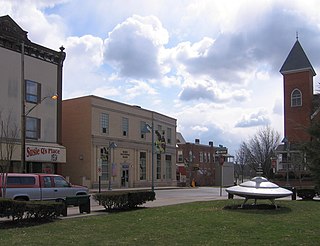
The Pittsburgh, Harmony, Butler and New Castle Railway, commonly called the Harmony Line, was a broad gauge interurban streetcar line connecting Pittsburgh, Pennsylvania, United States to Butler and New Castle via Harmony and a split at Evans City. There was also an extension that was later added to the line from Ellwood City to Beaver Falls.

Sacramento Northern Railway Rail line

The Sacramento Northern Railway was a 183-mile (295 km) electric interurban railway that connected Chico in northern California with Oakland via the California capital, Sacramento. In its operation it ran directly on the streets of Oakland, Sacramento, Yuba City, Chico, and Woodland and ran interurban passenger service until 1941 and freight service into the 1960s.

Pittsburgh Railways

Pittsburgh Railways was one of the predecessors of the Port Authority of Allegheny County. It had 666 PCC cars, the third largest fleet in North America. It had 68 streetcar routes, of which only three are used by the Port Authority as light rail routes. With the Port Authority's Transit Development Plan, many route names will be changed to its original, such as the 41D Brookline becoming the 39 Brookline. Many of the streetcar routes have been remembered in the route names of many Port Authority buses.

Transportation in Pittsburgh Overview of transportation in Pittsburgh, Penssylvania, United States

Pittsburgh, surrounded by rivers and hills, has a unique transportation infrastructure that includes roads, tunnels, bridges, railroads, inclines, bike paths, and stairways.

Pennsylvania Route 68 is a 90.036-mile-long (144.899 km) east–west state highway located in western Pennsylvania in the United States. The western terminus of the route is at the Ohio state line west of Glasgow, where PA 68 continues into Ohio as State Route 39. The eastern terminus is at U.S. Route 322 in Clarion. The route runs southwest-northeast across Beaver, Butler, Armstrong, and Clarion counties. PA 68 follows the Ohio River between the Ohio border and Beaver, where it crosses the Beaver River into Rochester and heads northeast away from the Ohio River. The route runs through rural areas to Butler County, where it intersects Interstate 79 (I-79) in Zelienople before serving Evans City and Butler. PA 68 passes through a section of Armstrong County before crossing the Allegheny River into Clarion County. Here, the route passes through Rimersburg and Sligo before it has an interchange with I-80 and continues to its terminus in Clarion.

P&W Subdivision

The P&W Subdivision is a railroad line owned and operated by CSX Transportation, the Allegheny Valley Railroad (AVR), and the Buffalo and Pittsburgh Railroad (BPRR) in the U.S. state of Pennsylvania. The line runs from Rankin north through Pittsburgh to West Pittsburg along a former Baltimore and Ohio Railroad line, once the Pittsburgh and Western Railroad.

Streetcars in Washington, D.C., and Maryland

Streetcars and interurbans operated in the Maryland suburbs of Washington, D.C., between 1890 and 1962. Lines in Maryland were established as separate legal entities, but eventually they were all owned or leased by DC Transit. Unlike the Virginia lines, the Washington and Maryland lines were scheduled as a single system. Most of the streetcars were built with grand plans in mind, but none succeeded financially. A combination of the rise of the automobile, various economic downturns and bustitution eventually spelled the end of streetcars in southern Maryland.

Lehigh Valley Transit Company

The Lehigh Valley Transit Company (LVT) was a regional transport company, headquartered in Allentown, Pennsylvania, that began operations in 1901 as an urban trolley and interurban rail transport company. It operated successfully into the 1930s, struggled financially during the Depression, and was saved from abandonment by a dramatic ridership increase due to the Second World War. In 1951, the LVT, once again financially struggling, ended its 36-mile (58 km) interurban rail service from Allentown to Philadelphia. In 1952, it ended its Allentown area local trolley service. It operated local bus service in the Allentown, Bethlehem, and Easton, Pennsylvania, areas until going out of business in 1972.

Eidenau is an unincorporated community in Jackson Township, Butler County, Pennsylvania, United States.

The Pittsburgh, Virginia and Charleston Railway was a predecessor of the Pennsylvania Railroad in the U.S. state of Pennsylvania. By 1905, when it was merged into the Pennsylvania, it owned a main line along the left (west) side of the Monongahela River, to Pittsburgh's South Side from West Brownsville. Branches connected to the South-West Pennsylvania Railway in Uniontown via Redstone Creek and to numerous coal mines.

Buffalo and Susquehanna Railroad

The Buffalo and Susquehanna Railroad was a railroad company that formerly operated in western and north central Pennsylvania and western New York. It was created in 1893 by the merger and consolidation of several smaller logging railroads. It operated independently until 1929, when a majority of its capital stock was purchased by the Baltimore and Ohio Railroad. At the same time, the B&O also purchased control of the neighboring Buffalo, Rochester, and Pittsburgh Railway. The Baltimore and Ohio officially took over operations of both roads in 1932.

Washington, Baltimore and Annapolis Electric Railway

The Washington, Baltimore and Annapolis Electric Railway (WB&A) was an American railroad of central Maryland and Washington, D.C., built in the 19th and 20th century. The WB&A absorbed two older railroads, the Annapolis and Elk Ridge Railroad and the Baltimore & Annapolis Short Line, and added its own electric streetcar line between Baltimore and Washington. It was built by a group of Cleveland, Ohio, electric railway entrepreneurs to serve as a high-speed, showpiece line using the most advanced technology of the time. It served Washington, Baltimore, and Annapolis, Maryland, for 27 years before the "Great Depression" and the rise of the automobile forced an end to passenger service during the economic pressures of the 1930s "Depression" southwest to Washington from Baltimore & west from Annapolis in 1935. Only the Baltimore & Annapolis portion between the state's largest city and its state capital continued to operate electric rail cars for another two decades, replaced by a bus service during the late 1950s into 1968. Today, parts of the right-of-way are used for the light rail line, rail trail for hiking - biking trails, and roads through Anne Arundel County.

References

  1. 1 2 William D. Middleton (1961). The Interurban Era. Kalmbach Publishing. pp.  113, 430.
  2. Robert B. Van Atta (December 23, 2001). "EARLY NORTH HILLS CARS". Pittsburgh Tribune. Retrieved October 6, 2009.
  3. "Rachel Carson Trails – Harmony Trail". February 3, 2007. Retrieved September 2, 2009.
  4. "Zelienople Historical Society – The Harmony Line – The End of an Era". 2004. Archived from the original on July 6, 2010. Retrieved October 4, 2009.
  5. "Pittsburghtransit.com – The Routes – PCC Operation". August 28, 2005. Archived from the original on August 28, 2005. Retrieved August 9, 2009.
  6. Butler, PA Quadrangle (Map) (Feb. 1911 ed.). 1:62500. 15 Minute. United States Geological Survey.
  7. Sewickley, PA Quadrangle (Map) (Feb. 1911 ed.). 1:62500. 15 Minute. United States Geological Survey . Retrieved November 14, 2010.
  8. "Three killed as electric cars crash" (PDF). The New York Times. March 28, 1909. Retrieved November 22, 2009.