
The main chain of the Alps, also called the Alpine divide is the central line of mountains that forms the drainage divide of the range. Main chains of mountain ranges are traditionally designated in this way, and generally include the highest peaks of a range. The Alps are something of an unusual case in that several significant groups of mountains are separated from the main chain by sizable distances. Among these groups are the Dauphine Alps, the Eastern and Western Graians, the entire Bernese Alps, the Tödi, Albula and Silvretta groups, the Ortler and Adamello ranges, and the Dolomites of Veneto and South Tyrol, as well as the lower Alps of Vorarlberg, Bavaria, and Salzburg.

Exploration of the higher region of the Alps by travellers from outside the immediate region only became popular from the 18th century. About 20 glacier passes were known before 1600, 25 more before 1700, and another 20 before 1800. While an attempt in 1689 to "re-open" the Col du Géant by Philibert-Amédée Arnod, an official from the duchy of Aosta, may be counted as having been made by a non-native, historical records do not show any further such activities until the last quarter of the 18th century. There are some records of very early ascents by non-natives, including that of the Rocciamelone in 1358 in fulfilment of a vow; that of the Mont Aiguille in 1492 by order of Charles VIII of France; and the ascent of the Gnepfstein, the lowest and the most westerly of the seven summits by Conrad Gessner in 1555.

The Dufourspitze is the highest peak of Monte Rosa, an ice-covered mountain massif in the Alps. Dufourspitze is the highest mountain of both Switzerland and the Pennine Alps and is also the second-highest mountain of the Alps and Western Europe, after Mont Blanc. It is located between Switzerland and Italy. The peak itself is located wholly in Switzerland.

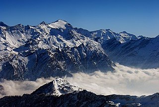
Piz Bernina is the highest mountain in the Eastern Alps, the highest point of the Bernina Range, and the highest peak in the Rhaetian Alps. It rises 4,048 m (13,281 ft) and is located south of Pontresina in the Bernina Region and near the major Alpine resort of St. Moritz, in the Engadin valley. It is also the most easterly mountain higher than 4,000 m (13,000 ft) in the Alps, the highest point of the Swiss canton of Grisons, and the fifth-most prominent peak in the Alps. Although the summit lies within Switzerland, the massif is on the border with Italy. The "shoulder" known as La Spedla is the highest point in the Italian Lombardy region.

The Bernina Range is a mountain range in the Alps of eastern Switzerland and northern Italy. It is considered to be part of the Rhaetian Alps within the Central Eastern Alps. It is one of the highest ranges of the Alps, covered with many glaciers. Piz Bernina, its highest peak, is the most easterly four-thousand-metre peak in the Alps. The peak in the range which sees the most ascents is Piz Palü.
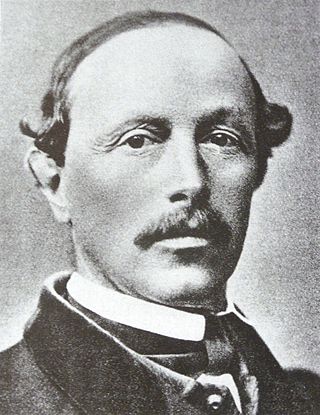
Christian Klucker was a Swiss mountain guide who made many first ascents in the Alps, particularly in the Bernina Range, the Bregaglia and the Pennine Alps.
The Rheinwaldhorn is the highest point in the Swiss canton of Ticino at 3,402 metres above sea level. It lies on the border between the cantons of Graubünden and Ticino, in the Adula massif, part of the St. Gotthard massif of the Adula Alps in southern Switzerland.

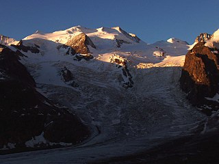
Piz Palü is a mountain in the Bernina Range of the Alps, located between Switzerland and Italy. It is a large glaciated massif composed of three main summits, on a ridge running from west to east. The main summit is 3,899 metres high and is located within the Swiss canton of Graubünden, although the border with the Italian region of Lombardy runs about 100 metres west of it at almost the same height. The western summit is named Piz Spinas and is the only one not covered by ice. The eastern summit is named Piz Palü Orientale. The name Palü derives from the Latin palus, meaning a swamp, and the mountain is said to be named after the Alpe Palü, a high alpine pasture some 4 km to its east.

Piz Badile is a mountain of the Bregaglia range in the Swiss canton of Graubünden and the Italian region of Lombardy. The border between the two countries runs along the summit ridge. Its north-east face, overlooking the Swiss Val Bregaglia near Soglio, is considered one of the six great north faces of the Alps. The name Badile means spade or shovel.

Piz Roseg is a mountain of the Bernina Range, overlooking the Val Roseg in the Swiss canton of Graubünden.
Piz Zupò is a mountain in the Bernina Range of the Alps, located on the border between Switzerland and Italy. It lies between the valleys of Morteratsch (Graubünden) and Malenco (Lombardy). Piz Zupò is the second highest peak in the range after Piz Bernina.

Dr Paul Güssfeldt was a German geologist, mountaineer and explorer.

Piz Morteratsch is a mountain in the Bernina Range in Switzerland. It is bordered on the east by the Morteratsch Glacier and on the south-west by the Tschierva Glacier.

Crast' Agüzza is a mountain in the Bernina Range in Italy and Switzerland.
Piz Argient is a mountain in the Bernina Range of the Alps on the border between Italy and the Swiss canton of Graubünden.

Piz Fora is a mountain in the Bernina Range (Alps), on the border of Italy and Switzerland. The mountain has an elevation of 3,363 metres (11,033 ft) and is the tripoint between the valleys of Val Fedoz, Val Fex and Val Malenco.
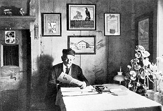
Johann Wilhelm Fortunat Coaz was a Swiss forester, topographer and mountaineer from Graubünden. In 1850 he made the first ascent of Piz Bernina, the highest mountain in the Eastern Alps. He also gave Piz Bernina its name, after the eponymous pass.

Thomas Middlemore was an English mountaineer who made multiple first ascents during the silver age of alpinism. His audacity earned him a reputation as the enfant terrible within the Alpine Club. He was also the head of the Middlemores Saddles leather goods company in Birmingham, England, after the retirement of his father, William Middlemore, in 1881. Thomas Middlemore had taken over the management of the company in 1868 and established a bicycle saddle factory in Coventry.

