
A mountain is an elevated portion of the Earth's crust, generally with steep sides that show significant exposed bedrock. Although definitions vary, a mountain may differ from a plateau in having a limited summit area, and is usually higher than a hill, typically rising at least 300 metres (980 ft) above the surrounding land. A few mountains are isolated summits, but most occur in mountain ranges.

Lenin Peak or Ibn Sina (Avicenna) Peak, rises to 7,134 metres (23,406 ft) in Gorno-Badakhshan (GBAO) on the Kyrgyzstan–Tajikistan border, and is the second-highest point of both countries. It is considered one of the less technical 7,000 m peaks in the world to climb and it has by far the most ascents of any 7,000 m or higher peak on Earth, with every year seeing hundreds of mountaineers make their way to the summit. Lenin Peak is the highest mountain in the Trans-Alay Range of Central Asia, and in the Pamir Mountains in Tajikistan it is exceeded only by Ismoil Somoni Peak. It was thought to be the highest point in the Pamirs in Tajikistan until 1933, when Ismoil Somoni Peak was climbed and found to be more than 300 metres higher. Two mountains in the Pamirs in China, Kongur Tagh and Muztagh Ata, are higher than the Tajik summits.

Korab is the highest peak of the eponymous mountain range and the fourth-highest mountain located entirely in the Balkan Peninsula, standing at 2,764 metres.

Kebnekaise is the highest mountain in Sweden. The Kebnekaise massif, which is part of the Scandinavian mountain range, has two main peaks. The glaciated southern peak used to be the highest at 2,120 metres (6,960 ft) above sea level, but has shrunk by 24 meters during the last 50 years, making the northern icefree peak at 2,096.8 metres (6,879 ft) the highest. Kebnekaise lies in Swedish Lapland, about 150 kilometres (93 mi) north of the Arctic Circle and west of Kiruna near the Kungsleden hiking trail between Abisko and Hemavan.
Ingleborough is the second-highest mountain in the Yorkshire Dales, England. It is one of the Yorkshire Three Peaks, and is frequently climbed as part of the Three Peaks walk. A large part of Ingleborough is designated as a Site of Special Scientific Interest and National Nature Reserve and is the home of a joint project, Wild Ingleborough, with aims to improve the landscape for wildlife and people.
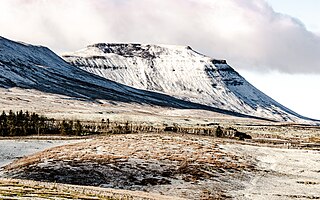
A summit is a point on a surface that is higher in elevation than all points immediately adjacent to it. The topographic terms acme, apex, peak, and zenith are synonymous.

The Dufourspitze is the highest peak of Monte Rosa, an ice-covered mountain massif in the Alps. Dufourspitze is the highest mountain of both Switzerland and the Pennine Alps and is also the second-highest mountain of the Alps and Western Europe, after Mont Blanc. It is located between Switzerland and Italy. The peak itself is located wholly in Switzerland.

Piz Bernina is the highest mountain in the Eastern Alps, the highest point of the Bernina Range, and the highest peak in the Rhaetian Alps. It rises 4,048 m (13,281 ft) and is located south of Pontresina in the Bernina Region and near the major Alpine resort of St. Moritz, in the Engadin valley. It is also the most easterly mountain higher than 4,000 m (13,000 ft) in the Alps, the highest point of the Swiss canton of Grisons, and the fifth-most prominent peak in the Alps. Although the summit lies within Switzerland, the massif is on the border with Italy. The "shoulder" known as La Spedla is the highest point in the Italian Lombardy region.

Kaaterskill High Peak is one of the Catskill Mountains, located in the Town of Hunter in Greene County, New York, United States. It was once believed to be the highest peak in the entire range, but its summit, at 3,655 feet (1,114 m) in elevation, places it only 23rd among the Catskill High Peaks. It is, however, the fourth most prominent peak in the range. Due to its situation as the easternmost High Peak, its summit is just outside the watersheds of New York City's reservoirs in the region.

The Devil's Path is a hiking trail in the Greene County section of the Catskill Mountains of New York, sometimes described as one of the more challenging trails in the New York Tri-state area. It goes across the eponymous mountain range and then three other peaks to the west, offering hikers and peakbaggers a chance to reach the summits of five of the 35 Catskill High Peaks. It draws hikers from not just the region but far outside, due to the challenging climbs straight up and down the steep gaps between the four peaks of the range, which often require hikers to use hands as well as feet to pull themselves almost straight up cliffs and through rocky chutes. These climbs, however, lead to views across the Catskill range.

The Seven Second Summits are the second-highest mountains of each of the seven continents. All of these mountains are separate peaks rather than a sub-peak of the continents' high point. The Seven Second Summits are considered a harder challenge than the traditional Seven Summits.
In mountaineering in the United States, a thirteener is a mountain that exceeds 13,000 feet (3,962.4 m) above mean sea level, similar to the more familiar "fourteeners," which exceed 14,000 feet (4,267.2 m). In most instances, "thirteeners" refers only to those peaks between 13,000 and 13,999 feet in elevation.

The Allgäu Alps are a mountain range in the Northern Limestone Alps, located on the Austria–Germany border, which covers parts of the German states of Bavaria and Baden-Württemberg and the Austrian states of Tyrol and Vorarlberg. The range lies directly east of Lake Constance.

Balsam Mountain is one of the High Peaks of the Catskill Mountains in the U.S. state of New York. Its exact height has not been determined, so the highest contour line, 3,600 feet (1,100 m), is usually given as its elevation. It is located in western Ulster County, on the divide between the Hudson and Delaware watersheds. The summit and western slopes of the peak are within the Town of Hardenburgh and its eastern slopes are in Shandaken. The small community of Oliverea is near its base on that side. Most of the mountain is publicly owned, managed by the New York State Department of Environmental Conservation as part of the state Forest Preserve, part of the Big Indian-Beaverkill Range Wilderness Area in the Catskill Park. The summit is on a small corner of private land.

Arizona is a landlocked state situated in the southwestern region of the United States of America. It has a vast and diverse geography famous for its deep canyons, high- and low-elevation deserts, numerous natural rock formations, and volcanic mountain ranges. Arizona shares land borders with Utah to the north, the Mexican state of Sonora to the south, New Mexico to the east, and Nevada to the northwest, as well as water borders with California and the Mexican state of Baja California to the southwest along the Colorado River. Arizona is also one of the Four Corners states and is diagonally adjacent to Colorado.

The Madonie are one of the principal mountain ranges on the island of Sicily, located in the Northern part of the island.

Pizzo Coca is a mountain that straddles the Val Seriana and the Valtellina in Lombardy, Italy. It is the highest peak in the Bergamo Alps. Its height is 3,050 metres with a prominence height of 1,878 metres and a saddle of 1,172 metres. A post-glacial valley exists near a point called Ometto in sassi at 2,400 meters.
Carbonara is an Italian pasta dish.

