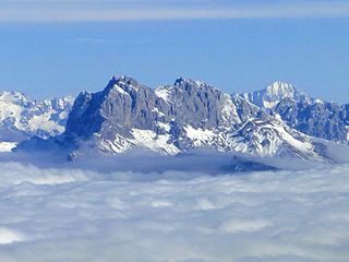
Presolana is a mountain located in Lombardy, northern Italy, about 35 km north of Bergamo.

Pizzo Campo Tencia is a mountain in the Lepontine Alps, which lies in the canton of Ticino, Switzerland. Pizzo Campo Tencia is the highest peak located entirely inside the canton.

The Jazzihorn is a mountain of the Pennine Alps, located on the Swiss-Italian border. On the Italian side it is named Pizzo Cingino Nord as another summit is named Pizzo Cingino Sud on the south. The Jazzihorn has an elevation of 3,227 metres above sea level and lies between the valleys of Saastal (Valais) and Valle d'Antrona (Piedmont).

Pizzo Barone is a mountain of the Lepontine Alps in Switzerland. It is located south of Pizzo Campo Tencia and is the highest summit of the Valle Verzasca in the canton of Ticino. From Sonogno a trail leads to the summit.

Pizzo di Röd is a mountain of the Lepontine Alps, overlooking Fusio in the canton of Ticino. It is located on the chain separating the Valle di Peccia from the Val Lavizzara.

The Cima della Bondasca or Pizzo del Ferro centrale is a mountain in the Bregaglia Range (Alps), located on the border between Italy and Switzerland. Its summit is the triple watershed between Valle del Ferro (Italy), Val Bondasca and Val d'Albigna (Switzerland).

Pizzo Quadro is a mountain of the Lepontine Alps on the Swiss-Italian border. With an elevation of 2,793 metres above sea level, it is the highest summit of the range lying south of the Wandfluhhorn and the Guriner Furggu. Pizzo Quadro is located between the localities of San Rocco di Prèmia (Piedmont) and Campo (Ticino).

Pizzo di Porcaresc is a mountain of the Lepontine Alps, located on the border between Switzerland and Italy. Its summit is the tripoint between the Valle dell'Isorno, the Valle di Campo and the Valle di Vergeletto.

Pizzo Castello is a mountain of the Lepontine Alps, located in the canton of Ticino, Switzerland. It is situated in the upper Valle Maggia, between the Val Bavona (west) and Valle di Peccia (east).

Pizzo d'Orsalia is a mountain of the Swiss Lepontine Alps, overlooking Bosco/Gurin in the canton of Ticino. It lies on the chain that separates the Val Calnègia from the Valle di Bosco/Gurin.

The Rosso di Ribia is a mountain of the Lepontine Alps, located in the canton of Ticino, Switzerland. with a height of 2,547 metres above sea level, it is the culminating point on the range between the Valle di Campo and Valle di Vergeletto. The Rosso di Ribia lies five kilometres east of Pizzo di Porcarese, where the border with Italy runs.

Pizzo Massari is a mountain of the Lepontine Alps, overlooking Ambrì in the canton of Ticino. It is located on the chain separating the Val Lavizzara from the Leventina. The lakes Lago del Sambuco and Lago Tremorgio lie on its western and eastern side respectively.

The Poncione Piancascia is a mountain of the Swiss Lepontine Alps, overlooking Brione in the canton of Ticino. It lies between the Valle Maggia and the Valle Verzasca. The Poncione di Piancascia has an elevation of 2,360 metres and is the highest summit on the range south of Pizzo delle Pecore.

The Poncione di Piotta is a mountain of the Swiss Lepontine Alps, located between Lavertezzo and Moleno in the canton of Ticino. It lies on the chain that separates the valley of Verzasca (west) from the Leventina valley (east).

Pizzo di Cadrèigh is a mountain of the Swiss Lepontine Alps, located west of Olivone in the canton of Ticino. It lies south of the Scopi, between the Val di Campo and the Valle Santa Maria.
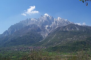
The Concarena is a mountain in Lombardy, northern Italy. It is multi summited and its highest peak is the Cima della Bacchetta, with a height of 2,549 m.

Pizzo Sterla is a mountain of Lombardy, Italy, located north of Chiavenna. On its northern side it overlooks the Valle di Lei and the lake Lago di Lei.

Pizzo Coca is a mountain that straddles the Val Seriana and the Valtellina in Lombardy, Italy. It is the highest peak in the Bergamo Alps. Its height is 3,050 metres with a prominence height of 1,878 metres and a saddle of 1,172 metres. A post-glacial valley exists near a point called "ometto in sassi" at 2,400 meters.
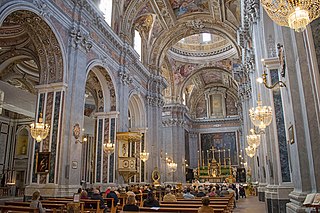
Francesco Grimaldi was an Italian Theatine Order priest and architect, working mainly in Naples.

The Altemberg is a mountain in the Pennine Alps of north-western Italy; with an elevation of 2,395 m (7,858 ft) is the highest peak of the Alpi Cusiane.

