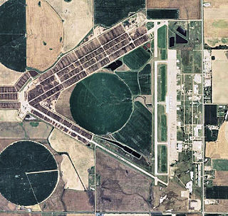
Dodge City Regional Airport is three miles east of Dodge City, in Ford County, Kansas. It is used for general aviation and was at one point subsidized by the Essential Air Service program.

Liberal Mid-America Regional Airport is two miles west of Liberal, in Seward County, Kansas. It is used for general aviation and was at one point subsidized by the Essential Air Service program. Formerly Liberal Municipal Airport, it hosts the Mid-America Air Museum.

Buckeye Municipal Airport is a city-owned public-use airport located 7 miles northwest of the central business district of Buckeye, a city in Maricopa County, Arizona, United States. The airport is included in the FAA's National Plan of Integrated Airport Systems for 2009–2013, which categorizes it as a general aviation facility. It is not served by any commercial airlines at this time.
Pompano Beach Airpark is a public airport located one mile (1.6 km) northeast of the central business district of Pompano Beach, in Broward County, Florida, United States. This airport is publicly owned by City of Pompano Beach.

Delaware Airpark is a public use airport serving the Dover area. It is owned by the Delaware Department of Transportation and operated by the Delaware River and Bay Authority and located one nautical mile (2 km) west of the central business district of Cheswold, a town in Kent County, Delaware, United States. It is included in the Federal Aviation Administration (FAA) National Plan of Integrated Airport Systems for 2017–2021, in which it is categorized as a local general aviation facility.
Lloyd Stearman Field, also known as Benton Airpark, is a public airport located one mile southwest of the central business district of Benton, in Butler County, Kansas, USA. The airport covers 30 acres and has one runway. It was named in honor of aviation pioneer Lloyd Stearman and seven Stearman World War II-era training biplanes are based there. The airfield was used for several scenes from the 1969 movie, "The Gypsy Moths".

Mesquite Airport is a public use airport located two nautical miles (4 km) north of the central business district of Mesquite, in Clark County, Nevada, United States. It is owned by the City of Mesquite.

Jean Airport is a public use airport located one nautical mile (2 km) south of Jean, a town in Clark County, Nevada, United States. It is owned by Clark County and operated by the Clark County Department of Aviation. Also known as Jean Sport Aviation Center, it is mainly used for sports aviation like gliders and sky diving.

Rosaschi Air Park is a public use airport owned by the U.S. Bureau of Land Management and located two nautical miles (4 km) north of the central business district of Smith, in Lyon County, Nevada, United States.

Newton City-County Airport is three miles east of Newton, in Harvey County, Kansas. It is owned by the City of Newton and Harvey County.

Eagle Creek Airpark is a public use airport located seven nautical miles (13 km) west of the central business district of Indianapolis, a city in Marion County, Indiana, United States. It is owned by the Indianapolis Airport Authority and serves as a reliever airport for Indianapolis International Airport.

Keystone Airpark, also known as Keystone Heights Airport, is a public use airport located three nautical miles (6 km) north of the central business district of Keystone Heights, a town in Clay County, Florida, United States. The airport is situated in Clay County and Bradford County.

Scott Municipal Airport is a public-use airport located four nautical miles southwest of the central business district of Oneida, a city in Scott County, Tennessee, United States. The airport is owned by Scott County. It is located adjacent to the Big South Fork Airpark, a gated community and residential airpark.

Pine Hill Airport is a public use airport located five nautical miles southwest of Albion, a village in Orleans County, New York, United States. The airport property is owned by Eugene Haines and leased by the Vintage Aircraft Group.

Eagle Airpark is a public use airport in Mohave County, Arizona, United States. It is located 14 miles south of the central business district of Bullhead City.

Pratt Regional Airport is a public airport five miles north of Pratt, in Pratt County, Kansas. Previously known as Pratt Industrial Airport, it is on the site of the former Pratt Army Airfield.
Caldwell Municipal Airport is a city-owned public-use airport located one nautical mile east of the central business district of Caldwell, a city in Sumner County, Kansas, United States.
Jetmore Municipal Airport is a city-owned airport seven miles south of Jetmore, a city in Hodgeman County, Kansas.

Stockton Municipal Airport is a city-owned, public-use airport located three nautical miles (6 km) southwest of the central business district of Stockton, a city in Rooks County, Kansas, United States.


