Related Research Articles

Jet Propulsion Laboratory (JPL) is a Federally Funded Research and Development Center (FFRDC) in La Cañada Flintridge, California, Crescenta Valley, United States. Founded in 1936 by Caltech researchers, the laboratory is now owned and sponsored by the National Aeronautics and Space Administration (NASA) and administered and managed by the California Institute of Technology.

Pioneer 11 is a NASA robotic space probe launched on April 5, 1973, to study the asteroid belt, the environment around Jupiter and Saturn, the solar wind, and cosmic rays. It was the first probe to encounter Saturn, the second to fly through the asteroid belt, and the second to fly by Jupiter. Later, Pioneer 11 became the second of five artificial objects to achieve an escape velocity allowing it to leave the Solar System. Due to power constraints and the vast distance to the probe, the last routine contact with the spacecraft was on September 30, 1995, and the last good engineering data was received on November 24, 1995.

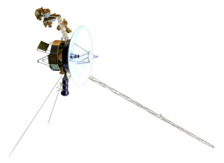
Voyager 2 is a space probe launched by NASA on August 20, 1977, as a part of the Voyager program. It was launched on a trajectory towards the gas giants Jupiter and Saturn and enabled further encounters with the ice giants Uranus and Neptune. It remains the only spacecraft to have visited either of the ice giant planets, and was the third of five spacecraft to achieve Solar escape velocity, which will allow it to leave the Solar System. It has been sending scientific data to Earth for 47 years, 1 month, 1 day, making it the oldest active space probe. Launched 16 days before its twin Voyager 1, the primary mission of the spacecraft was to study the outer planets and its extended mission is to study interstellar space beyond the Sun's heliosphere.

Rhea is the second-largest moon of Saturn and the ninth-largest moon in the Solar System, with a surface area that is comparable to the area of Australia. It is the smallest body in the Solar System for which precise measurements have confirmed a shape consistent with hydrostatic equilibrium. Rhea has a nearly circular orbit around Saturn, but it is also tidally locked, like Saturn's other major moons; that is, it rotates with the same period it revolves (orbits), so one hemisphere always faces towards the planet.

Cassini–Huygens, commonly called Cassini, was a space-research mission by NASA, the European Space Agency (ESA), and the Italian Space Agency (ASI) to send a space probe to study the planet Saturn and its system, including its rings and natural satellites. The Flagship-class robotic spacecraft comprised both NASA's Cassini space probe and ESA's Huygens lander, which landed on Saturn's largest moon, Titan. Cassini was the fourth space probe to visit Saturn and the first to enter its orbit, where it stayed from 2004 to 2017. The two craft took their names from the astronomers Giovanni Cassini and Christiaan Huygens.

The Lunar Orbiter program was a series of five uncrewed lunar orbiter missions launched by the United States in 1966 and 1967. Intended to help select Apollo landing sites by mapping the Moon's surface, they provided the first photographs from lunar orbit and photographed both the Moon and Earth.

Iapetus is the outermost of Saturn's large moons. With an estimated diameter of 1,469 km (913 mi), it is the third-largest moon of Saturn and the eleventh-largest in the Solar System. Named after the Titan Iapetus, the moon was discovered in 1671 by Giovanni Domenico Cassini.

The Discovery Program is a series of Solar System exploration missions funded by the U.S. National Aeronautics and Space Administration (NASA) through its Planetary Missions Program Office. The cost of each mission is capped at a lower level than missions from NASA's New Frontiers or Flagship Programs. As a result, Discovery missions tend to be more focused on a specific scientific goal rather than serving a general purpose.

Planetary geology, alternatively known as astrogeology or exogeology, is a planetary science discipline concerned with the geology of celestial bodies such as planets and their moons, asteroids, comets, and meteorites. Although the geo- prefix typically indicates topics of or relating to Earth, planetary geology is named as such for historical and convenience reasons; due to the types of investigations involved, it is closely linked with Earth-based geology. These investigations are centered around the composition, structure, processes, and history of a celestial body.

The two moons of Mars are Phobos and Deimos. They are irregular in shape. Both were discovered by American astronomer Asaph Hall in August 1877 and are named after the Greek mythological twin characters Phobos and Deimos who accompanied their father Ares into battle.

Hazcams are photographic cameras mounted on the front and rear of NASA's Spirit, Opportunity, Curiosity and Perseverance rover missions to Mars and on the lower front portion of Chinese Yutu rover mission to the Moon.

Cydonia is a region on the planet Mars that has attracted both scientific and popular interest. The name originally referred to the albedo feature that was visible from earthbound telescopes. The area borders the plains of Acidalia Planitia and the highlands of Arabia Terra. The region includes the named features Cydonia Mensae, an area of flat-topped mesa-like features; Cydonia Colles, a region of small hills or knobs; and Cydonia Labyrinthus, a complex of intersecting valleys. As with other albedo features on Mars, the name Cydonia was drawn from classical antiquity, in this case from Kydonia, a historic polis on the island of Crete. Cydonia contains the "Face on Mars", located about halfway between the craters Arandas and Bamberg.

The Astrogeology Science Center is the entity within the United States Geological Survey concerned with the study of planetary geology and planetary cartography. It is housed in the Shoemaker Building in Flagstaff, Arizona. The Center was established in 1963 by Eugene Merle Shoemaker to provide lunar geologic mapping and to assist in training astronauts destined for the Moon as part of the Apollo program.

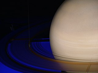
The exploration of Saturn has been solely performed by crewless probes. Three missions were flybys, which formed an extended foundation of knowledge about the system. The Cassini–Huygens spacecraft, launched in 1997, was in orbit from 2004 to 2017.

Integrated Software for Imagers and Spectrometers (Isis) is a specialized software package developed by the USGS to process images and spectra collected by current and past NASA planetary missions sent to Earth's Moon, Mars, Jupiter, Saturn, and other solar system bodies.

The Lunar Reconnaissance Orbiter (LRO) is a NASA robotic spacecraft currently orbiting the Moon in an eccentric polar mapping orbit. Data collected by LRO have been described as essential for planning NASA's future human and robotic missions to the Moon. Its detailed mapping program is identifying safe landing sites, locating potential resources on the Moon, characterizing the radiation environment, and demonstrating new technologies.

The Lunar Orbiter Image Recovery Project (LOIRP) was a project to digitize the original analog data tapes from the five Lunar Orbiter spacecraft that were sent to the Moon in 1966 and 1967; it was funded by NASA, SkyCorp, SpaceRef Interactive, and private individuals.

Mark Robert Showalter is a senior research scientist at the SETI Institute. He is the discoverer of six moons and three planetary rings. He is the Principal Investigator of NASA's Planetary Data System Rings Node, a co-investigator on the Cassini–Huygens mission to Saturn, and works closely with the New Horizons mission to Pluto.

Amanda R. Hendrix is an American planetary scientist known for her pioneering studies of solar system bodies at ultraviolet wavelengths. She is a senior scientist at the Planetary Science Institute. Her research interests include moon and asteroid surface composition, space weathering effects and radiation products. She is a co-investigator on the Cassini UVIS instrument, was a co-investigator on the Galileo UVS instrument, is a Participating Scientist on the Lunar Reconnaissance Orbiter LAMP instrument and is a Principal Investigator on Hubble Space Telescope observing programs. As of 2019, she is also the co-lead of the NASA Roadmaps to Oceans World Group.

Ralph Bernstein is a German–born American engineer known for his contributions to digital imaging, image processing, and geosciences. He is a member of the American Society for Photogrammetry and Remote Sensing (ASPRS).
References
- ↑ "PDS: PDS Charter" (PDF). pds.nasa.gov. Archived from the original (PDF) on 2016-12-16. Retrieved 2017-08-16.
- 1 2 3 4 "PDS: PDS Roadmap 2017 to 2026" (PDF). pds.nasa.gov. Retrieved 2023-01-28.
- 1 2 "Chapter 11. Media Formats for Data Submission and Archive". PDS Standards Reference (PDF). NASA. Retrieved January 28, 2023.
- ↑ "PDS – Guidelines for Archiving". NASA. Retrieved January 29, 2023.
- ↑ "NASA Issues New Awards for Planetary Data System". www.prnewswire.com. Retrieved 2015-10-16.
- ↑ "About the PDS". NASA. Retrieved January 28, 2023.
- ↑ "PDS: Node Descriptions". pds.nasa.gov. Retrieved 2022-09-08.
- ↑ "PDS Geosciences Node, Washington University in St. Louis, Missouri". pds-geosciences.wustl.edu. Retrieved 2022-09-08.
- ↑ "Cartography and Imaging Sciences Node of NASA Planetary Data System | USGS Astrogeology Science Center". astrogeology.usgs.gov. Retrieved 2022-09-08.
- ↑ "Ring-Moon Systems Node Home". pds-rings.seti.org. Retrieved 2022-09-08.
- ↑ "NASA PDS: Small Bodies Node". University of Maryland. Retrieved January 28, 2023.
- ↑ "Planetary Data System - Engineering Node". NASA JPL. Retrieved January 28, 2023.
- ↑ "The Navigation and Ancillary Information Facility". NASA JPL. Retrieved January 28, 2023.
- ↑ "PDS: PDS Requirements" (PDF). pds.nasa.gov. Archived from the original (PDF) on 2017-04-26. Retrieved 2017-08-16.
- ↑ "PDS: PDS Organization". pds.nasa.gov. Archived from the original on 2017-05-13. Retrieved 2015-10-16.