Related Research Articles

Great Basin National Park is an American national park located in White Pine County in east-central Nevada, near the Utah border, established in 1986. The park is most commonly entered by way of Nevada State Route 488, which is connected to U.S. Routes 6 and 50 by Nevada State Route 487 via the small town of Baker, the closest settlement.
Ormsby County was a county in Nevada Territory from 1861 to 1864 and in the State of Nevada from 1864 until 1969. It contained Carson City, the county seat, and later, the state capital, founded two years earlier.

The Wasatch Range or Wasatch Mountains is a mountain range in the western United States that runs about 160 miles (260 km) from the Utah-Idaho border south to central Utah. It is the western edge of the greater Rocky Mountains, and the eastern edge of the Great Basin region. The northern extension of the Wasatch Range, the Bear River Mountains, extends just into Idaho, constituting all of the Wasatch Range in that state.
The Tule Desert is located in southeastern Nevada in Lincoln County, near the Utah state line. The desert lies northeast of the Mormon Mountains, south of the Clover Mountains and west of the Tule Springs Hills.

Seitz Lake is a glacial tarn in the Ruby Mountains, in Elko County in the northeastern part of the state of Nevada. It is located near the head of Seitz Canyon at approximately 40°38.2′N115°27.4′W, and at an elevation of 8915 feet. It has an area of approximately 17 acres, and a depth of up to 20 feet.

Griswold Lake is a glacial tarn in the Ruby Mountains of Elko County, Nevada, United States. It is within the Ruby Mountains Ranger District of the Humboldt-Toiyabe National Forest. The lake is located at the head of Hennen Canyon, at approximately 40°38.1′N115°29.2′W, and at an elevation of 9222 feet. It has an area of approximately 17 acres, and a depth of up to 20 feet.
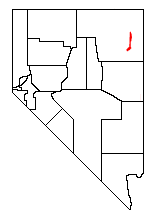
The Pequop Mountains are a mountain range located in eastern Elko County, in northeastern Nevada in the western United States. The range runs generally north-south for approximately 51 miles (82 km) The high point of the range is an unnamed peak located at 40°55.46'N and 114°35.38'W.
Nevershine Hollow is a valley east of the South Hills, in Beaver County, Utah. The mouth of the valley is at an elevation of 6,165 feet / 1,879 meters. Its head is at an elevation of 6,500 feet at 38°09′43″N112°36′38″W, north of Beaver Ridge.
Beaver Ridge a ridge in Beaver County, Utah. It lies south of Nevershine Hollow and north of the canyon of Fremont Wash. It reaches an elevation of 6,552 feet / 1,997 meters.
Pinto Valley is a basin in the Black Mountains of Clark County, Nevada. It lies at an elevation of 1759 feet / 536 meters.
South Mountains are a range of mountains primarily in White Pine County, Nevada and partially to the east in Juab County, Utah. The range is sometimes referred to as the Deep Creek Mountains, or the Ibenpah Mountains. The South Mountains are divided from the Kern Mountains to the south by Tippett Canyon on the west and Pleasant Valley to the east. They are divided from the Deep Creek Range to the east in Utah by Johnson Canyon, on the north, and by Water Canyon on the south. The range is bounded on the north by Spring Creek Flat and on the west by Antelope Valley.
Spring Creek formerly known as West Creek, and Round Valley Creek, is a stream, tributary to West Deep Creek in White Pine County, Nevada with its source in Juab County, Utah.
Spring Creek Mountain is a summit of the South Mountains in Juab County, Utah, but the mountain lies partly within White Pine County, Nevada.
Spring Creek Flat is a flat mostly in White Pine County, Nevada; but also partly in Juab County, Utah and still less in Tooele County, Utah.
Spring Valley is a long north south trending basin, largely in White Pine County, Nevada and a small portion in the extreme south in Lincoln County, Nevada. It extends from 39°59′00″N114°29′33″W in White Pine County to the north to 38°33′57″N114°21′05″W in the south in Lincoln County. The bottom of the basin is at Yelland Dry Lake at an elevation of 5551 feet / 1692 meters.
Ferber Hills is a range of hills in Elko County, Nevada and Tooele County, Utah. The range is formed in three parallel ridges of hills trending northwest to southeast. Its highest summit is Utah Peak, in the center of the central ridge of the range, at an elevation of 6,680 feet, just east of the state line in Tooele County, Utah. Its second highest Summit is Ferber Peak, that rises to and elevation of 6,601 feet, at the south end of the southernmost ridge of the range at 40°12′43″N114°03′18″W just west of the state line in Elko County, Nevada. The highest point in the smaller northernmost ridge is an unnamed summit at 40°17′12″N113°59′48″W with an elevation of 5,745 feet in Tooele County.
Pleasant Valley Draw is a stream, in the lower end of Pleasant Valley, that has its source and has its mouth in Juab County, Utah. The source of Pleasant Valley Draw is located at an elevation of 5,710 feet / 1,885 meters at 39°38′27″N114°01′06″W. Its mouth is found at an elevation of 5,236 feet / 1,596 meters lower in Pleasant Valley, in Utah.
Tippett Canyon, is a valley whose creek drains the northwest watershed of the South Mountains in White Pine County, Nevada. Its mouth is at an elevation of 6,450 feet / 1,966 meters. Its source is at the head of the canyon near Cedar Pass, at an elevation of 6,649 feet / 2,196 meters at 39°46′04″N114°10′02″W.
Cedar Pass is a gap between Tippett Canyon and Pleasant Valley in White Pine County, Nevada. These valleys divide the South Mountains from the Kern Mountains. It is lies at an altitude of 7,264 feet / 2,214 meters.
Johnson Canyon is a valley or canyon in Juab County, Utah. Its creek drains the eastern watershed of the South Mountains and divides those mountains from the Deep Creek Range to the east. The mouth of the canyon is at an elevation of 6,686 feet / 2,038 meters. Its source is at the head of the canyon at an elevation of 2,530 feet / 836 meters at 39°45′22″N114°01′48″W.
References
Coordinates: 39°38′27″N114°01′06″W / 39.64083°N 114.01833°W
| | This White Pine County, Nevada state location article is a stub. You can help Wikipedia by expanding it. |
| | This article about a location in Utah is a stub. You can help Wikipedia by expanding it. |