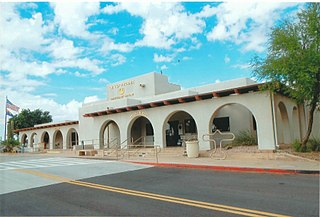
Phoenix Deer Valley Airport is a public airport 24 miles north of central Phoenix, in Maricopa County, Arizona, United States, within the Phoenix city limits. It is owned by the City of Phoenix. The FAA's National Plan of Integrated Airport Systems for 2009–2013 categorized it as a reliever airport for Phoenix Sky Harbor International Airport.
Nogales International Airport is a county-owned public-use airport located 8 miles northeast of the central business district of Nogales, a city in Santa Cruz County, Arizona, United States and is also a port of entry into the United States. It is included in the Federal Aviation Administration (FAA) National Plan of Integrated Airport Systems for 2019–2023, in which it is categorized as a local general aviation facility. It is not served by any commercial passenger airlines as of June 2014.
Oneonta Municipal Airport is a public use airport located three nautical miles north of the central business district of Oneonta, a city in Otsego County, New York, United States. The airport is owned by the City of Oneonta. It once had scheduled air service on Mohawk Airlines, formerly known as Catskill Airways.

Lake Placid Airport is a public use airport located one nautical mile southeast of the central business district of Lake Placid, a village in the Town of North Elba, Essex County, New York, United States. It is owned by the North Elba Park District.
Scott Field is a public airport located two miles (3 km) northwest of the central business district of Mangum, a city in Greer County, Oklahoma, United States. It is owned by the City of Mangum.
Beach Airport is a public airport located one mile (1.6 km) east-northeast of the central business district of Beach, in Golden Valley County, North Dakota, United States. It is owned by the Golden Valley County Airport Authority.

Eagle Creek Airpark is a public use airport located seven nautical miles (13 km) west of the central business district of Indianapolis, a city in Marion County, Indiana, United States. It is owned by the Indianapolis Airport Authority and serves as a reliever airport for Indianapolis International Airport.

Bibb County Airport is a county-owned public-use airport in Bibb County, Alabama, United States. It is located 3 nautical miles (6 km) east of the central business district of Centreville, Alabama. According to the FAA's National Plan of Integrated Airport Systems for 2009–2013, it is categorized as a general aviation facility.
Minchumina Airport is a state-owned public-use airport serving Lake Minchumina, in the Yukon-Koyukuk Census Area of the U.S. state of Alaska. It is also known as Lake Minchumina Airport. In the past, the airport used MHM IATA code.
Decatur Municipal Airport is a city-owned public airport two miles (3.7 km) north of Decatur, in Wise County, Texas.
Desert Center Airport is a private-use airport located five nautical miles northeast of the central business district of Desert Center, in Riverside County, California, United States.
Valle Airport is a privately owned public use airport located 29 miles north of Williams, Arizona, United States. Valle is the second location of Planes of Fame Air Museum.
Grand Canyon Bar 10 Airport is a public-use airport located 69 miles south-east of the CBD of Whitmore, in Mohave County, Arizona, United States, near the Grand Canyon.
Luverne Municipal Airport, also known as Quentin Aanenson Field, is a public use airport in Rock County, Minnesota, United States. It is owned by the City of Luverne and located two nautical miles (4 km) south of its central business district. This airport is included in the National Plan of Integrated Airport Systems for 2011–2015, which categorized it as a general aviation facility.

Manila Municipal Airport is a public-use airport located two nautical miles northeast of the central business district of Manila, in Mississippi County, Arkansas, United States. It is owned by the City of Manila.
Wheatland County Airport is a county-owned, public-use airport located two nautical miles (4 km) northwest of the central business district of Harlowton, a city in Wheatland County, Montana, United States. It is included in the National Plan of Integrated Airport Systems for 2011–2015, which categorized it as a general aviation airport.
Thompson Falls Airport is a county-owned, public-use airport located three nautical miles (6 km) southeast of the central business district of Thompson Falls, a city in Sanders County, Montana, United States. It is included in the National Plan of Integrated Airport Systems for 2011–2015, which categorized it as a general aviation airport.
Polacca Airport is a public use airport in Navajo County, Arizona, United States. The airport is owned by the Hopi Tribe. It is located 3.5 miles southwest of the central business district of Polacca, an unincorporated community on the Hopi Reservation.
Stanford Airport is a county-owned, public-use airport located one nautical mile (2 km) south of the central business district of Stanford, Judith Basin County, Montana. It is included in the National Plan of Integrated Airport Systems for 2011–2015, which categorized it as a general aviation facility.
Cibecue Airport is a public use airport located 4.6 miles southeast of the central business district of Cibecue, in Navajo County, Arizona, United States. It is owned by the White Mountain Apache Tribe. This airport is included in the National Plan of Integrated Airport Systems, which categorized it as a general aviation facility.


