
The geography of France consists of a terrain that is mostly flat plains or gently rolling hills in the north and west and mountainous in the south and the east.

Borchgrevink Glacier is a large glacier in the Victory Mountains, Victoria Land, draining south between Malta Plateau and Daniell Peninsula, and thence projecting into Glacier Strait, Ross Sea, as a floating glacier tongue, the Borchgrevink Glacier Tongue, just south of Cape Jones. It was named by the New Zealand Geological Survey Antarctic Expedition, 1957–58, for Carsten Borchgrevink, leader of the British Antarctic Expedition, 1898–1900. Borchgrevink visited the area in February 1900 and first observed the seaward portion of the glacier.
Na Rì is a rural district of Bắc Kạn Province in the Northeast region of Vietnam. As of 2003 the district had a population of 38,833. The district covers an area of 834 km². The district capital lies at Yên Lạc.
Nghĩa Hưng is a rural district of Nam Định Province in the Red River Delta region of Vietnam. As of 2003 the district had a population of 202,231. The district covers an area of 250 km². The district capital lies at Liễu Đề.

Bến Cầu is a rural district of Tây Ninh Province in the Southeast region of Vietnam. As of 2006, the district had a population of 62,664. The district covers an area of 229 km². The district capital lies at Bến Cầu.
Vũng Liêm is a rural district (huyện) of Vinh Long province, in the Mekong Delta region of Vietnam. As of 2003 the district had a population of 176,233. The district covers an area of 294 km². The district capital lies at Vũng Liêm.
Jacobsen Glacier is a glacier flowing east-northeast from Mount Reid, in the Holland Range, Antarctica, into the Ross Ice Shelf. It was mapped by the United States Geological Survey from Tellurometer surveys (1961–62) and Navy air photos (1960), and was named by the Advisory Committee on Antarctic Names for H. Jacobsen, Master of the USNS Chattahoochee during U.S. Navy Operation Deep Freeze 1964 and 1965.
Pryor Glacier is a glacier flowing northeastward, to the north of Mount Shields and Yermak Point, into Rennick Bay. The feature is about 30 nautical miles (60 km) long and forms a physical separation between Wilson Hills and Usarp Mountains. Mapped by United States Geological Survey (USGS) from surveys and U.S. Navy aerial photographs, 1960-62. Named by Advisory Committee on Antarctic Names (US-ACAN) for Madison E. Pryor, scientific leader at McMurdo Station (1959) and U.S. Exchange Scientist at the Soviet Mirny Station (1962).
Balia, Bangladesh may refer to the following locations in Bangladesh:

Poienarii de Muscel is a commune in Argeș County, in southern central Romania. It is composed of five villages: Groșani, Jugur, Poienari, Șerbănești and Valea Îndărăt.

Wola Żulińska is a village in the administrative district of Gmina Łopiennik Górny, within Krasnystaw County, Lublin Voivodeship, in eastern Poland. It lies approximately 11 kilometres (7 mi) east of Łopiennik Górny, 10 km (6 mi) north of Krasnystaw, and 46 km (29 mi) south-east of the regional capital Lublin.

Khachkend is a village in the Kalbajar Rayon of Azerbaijan.
Pieróg is a village in the administrative district of Gmina Kotuń, within Siedlce County, Masovian Voivodeship, in east-central Poland.
The Findlay Group is a group of islands in the Canadian Arctic Archipelago in Qikiqtaaluk Region, Nunavut. This Arctic Ocean group consists of Lougheed Island, Stupart Island, Edmund Walker Island, Grosvenor Island and Patterson Island.
Sarkajmy is a village in the administrative district of Gmina Korsze, within Kętrzyn County, Warmian-Masurian Voivodeship, in northern Poland. It lies approximately 4 kilometres (2 mi) west of Korsze, 22 km (14 mi) north-west of Kętrzyn, and 58 km (36 mi) north-east of the regional capital Olsztyn.
Bắc Lý is a commune (xã) and village in Hiệp Hòa District, Bắc Giang Province, in northeastern Vietnam.
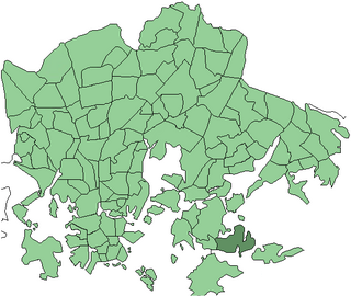
Jollas is a southeastern neighborhood of Helsinki, Finland.
Savalduma is a village in Tapa Parish, Lääne-Viru County, in northeastern Estonia.
Miiaste is a village in Põlva Parish, Põlva County in southeastern Estonia.

Bani Matar District is a district of the Sana'a Governorate, Yemen. As of 2003, the district had a population of 100,012 inhabitants.


