
Kowloon is an urban area in Hong Kong comprising the Kowloon Peninsula and New Kowloon. It has a population of 2,019,533 and a population density of 43,033/km2 (111,450/sq mi) in 2006. It is one of the three areas of Hong Kong, along with Hong Kong Island and the New Territories. It is the smallest, second most populous and most densely populated of the divisions.

The Islands District is one of the 18 districts of Hong Kong. It is part of the New Territories. It had a population of 185,282 in 2021.

The Po Toi Islands are a small group of islands with a population of around 200, south-east of Hong Kong Island, off Stanley, in Hong Kong. The main island of the group is Po Toi Island. Administratively, they are part of Islands District.
Waglan Island is a member of the Po Toi group of islands in Hong Kong. Wagan Lighthouse, a declared monument dating to 1893 stands there. Since 1989 Wagan lighthouse is automated and Wagan Island is uninhabited. The island also hosts a ground of meteorological observation and recording for the Hong Kong Observatory.
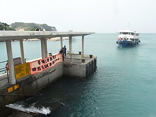
Po Toi is the main island of the Po Toi Islands and the southernmost island of Hong Kong, with an area of 3.69 km2.

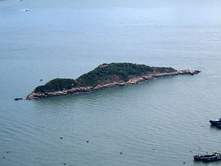
Green Island is an island off the northwest coast of Kennedy Town, Hong Kong Island, separated by the Sulphur Channel. A smaller island nearby to the east, uninhabited, is called Little Green Island (小青洲). Administratively, the two islands are part of Central and Western District.
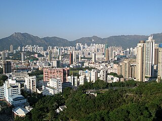
Kowloon City district is one of the 18 districts of Hong Kong. It is located in the city of Kowloon and cut through by Boundary Street. It had a population of 381,352 in 2001, and increased to 418,732 in 2016. The district has the third most educated residents while its residents enjoy the highest income in Kowloon. It borders all the other districts in Kowloon, with Kwun Tong district to the east, Wong Tai Sin district to its northeast, Sham Shui Po district to its northwest, and Yau Tsim Mong district to its southwest.

Ma Tau Chung is an area in Kowloon, Hong Kong, west of Ma Tau Kok and east of Ma Tau Wai. It was named after a creek which originated in Quarry Hill emptying into Kowloon Bay. The village of Ma Tau Chung stood on its banks near the river mouth near the Sacred Hill.

Prehistoric Hong Kong is the period between the arrival of the first humans in Hong Kong and the start of recorded Chinese history during the Han dynasty. The history of the southern region is reckoned to have been first recorded in 214 BC with Qin Shi Huang conquering the Baiyue and creating the Jiaozhou province.

Tang Lung Chau is a islet located off the southern coast of Ma Wan island to the northwest of Hong Kong Island, Hong Kong. It is located within Tsuen Wan District of the New Territories.

Blake Pier at Stanley is a public pier in Stanley, Hong Kong. The name originally referred to Blake Pier, Central, a ferry pier in Central, Hong Kong. The pier was named after Sir Henry Arthur Blake, the twelfth governor of Hong Kong. It was originally located at the site of the Central Reclamation Phase 1 project.

Po Toi O is a small fishing village and a bay at Clear Water Bay Peninsula, Sai Kung, New Territories, Hong Kong.
Articles related to Hong Kong include:
Magazine Island, originally known as One Tree Island, is an island of Hong Kong, located off the southwest coast of Hong Kong Island, and off the northwestern tip of Ap Lei Chau. For the purpose of local council, it is part of Southern District.

The Yuwengdao Lighthouse or Yuwongdao Lighthouse, Fisher Island Lighthouse, Yuweng Tao Lighthouse, Yu-Won Island Lighthouse, West Island Lighthouse and Xiyu Lighthouse is a lighthouse in Wai'an Village, Xiyu Township, Penghu County, Taiwan. The Yuwengdao Lighthouse is the oldest lighthouse in Taiwan.

Beaufort Island is a member of the Po Toi group of islands in Hong Kong. Its size is about 120 ha while its highest point is 270 m (890 ft) above sea level.

