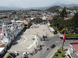
Chimaltenango is a city in Guatemala with a population of 96,985. It serves as both the capital of the department of Chimaltenango and the municipal seat for the surrounding municipality of the same name. Chimaltenango stands some 56 kilometres (35 mi) west of Guatemala City, on the Pan-American Highway. The municipal capital produces textiles and pottery.
Escuintla is an industrial city in Guatemala, its land extension is 4,384 km2, and it is nationally known for its sugar agribusiness. Its capital is a municipality with the same name. Citizens celebrate from December 6 to 9 with a small fair in honor to The Immaculate Conception.

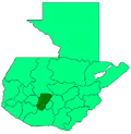
Chimaltenango is a department of Guatemala. The capital is Chimaltenango.

Jocotenango is a town and small municipality in the northeast section of Guatemalan department of Sacatepéquez, and is situated north of Antigua Guatemala. It has seven zones, two villages, and one hamlet. According to the 2018 census, the municipality has a total population of 21,657 of which 1,680 are native population and the balance are non-indigenous; and approximately 19,280 live in an urban area, while the balance are rural dwellers.
Canillá is a municipality in the Guatemalan department of El Quiché with a surface area of 123 km2 and a population of 15,053 people.
Pachalúm is a municipality in the Guatemalan department of El Quiché.

Chiantla is a town and municipality in the Guatemalan department of Huehuetenango. The municipality is situated at 2,000 metres above sea level and covers an area of 521 km2. The annual festival is on January 28.

Jacaltenango is a town and municipality situated in the Western Highlands of Guatemala. It is located in a valley surrounded by the Sierra Madre Mountains. Jacaltenango serves as the municipal seat for the surrounding municipality of the same name. In 2002, its urban population was about 23,500 but at the 2018 census the town's population has decreased to 22,533.

San Pedro Soloma is a town and municipality of Huehuetenango, a department of Guatemala. It is located in the Sierra de los Cuchumatanes at 2,300 m above sea level. The municipality covers a total area of 264 km2 with elevations ranging from 1,900 m to 3,500 m. Its population of 49,030 is spread over the town of Soloma, 19 villages and 50 smaller rural communities (caserios).
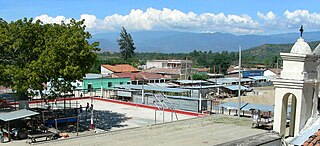
Acatenango is a town and municipality in the Chimaltenango department of Guatemala. It is in this municipality that the Acatenango volcano is located. The town is in the valley of the Cocoyá River.

San Juan Comalapa is a town, with a population of 32,312, and a municipality in the Chimaltenango department of Guatemala.
El Tejar is a municipality and town in the Chimaltenango department of Guatemala. As of 2018, the municipality has a population of 15,639.

Patzún is a town, with a population of 26,632 and a municipality in the Chimaltenango department of Guatemala.
San Andrés Itzapa is a town, with a population of 24,992, and a municipality of Chimaltenango, Guatemala. San Andrés Itzapa is in the eastern region of Chimaltenango, while the district capital lies to the north, Acatenango lies to the south and to the east is Parramos. The municipality cover an area of 63.7 km2, with a total population of 32,083.
San Martín Jilotepeque is a town, with a population of 10,812, and a municipality in the Chimaltenango department of Guatemala. It was the site of a bus accident in 2013.
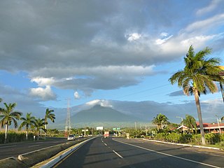
Yepocapa, also known as San Pedro Yepocapa, is a town with a population of 17,021, and a municipality in the Chimaltenango department of Guatemala. It is located at the base of Volcán de Fuego, which has destroyed the town several times, most recently on 15 October 1974.
Zaragoza is a town, with a population of 11,176, and a municipality in the Chimaltenango department of Guatemala.

San Juan Ostuncalco, is a town, with a population of 20,763, and a municipality in the Quetzaltenango department of Guatemala. Beside Spanish, local people speak the Mam language.
Malacatán is a town and municipality in the San Marcos department of Guatemala, located to the west of San Marcos town. It is fairly close to the border with Mexico - the border-crossing point is in the nearby village of El Carmen.

San Antonio Palopó is a municipality in the Sololá Department of Guatemala. The village is on the eastern shore of Lake Atitlán. The lowest elevation is 1,562 metres (5,125 ft) at the shoreline. The people of the region are Cakchiquel Maya with a distinctive style of clothing. The patron saint of the village is St. Anthony of Padua. The annual festival takes place on 13 June.