San Juan Comalapa | |
|---|---|
Municipality and town | |
 Church, San Juan Comalapa | |
 San Juan Comalapa Location in Guatemala | |
| Coordinates: 14°44′N90°53′W / 14.733°N 90.883°W | |
| Country | |
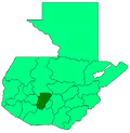
| Department | |
| Government | |
| • Mayor (2016–2020) | Justo Rufino Simlox Pichiyá [1] |
| Area | |
• Total | 48 sq mi (125 km2) |
| Population (2018) [2] | |
• Total | 48,597 |
| • Density | 1,010/sq mi (389/km2) |
| Time zone | UTC+6 (Central Time) |
| Climate | Cwb |
San Juan Comalapa is a town, with a population of 32,312 (2018 census), [3] and a municipality in the Chimaltenango department of Guatemala.
Contents
- History
- Spanish colony
- 20th century
- Sister cities
- Climate
- Geographic location
- See also
- Notes and references
- References
- Bibliography
- External links
San Juan Comalapa is sometimes called the "Florence of America", because of the many Kaqchikel painters living there (one of the more celebrated painters being Paula Nicho Cumez). It is also the birthplace of Rafael Álvarez Ovalle, who composed Guatemala national anthem. The painting tradition started in the 1930s, when Kaqchikel painter Andrés Curruchich (1891–1969) started painting with oil. His creativity was noted so much that he started showing his art in the United States and achieved international success. Because of this, Curruchiche decided to teach the new generations his form of painting. Today there are some 500 painters in San Juan Comalapa, and the majority of them still use the techniques of Curruchiche. These painters are dedicated to paint the costumes, life experiences and traditions of the Indian towns.