Podbrdy | |
|---|---|
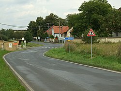 Entrance to Podbrdy | |
 Podbrdy Location in the Czech Republic | |
| Coordinates: 49°51′47″N14°7′36″E / 49.86306°N 14.12667°E | |
| Country | |
| Region | Central Bohemian |
| District | Beroun |
| First mentioned | 1788 |
| Area | |
• Total | 3.78 km2 (1.46 sq mi) |
| Elevation | 350 m (1,150 ft) |
| Population (2025-01-01) [1] | |
• Total | 250 |
| • Density | 66/km2 (170/sq mi) |
| Time zone | UTC+1 (CET) |
| • Summer (DST) | UTC+2 (CEST) |
| Postal code | 267 27 |
| Website | www |
Podbrdy is a municipality and village in Beroun District in the Central Bohemian Region of the Czech Republic. It has about 300 inhabitants.