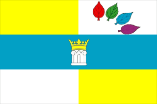
Avangard is a rural locality in Itkulovsky Selsoviet of Ishimbaysky District, Bashkortostan, Russia. The population was 7 as of 2018.

Peski is an urban locality in Kolomensky District of Moscow Oblast, Russia. Population: 3,845 (2010 Census); 3,736 (2002 Census); 4,074 (1989 Soviet census).
Kalininskoye is a rural locality in Kaltymanovsky Selsoviet, Iglinsky District, Bashkortostan, Russia. The population was 9 as of 2010. There are 3 streets.
Petrovskoye is a rural locality in Kaltovsky Selsoviet, Iglinsky District, Bashkortostan, Russia. The population was 15 as of 2010. In the district there are 3 streets.
Murzino is a rural locality in Novokiyeshkinsky Selsoviet, Karmaskalinsky District, Bashkortostan, Russia. The population was 172 as of 2010. There are 5 streets in the locality.
Gorny is a rural locality in Kara-Yakupovsky Selsoviet, Chishminsky District, Bashkortostan, Russia. The rural locality has 10 streets and, as of 2010, a population of 712.
Kalmashevo is a rural locality in Yeremeyevsky Selsoviet, Chishminsky District, Bashkortostan, Russia. The rural locality has 11 streets and, as of 2010, a population of 686.
Klyashevo is a rural locality in Arovsky Selsoviet, Chishminsky District, Bashkortostan, Russia. The rural locality has 18 streets and, as of 2010, a population of 560.
Novotroitskoye is a rural locality and the administrative centre of Novotroitsky Selsoviet, Chishminsky District, Bashkortostan, Russia. The rural locality has 11 streets and, as of 2010, a population of 411.
Chernigovka is a rural locality in Arovsky Selsoviet, Chishminsky District, Bashkortostan, Russia. As of 2010, the population was 115 in this rural locality which has 14 streets.
Chukrakly is a rural locality in Durasovsky Selsoviet, Chishminsky District, Bashkortostan, Russia. The population of this rural locality was 130 as of 2010. There is 1 street.
Podlesny is a rural locality in Sevsky District, Bryansk Oblast, Russia. The population was 6 as of 2010.
Zaborye is a rural locality in Simskoye Rural Settlement, Yuryev-Polsky District, Vladimir Oblast, Russia. The population was 3 as of 2010.
Ozyorny is a rural locality in Simskoye Rural Settlement, Yuryev-Polsky District, Vladimir Oblast, Russia. The population was 2 as of 2010.
Podlesny is a rural locality in Simskoye Rural Settlement, Yuryev-Polsky District, Vladimir Oblast, Russia. The population was 1 as of 2010.

Uglyanets is a rural locality and the administrative center of Uglyanskoye Rural Settlement, Verkhnekhavsky District, Voronezh Oblast, Russia. The population was 4,151 (2021 Census); 3,658 as of 2010. There are 53 streets.
Podlesny is a rural locality in Uglyanskoye Rural Settlement, Verkhnekhavsky District, Voronezh Oblast, Russia. The population was 2,460 as of 2010. There are 30 streets.
Kopanishche is a rural locality and the administrative center of Kopanishchenskoye Rural Settlement, Liskinsky District, Voronezh Oblast, Russia. The population was 958 as of 2010. There are 10 streets.
Podlesny is a rural locality in Klyukvinsky Selsoviet Rural Settlement, Kursky District, Kursk Oblast, Russia. Population: 609 (2010 Census); 623 (2002 Census);


