
The San Juan Islands are an archipelago in the Pacific Northwest of the United States between the U.S. state of Washington and Vancouver Island, British Columbia, Canada. The San Juan Islands are part of Washington state, and form the core of San Juan County.

The Strait of Juan de Fuca is a body of water about 96 miles long that is the Salish Sea's outlet to the Pacific Ocean. The international boundary between Canada and the United States runs down the centre of the Strait.
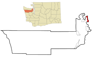
Marrowstone is a census-designated place (CDP) in Jefferson County, Washington, United States. The population was 844 at the 2010 census. All Marrowstone addresses are in Nordland, Washington, and the ZIP code for Marrowstone Island is 98358.

Birch Bay is a protected bay of the east shore of the Salish Sea, between Semiahmoo Bay and Lummi Bay; approximately 100 miles (160 km) north of Seattle and 35 miles (56 km) south of Vancouver, BC, Canada.

Admiralty Inlet is a strait in the U.S. state of Washington connecting the eastern end of the Strait of Juan de Fuca to Puget Sound. It lies between Whidbey Island and the northeastern part of the Olympic Peninsula.

Cape Blanco is a prominent headland on the Pacific Ocean coast of southwestern Oregon in the United States, forming the westernmost point in the state. Cape Blanco extends further west than any point of land in the contiguous United States except portions of the Olympic Peninsula in Washington, including Cape Alava, the true westernmost point. The cape is part of Cape Blanco State Park and is the location of the Cape Blanco Light, first lit in 1870.

Dungeness Spit is a long sand spit jutting out approximately 5 miles (8 km) from the northern edge of the Olympic Peninsula in northeastern Clallam County, Washington, USA, into the Strait of Juan de Fuca. It is the longest natural sand spit in the United States. The spit is growing in length by about 15 feet (4.6 m) per year. The body of water it encloses is called Dungeness Bay. The Dungeness Spit is entirely within the Dungeness National Wildlife Refuge and home of the New Dungeness Lighthouse. Its land area, according to the United States Census Bureau, is 1,271,454 square meters. The lighthouse once was run by United States Coast Guard, but in 1976 the agency installed an automatic light. Since 1994 the lighthouse has been staffed and maintained by the volunteer "New Dungeness Light Station Association". The spit is open to the public year around.

Mukilteo Lighthouse Park encompasses the lighthouse at the west end of the city of Mukilteo, Washington, and 12 acres (0.049 km2) south of it. The property is west and south of the Washington State Ferries terminal with ferry service to Clinton, Whidbey Island, and is bordered on the south and east by the BNSF Railway mainline. Whidbey Island lies across a narrow portion of Possession Sound and is easily visible from the shore.
Point Partridge is the most westerly point of Whidbey Island, the largest island in Puget Sound. The point lies north of the Fort Ebey military reservation and south of West Beach. The primary importance of Point Partridge is as the northern and eastern reference point for the dividing line between Puget Sound and the Strait of Juan de Fuca. The other reference is Point Wilson.

Discovery Bay is a small bay connected to the Strait of Juan de Fuca on the Olympic Peninsula in Washington state; it was also historically called Port Discovery. An unincorporated community also named Discovery Bay lies in Jefferson County at the southern end of the bay.

Cape Flattery is the northwesternmost point of the contiguous United States. It is in Clallam County, Washington on the Olympic Peninsula, where the Strait of Juan de Fuca joins the Pacific Ocean. It is also part of the Makah Reservation, and is the northern boundary of the Olympic Coast National Marine Sanctuary. Cape Flattery can be reached from a short hike, most of which is boardwalked. The westernmost point in the contiguous United States is at Cape Alava, south of Cape Flattery in Olympic National Park. However, the westernmost tip of Cape Flattery is almost exactly as far west as Cape Alava, the difference being approximately 5 seconds of longitude, about 360 feet (110 m), at high tide and somewhat more at low tide.
The Quimper Peninsula is a narrow peninsula forming the most northeastern extent of the Olympic Peninsula of Washington state in the northwestern United States of America.

Manuel Quimper Benítez del Pino was a Spanish Peruvian explorer, cartographer, naval officer, and colonial official. He participated in charting the Strait of Juan de Fuca and the Sandwich Islands in the late 18th century. He was later appointed a colonial governor in his native Peru at the beginning of the fight for independence there. He retired to Spain, but was able to return to Peru where he served as a naval officer in the new republic and pursued a literary career, publishing over 20 books about his experiences before his death there in Lima.

Discovery Island is located off the eastern side of Vancouver Island and is viewable from Ten Mile Point, near Cadboro Bay, and Oak Bay. Discovery Island Marine Provincial Park occupies the southern portion of Discovery Island, 3 miles (4.8 km) east of Oak Bay. The northern portion of the island is part of Discovery Island Indian Reserve 3, under the control of the Songhees First Nation.
Smith Island is an island located in the eastern Strait of Juan de Fuca, Washington, about midway between Admiralty Inlet and Lopez Island. It is connected to the smaller Minor Island, to its east, by a low spit that is covered at high tide. The low, grassy islands have a few trees and are an important habitat for seabirds, and the beaches are a resting site for sea lions. The islands are part of the San Juan Islands National Wildlife Refuge, and are usually closed to the public.
Possession Sound is part of Puget Sound, located in the U.S. state of Washington between Whidbey Island and the shoreline of Snohomish County approximately between the cities of Everett and Mukilteo. Possession Sound connects the main Puget Sound basin to the south with Saratoga Passage and Port Susan to the north. The Snohomish River flows into Possession Sound at Port Gardner Bay. Gedney Island, also called Hat Island, is located in Possession Sound.

Rosario Strait is a strait in northern Washington state, separating San Juan County and Skagit and Whatcom Counties. It extends from the Strait of Juan de Fuca about 23 kilometres (14 mi) north to the Strait of Georgia. The USGS defines its southern boundary as a line extending from Point Colville on Lopez Island to Rosario Head on Fidalgo Island, and its northern boundary as a line from Point Migley on Lummi Island to the east tip of Puffin Island and then to Point Thompson on Orcas Island. Rosario Strait runs north-south between Lopez, Decatur, Blakely, and Orcas Islands on the west, and Fidalgo, Cypress, Sinclair, and Lummi Islands on the east.

Saratoga Passage lies in Puget Sound between Whidbey Island and Camano Island.

Spanish expeditions to the Pacific Northwest were undertaken several times during the Age of Exploration. Spanish claims to the Pacific Northwest date to the papal bull of 1493, and the Treaty of Tordesillas signed in 1494. In 1513, this claim was reinforced by Spanish explorer Vasco Núñez de Balboa, the first European to sight the Pacific Ocean, when he claimed all lands adjoining this ocean for the Spanish Crown. Spain only started to colonize the claimed territory north of present-day Mexico in the 18th century, when it settled the northern coast of Las Californias.
Skagit Bay is a bay and strait located in the U.S. state of Washington. It is part of the Whidbey Island Basin of Puget Sound. The Skagit River empties into Skagit Bay. To the south, Skagit Bay connects with the rest of Puget Sound via Saratoga Passage and Possession Sound. The boundary between Saratoga Passage and Skagit Bay is between Polnell Point on Whidbey Island and Rocky Point on Camano Island. To the northwest, Skagit Bay connects to the Strait of Juan de Fuca via the narrow strait of Deception Pass. A third waterway, the Swinomish Channel, connects Skagit Bay with Padilla Bay to the north.
