Portal, Nebraska | |
|---|---|
 Portal, Nebraska  Portal, Nebraska | |
| Coordinates: 41°10′35″N96°04′51″W / 41.17639°N 96.08083°W | |
| Country | |
| State | |
| County | Sarpy |
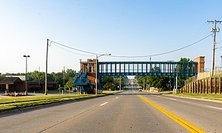
Portal is an unincorporated community in Sarpy County, Nebraska, United States. [1]
Portal, Nebraska | |
|---|---|
| Portal, Nebraska Portal, Nebraska | |
| Coordinates: 41°10′35″N96°04′51″W / 41.17639°N 96.08083°W | |
| Country | |
| State | |
| County | Sarpy |
Portal is an unincorporated community in Sarpy County, Nebraska, United States. [1]
Portal was established on the railroad. [2] A post office opened at Portal in 1887, and remained in operation until 1898. [3]

Sarpy County is a county located in the U.S. state of Nebraska. As of the 2020 United States Census, the population was 190,604, making it the third-most populous county in Nebraska. Its county seat is Papillion.

Bellevue is a suburban city in Sarpy County, Nebraska, United States. It is part of the Omaha–Council Bluffs metropolitan area, and had a population of 64,176 as of the 2020 Census, making it the third-largest city in Nebraska, behind Omaha and Lincoln, and the second largest city in the U.S. named "Bellevue," behind Bellevue, Washington.

Chalco is a census-designated place (CDP) in northern Sarpy County, Nebraska, United States, and an adjacent suburb of Omaha, with La Vista located to the southeast. The population was 11,064 at the 2020 census.
La Vista is a city in Sarpy County, Nebraska, United States. The population was 16,746 at the 2020 census. The city was incorporated on February 23, 1960.

Papillion is a city in and the county seat of Sarpy County, Nebraska, United States. The city developed in the 1870s as a railroad town and suburb of Omaha. The city is part of the larger five-county metro area of Omaha. Papillion's population was 24,159 at the 2020 census. Its growth since the late 20th century has reflected Omaha's.

The Omaha metropolitan area, officially known as the Omaha–Council Bluffs, NE–IA, Metropolitan Statistical Area (MSA), is an urbanized region in Nebraska and Iowa in the American Midwest, centered on the city of Omaha, Nebraska. The region consists of eight counties, and extends over a large area on both sides of the Missouri River. Covering 4,407 square miles (11,410 km2) and with a population of 967,604 (2020), the Omaha metropolitan area is the most populous in both Nebraska and Iowa, and is the 58th most populous MSA in the United States. The 2003 revision to metropolitan area definitions was accompanied by the creation of micropolitan areas and combined statistical areas. Fremont, in Dodge County, Nebraska, was designated a micropolitan area. The Omaha–Council Bluffs–Fremont Combined Statistical Area has a population of 1,058,125 . Approximately 1.5 million people reside within the Greater Omaha area, within a 50 mi (80 km) radius of Downtown Omaha.

Nebraska's 1st congressional district is a congressional district in the U.S. state of Nebraska that encompasses most of its eastern quarter, except for Omaha and some of its suburbs, which are part of the 2nd congressional district. It includes the state capital Lincoln, as well as the cities of Bellevue, Fremont, and Norfolk. Following the 2010 United States Census, the 1st congressional district was changed to include an eastern section of Sarpy County; Dakota County was moved to the 3rd congressional district.

Nebraska's 2nd congressional district is a congressional district in the U.S. state of Nebraska that encompasses the core of the Omaha–Council Bluffs metropolitan area. It includes all of Douglas County, which includes the state's largest city Omaha; it also includes Sauders County and areas of Western Sarpy County. It has been represented in the United States House of Representatives since 2017 by Don Bacon, a member of the Republican Party. It was one of 18 districts that voted for Joe Biden in the 2020 presidential election while being won or held by a Republican in 2022.

Fontenelle's Post, first known as Pilcher's Post, and the site of the later city of Bellevue, was built in 1822 in the Nebraska Territory by Joshua Pilcher, then president of the Missouri Fur Company. Located on the west side of the Missouri River, it developed as one of the first European-American settlements in Nebraska. The Post served as a center for trading with local Omaha, Otoe, Missouri, and Pawnee tribes.

Peter Abadie Sarpy (1805–1865) was the French-American owner and operator of several fur trading posts, essential to the development of the Nebraska Territory, and a thriving ferry business. A prominent businessman, he helped lay out the towns of Bellevue and Decatur, Nebraska. Nebraska's legislature named Sarpy County after him in honor of his service to the state.
The Sarpy County Museum is located at 2402 Clay St in Bellevue, Nebraska. The museum holds a collection of artifacts and historical resources, covering the history of Sarpy County, Nebraska, including Bellevue, Gretna, La Vista, Papillion, and Springfield. The museum includes the history of fur traders and missionaries, period rooms, early agricultural pursuits, and a scale model of Fort Crook, which later became Offutt Air Force Base.
La Platte is a census-designated place (CDP) in Sarpy County, Nebraska, United States.
Richfield is a census-designated place (CDP) in Sarpy County, Nebraska, United States.
Avery is an Unincorporated community in Sarpy County, Nebraska, United States.
Gilmore is an unincorporated community in Sarpy County, Nebraska, United States.
Meadow is an unincorporated community in Sarpy County, Nebraska, United States.

Melia is a census-designated place (CDP) in Sarpy County, Nebraska, United States.
Beacon View is a census-designated place (CDP) in Sarpy County, Nebraska, United States. It is in the southwest part of the county, on the east bank of the Platte River. It is bordered to the south, across U.S. Route 6 (US 6), by the CDP of Linoma Beach. US 6 leads northeast 7 miles (11 km) to Gretna and southwest 3.5 miles (5.6 km) to Nebraska. Omaha is 28 miles (45 km) to the northeast.
Linoma Beach is a census-designated place (CDP) in Sarpy County, Nebraska, United States, comprising the Linoma Beach historic district and adjacent land to the east. The community is in the southwest part of the county, on the east bank of the Platte River. It is bordered to the north, across [[{U.S. Route 6 in Nebraska|U.S. Route 6]] (US 6), by the CDP of Beacon View. US 6 leads northeast 7 miles (11 km) to Gretna and southwest 3.5 miles (5.6 km) to Nebraska. Omaha is 28 miles (45 km) to the northeast.
Rick Holdcroft is a member of the Nebraska Legislature for District 36 from Bellevue, Nebraska. He was elected to the Nebraska Legislature on November 8, 2022. Holdcroft is the first senator to serve District 36 since it was relocated to Sarpy County after the Nebraska Legislature's 2021 redistricting. Holdcroft served in the United States Navy for 28 years.
Municipalities and communities of Sarpy County, Nebraska, United States | ||
|---|---|---|
| Cities | 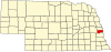 | |
| CDPs | ||
| Other communities | ||
| | This Sarpy County, Nebraska state location article is a stub. You can help Wikipedia by expanding it. |