Portbury Ashlands

Last updated
One of the ponds Portbury Ashlands - geograph 1785019 3f83eb45.jpg
One of the ponds

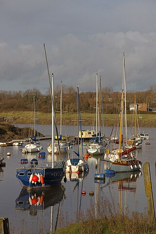
Portbury Ashlands which is now known as Portbury Wharf Nature Reserve is a nature reserve between Portishead and the Royal Portbury Dock in Somerset, England. It was formed from the redevelopment of the area of Portishead formerly occupied by two power stations. To the east of the harbour, an area known as "the Ashlands" was used for over 50 years to get rid of power station waste which was dumped into lagoons on the site. [1]

The Portishead power stations were coal-fed electric power stations. Construction work started on Portishead "A" power station in 1926. It began generating electricity in 1929 for the Bristol Corporation's Electricity Department. [2] [3] Construction of Portishead "B" power station began in 1949; it became operational in 1955. [2] [3] The stations used some local coal produced in the Somerset coalfield, which was delivered by train along the Portishead branch of the Great Western Railway (GWR). The main supply of coal was brought from South Wales, from Newport and Ely, Cardiff by boat into the dock; it was carried by Osborn & Wallis of Bristol. [4]

Avon Wildlife Trust have taken over management of the area, which covers around 100 acres (40 ha), from the developers Persimmon plc. [5] It was implemented as ecological mitigation for the housing development and included the introduction of a public access network. [6] In 2015 the North Somerset council decided to take over management of the reserve and that residents of the housing development would no longer need to pay the £50 per annum levy for the upkeep. Some local residents are worried that the council does not have the expertise required to take over from the wildlife trust and for the longer term implications for the site. [7] [8] [9] [10]

The site includes two large pools, several ponds, rhynes, grazing marsh, hay meadows and hedgerows. It provides a habitat for a wide range of plants and animals. Great crested newts (Triturus cristatus), water voles (Arvicola amphibius), grass snakes (Natrix natrix) and brown hares (Lepus europaeus) have been seen and there is evidence that otters (Lutra lutra) are moving in. A wide variety of birds are making their homes on the site, including barn owls (Tyto alba), and it is visited by large number of migratory birds which use the Severn Estuary on their journeys. These include: curlew (Numenius arquatus), dunlin (Calidris alpina), redshank (Tringa totanus) and shelduck (Tadorna tadorna). [11] The tidal range results in the estuary having one of the most extensive intertidal wildlife habitats in the UK, comprising mudflats, sandflats, rocky platforms and islands. These form a basis for plant and animal communities typical of extreme physical conditions of liquid mud and tide-swept sand and rock. The estuary is recognised as a wetland area of international importance and is designated as a Ramsar site. [12] Parts of the estuary have also been designated a Site of Special Scientific Interest. The SSSI includes most of the foreshore upstream from Cardiff and Brean Down and most of the upper estuary as far as Sharpness. [13] The Ashlands also provides a green link between the estuary and the Gordano Valley which has been designated as a national nature reserve. [14]

Related Research Articles

River Avon, Bristol River in the south west of England

The River Avon is a river in the south west of England. To distinguish it from a number of other rivers of the same name, it is often called the Bristol Avon. The name 'Avon' is a cognate of the Welsh word afon, meaning 'river'.

Portishead, Somerset Human settlement in England

Portishead is a coastal town on the Severn Estuary, 8 miles to the west of Bristol, but within the unitary district of North Somerset, which falls within the ceremonial county of Somerset, England. It has a population of around 25,000, with a growth rate considerably in excess of surrounding towns.

Avonmouth Human settlement in England

Avonmouth is a port and outer suburb of Bristol, England, facing two rivers: the reinforced north bank of the final stage of the Avon which rises at sources in Wiltshire, Gloucestershire and Somerset; and the eastern shore of the Severn Estuary. Strategically the area has been and remains an important part of the region's maritime economy particularly for larger vessels for the unloading and exporting of heavier goods as well as in industry including warehousing, light industry, electrical power and sanitation. The area contains a junction of and is connected to the south by the M5 motorway and other roads, railway tracks and paths to the north, south-east and east.

The Avon Wildlife Trust aims to protect and promote wildlife in the area of the former county of Avon — now Bath and North East Somerset, Bristol, North Somerset and South Gloucestershire, in England. It has its headquarters in Bristol and runs wildlife centres at Folly Farm, Somerset and Feed Bristol, Frenchay, North Bristol.

Severn Estuary Estuary and Site of Special Scientific Interest in Great Britain

The Severn Estuary is the estuary of the River Severn in the south-west of Great Britain, flowing into the Bristol Channel between England and South Wales. Its high tidal range, approximately 50 feet (15 m), means that it has been at the centre of discussions in the UK regarding renewable energy.

Easton in Gordano Human settlement in England

Easton in Gordano is a village in Somerset, England, about 4+12 miles (7 km) northwest of Bristol city centre. It is part of the civil parish of Pill and Easton-in-Gordano and within the unitary authority of North Somerset. In 2011 the population of the parish was 4,828.

Gordano Valley

Gordano is an area of North Somerset, in England. It has been designated as a National Nature Reserve.

Weston in Gordano Human settlement in England

Weston in Gordano is a village and civil parish in Somerset, England. It is situated in the middle of the Gordano valley on the north side, and in the Unitary Authority of North Somerset, on the road between Clevedon and Portishead. The parish has a population of 301.

Walton in Gordano Human settlement in England

Walton in Gordano is a village and civil parish in North Somerset, England. It is situated in a small valley at the side of the south-western end of the Gordano Valley, about a mile from Clevedon. The parish has a population of 273.

Portbury Human settlement in England

Portbury is a village and civil parish in Somerset, England within the unitary authority of North Somerset. The parish includes the hamlet of Sheepway which is situated on the moorland at the northern edge of the Gordano valley, between the Gordano services on the M5 motorway and Portishead, near the Royal Portbury Dock. The parish has a population of 827.

Royal Portbury Dock Port in United Kingdom

The Royal Portbury Dock is part of the Port of Bristol, in England. It is situated near the village of Portbury on the southern side of the mouth of the Avon, where the river joins the Severn estuary — the Avonmouth Docks are on the opposite side of the Avon, within Avonmouth. The deepwater dock was constructed between 1972 and 1977, and is now a major port for the import of motor vehicles into the UK. The M5 motorway runs nearby, and the huge car storage compounds around the dock are visible from the Avonmouth Bridge. A waste industrial area west of the port is being developed as the Portbury Ashlands Nature Reserve.

Pill, Somerset Human settlement in England

Pill is a village in North Somerset, England, situated on the southern bank of the Avon, about 4 miles (6 km) northwest of Bristol city centre. The village is the largest settlement in the civil parish of Pill and Easton-in-Gordano. The former hamlets of Lodway and Ham Green are now contiguous with Pill, and the village of Easton in Gordano is nearby. The parish extends northwest beyond the M5 motorway to include the Royal Portbury Dock.

North Somerset Levels

The North Somerset Levels is a coastal plain, an expanse of low-lying flat ground, which occupies an area between Weston-super-Mare and Bristol in North Somerset, England. The River Banwell, River Kenn, River Yeo and Land Yeo are the three principal rivers draining the area.

Portishead Railway

The Portishead Railway is a branch line railway running from Portishead in North Somerset to the main line immediately west of Bristol, England. It was constructed by the Bristol & Portishead Pier and Railway Company, but it was always operated by its main line neighbour, and was more usually thought of as the Portishead branch or the Portishead railway.

Weston Big Wood

Weston Big Wood is a 37.48 hectare woodland west of the town of Portishead, North Somerset, England. It is a nature reserve and biological Site of Special Scientific Interest, notified in 1971. The wood takes its name from the nearby village of Weston-in-Gordano.

Catcott, Edington and Chilton Moors

Catcott, Edington and Chilton Moors SSSI is a 1083 hectare biological Site of Special Scientific Interest in Somerset, England notified in 1967. It is close to the villages of Edington and Catcott.

Portishead power station Series of two coal and oil-fired power stations

Portishead Power Station refers to a series of two coal and oil-fired power stations which operated in the dock area of Portishead in Somerset, South West England, between 1929 and 1982.

The Gordano Round is a 27-mile (43 km) recreational Long-distance trail, running as a figure of eight around the Gordano Valley near Portishead in North Somerset, England.

References

  1. "Ashlands, Portishead Brownfield Regeneration, Earthworks and Infrastructure Design" (PDF). Supporta. Retrieved 17 March 2010.[ permanent dead link ]
  2. 1 2 Winter, Michael T., (2005). The Portishead Coal Boats: A History of Osborn & Wallis Ltd, Bristol. Lydney: Black Dwarf Publications. ISBN   1-903599-13-X
  3. 1 2 Crowhurst, Ken, (2001). Images of England: Portishead. Stroud: Tempus Publishing. ISBN   0-7524-2240-5
  4. Winter, Op cit., pages 177–180
  5. "Bikers spark fear for safety at Portbury wildlife haven". Bristol Evening Post. This is Bristol. 2008-08-30. Archived from the original on 13 September 2012. Retrieved 9 May 2010.
  6. "Application No: 06/P/1635/RM". North Area Committee 7 December 2006. North Somerset Council. Archived from the original on 7 June 2011. Retrieved 9 May 2010.
  7. "Future of Portbury Wharf Nature Reserve". North Somerset Council. Retrieved 5 April 2018.
  8. "Nature Notes". Private Eye. 1405: 18. 13 November 2015.
  9. "Open letter about Portbury Wharf nature reserve". North Somerset Council. Archived from the original on 17 November 2015. Retrieved 15 November 2015.
  10. "Statement on Portbury Wharf". Avon Wildlife Trust. Retrieved 15 November 2015.
  11. "Portbury Ashlands" (PDF). Wildlife. Avon Wildlife Trust (88): 6–7. Summer 2010. Archived from the original (PDF) on 2011-07-16.
  12. Information on Severn Estuary Ramsar site designation www.jncc.gov.uk, accessed 9 October 2019
  13. Severn Estuary SSSI citation
  14. "Gordano Valley NNR". Natural England. Retrieved 31 January 2010.

Coordinates: 51°29′24″N2°44′44″W / 51.49000°N 2.74556°W / 51.49000; -2.74556