Protected areas of Tasmania consist of protected areas located within Tasmania and its immediate onshore waters, including Macquarie Island. It includes areas of crown land managed by Tasmanian Government agencies as well as private reserves. As of 2016, 52% of Tasmania's land area has some form of reservation classification, the majority is managed by the Tasmania Parks & Wildlife Service. Marine protected areas cover about 7.9% of state waters.

Southwest National Park is an Australian national park located in the south-west of Tasmania, bounded by the Franklin-Gordon Wild Rivers National Park to the north and the Hartz Mountains National Park to the east. It is a part of a chain of national parks and state reserves that make up the Tasmanian Wilderness World Heritage Area. Covering an area of 6,183 km2 (2,387 sq mi), it is Tasmania's largest national park.

Cradle Mountain is a locality and mountain in the Central Highlands region of the Australian state of Tasmania. The mountain is situated in the Cradle Mountain-Lake St Clair National Park.

The Overland Track is an Australian bushwalking track, traversing Cradle Mountain-Lake St Clair National Park, within the Tasmanian Wilderness World Heritage Area. It's walked by more than nine thousand people each year, with numbers limited in the warmer months. Officially the track runs for 65 kilometres (40 mi) from Cradle Mountain to Lake St Clair however many choose to extend it by walking along Lake St Clair for an extra day, bringing it to 82 kilometres (51 mi). It winds through terrain ranging from glacial mountains, temperate rainforest, wild rivers and alpine plains.

Frenchmans Cap is a mountain in the West Coast region of Tasmania, Australia. The mountain is situated in the Franklin-Gordon Wild Rivers National Park.

Ben Lomond is a mountain in the north-east of Tasmania, Australia.

The South West Wilderness of Tasmania, Australia is a remote and inaccessible region of South West Tasmania containing unspoilt scenery, rugged peaks, wild rivers, unique flora and fauna, and a long and rugged coastline. Parts of the wilderness are more than 50 km from the nearest road, so the only access to the area is by foot, air or sea.
South West Tasmania is a region in Tasmania that has evoked curiosity as to its resources over the duration of European presence on the island.

Tasmania Parks and Wildlife Service is the government body responsible for protected areas of Tasmania on public land, such as national parks, historic sites and regional reserves. Historically it has also had responsibility for managing wildlife, including game.
Eucrenonaspides oinotheke is a species of crustacean in the family Psammaspidae, endemic to Tasmania, the only species described in the genus Eucrenonaspides. The Eucrenonaspides is a variation of the Anaspidaceans. It was described from a spring at 9 Payton Place, Devonport, Tasmania in 1980, making it "the first spring-dwelling syncarid recorded from the Australian region". It is listed as a vulnerable species on the IUCN Red List. A further undescribed species is known from south-western Tasmania.

Quamby Bluff is a mountain in Northern Tasmania, Australia that is an outlying part of the Great Western Tiers mountain range.

Mount Pelion West is a mountain located in the Central Highlands region of Tasmania, Australia. The mountain is part of the Pelion Range and is situated within the Cradle Mountain-Lake St Clair National Park at the easternmost boundary of the Murchison River catchment.

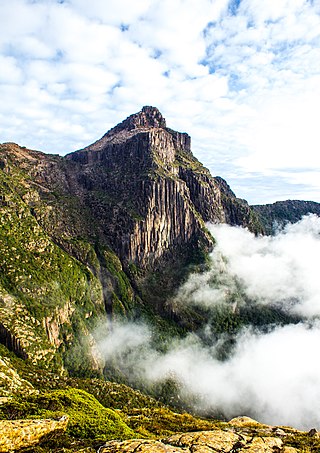
The Stacks Bluff is a peak in northeast Tasmania, Australia. The mountain is situated on the Ben Lomond plateau.

Mount Anne is a mountain located in the Southwest National Park in south-west region of Tasmania, Australia. The mountain lies within the UNESCO World Heritage-listed Tasmanian Wilderness.

Cathedral Mountain is a dominant mountain in the Cradle Mountain-Lake St Clair National Park in the central highlands in the state of Tasmania, Australia.

South Coast Tasmania runs from the South East Cape to the South West Cape of Tasmania. South Coast Tasmania is sometimes conflated with the South West Tasmania wilderness region.
Engineer Range is a mountain range in Western Tasmania, Australia.
The Spero River is a perennial river located in the West Coast or South West region of Tasmania, Australia.
Kutikina Cave is a rock shelter located on the Franklin River in the South West Wilderness, a World Heritage Area in the Australian state of Tasmania.
Exit Cave, Tasmania is a large multi entrance cave near Ida bay in southern Tasmania.
This page is based on this
Wikipedia article Text is available under the
CC BY-SA 4.0 license; additional terms may apply.
Images, videos and audio are available under their respective licenses.
