Prioksky City District

Last updated

Prioksky City District (Russian : Прио́кский райо́н) is one of the eight districts of the city of Nizhny Novgorod, Russia. It is located in the upper part of the city on the high right bank of the Oka River and has a land border only with Sovetsky City District along Meditsinskaya Street. It is also connected by the Myza Bridge with Avtozavodsky City District in the lower part of Nizhny Novgorod across the Oka. Population: 90,410(2010 Census); [1] 96,043(2002 Census); [2] 106,206(1989 Census). [3]

Russian language East Slavic language

Russian is an East Slavic language, which is official in the Russian Federation, Belarus, Kazakhstan and Kyrgyzstan, as well as being widely used throughout Eastern Europe, the Baltic states, the Caucasus and Central Asia. It was the de facto language of the Soviet Union until its dissolution on 25 December 1991. Although nearly three decades have passed since the breakup of the Soviet Union, Russian is used in official capacity or in public life in all the post-Soviet nation-states, as well as in Israel and Mongolia.

The classification system of the types of inhabited localities in Russia, the former Soviet Union, and some other post-Soviet states has certain peculiarities compared with the classification systems in other countries.

Nizhny Novgorod City in Nizhny Novgorod Oblast, Russia

Nizhny Novgorod, colloquially shortened to Nizhny, is a city in Russia and the administrative center (capital) of Volga Federal District and Nizhny Novgorod Oblast. From 1932 to 1990, it was known as Gorky, after the writer Maxim Gorky, who was born there.

Contents

The district local government headquarters are located in the district center on 40 Let Oktyabrya Street.

The district is essentially residential but it has some industrial enterprises. The latter include radio, electric, and electronics state-owned Frunze Plant as well as JSC Thermal and NITEL, which are in the same line of business. A number of scientific institutions are also located in the district. Their scope of interests are also connected with telecommunications and radar applications. A lot of small private-owned enterprises offer the service and employment opportunities for the residents of the district and the entire city.

Radar object detection system based on radio waves

Radar is a detection system that uses radio waves to determine the range, angle, or velocity of objects. It can be used to detect aircraft, ships, spacecraft, guided missiles, motor vehicles, weather formations, and terrain. A radar system consists of a transmitter producing electromagnetic waves in the radio or microwaves domain, a transmitting antenna, a receiving antenna and a receiver and processor to determine properties of the object(s). Radio waves from the transmitter reflect off the object and return to the receiver, giving information about the object's location and speed.

Transportation

Looking north along Gagarina Avenue C0481-NN-Gagarin-Ave.jpg
Looking north along Gagarina Avenue

The main north-south transportation line of the district is Gagarin Avenue, which forks into Arzamas and Bogorodsk roads after crossing the city border. The southern section of this road is now known as Sakharov Avenue. The main east-west roadway through the district is formed by the Myza Bridge across the Oka and Larin Street; this in fact is a part of transit federal motorway M7 from Moscow to Kazan. It also provides the shortest and fastest way to drive into Kstovo and points east throughout Nizhny Novgorod Oblast.

Arzamas City in Nizhny Novgorod Oblast, Russia

Arzamas is a city in Nizhny Novgorod Oblast, Russia, located on the Tyosha River, 410 kilometers (250 mi) east of Moscow. Population: 106,362 (2010 Census); 109,432 (2002 Census); 108,951 (1989 Census).

Moscow Capital city of Russia

Moscow is the capital and most populous city of Russia, with 13.2 million residents within the city limits, 17 million within the urban area and 20 million within the metropolitan area. Moscow is one of Russia's federal cities.

Kazan City of republic significance in Tatarstan, Russia

Kazan is the capital and largest city of the Republic of Tatarstan, Russia. With a population of 1,243,500, it is the sixth most populous city in Russia. Kazan is one of the largest religious, economic, political, scientific, educational, cultural and sports centers in Russia. Kazan lies at the confluence of the Volga and Kazanka Rivers in European Russia, about 715 kilometres (444 mi) east from Moscow. The Kazan Kremlin is a World Heritage Site.

The public transportation in Prioksky City District includes regional city bus routes, municipal trolleybus routes, municipal tram routes, and many privately owned marshrutka ("fixed-route taxis") vans. There are Myza commuter train rail station and Shcherbinki bus station for interurban transportation.

Trolleybus electric bus reliant on overhead wires

A trolleybus is an electric bus that draws power from overhead wires using spring-loaded trolley poles. Two wires and poles are required to complete the electrical circuit. This differs from a tram or streetcar, which normally uses the track as the return path, needing only one wire and one pole. They are also distinct from other kinds of electric buses, which usually rely on batteries. Power is most commonly supplied as 600-volt direct current, but there are exceptions.

Tram Vehicle used for tramway traffic

A tram is a rail vehicle which runs on tramway tracks along public urban streets; some include segments of segregated right-of-way. The lines or networks operated by tramcars are called tramways. Historically the term electric street railways was also used in the United States. In the United States, the term tram has sometimes been used for rubber-tyred trackless trains, which are unrelated to other kinds of trams.

<i>Marshrutka</i>

Marshrutka, from marshrutn[oy]e taksirouted taxicab, is a form of public transportation such as a share taxi for the countries of CIS, the Baltic states, Bulgaria, Georgia, Turkmenistan, and Ukraine. The role of the modern marshrutka is theoretically similar to the share taxi, which uses minibuses in some other countries.

Sights and culture

One of the apartment of this fairly ordinary apartment building is now Sakharov Museum C0476-NN-Sakharov-house.jpg
One of the apartment of this fairly ordinary apartment building is now Sakharov Museum

The culture institutions include three movie theaters, one of which is specialized for children, a large Switzerland park and Shchyolokovsky Khutor forest, attractive places to rest, and the District history museum nearby of the authorities headquarters. There are two monuments in the Switzerland park, dedicated to memory of fallen Russian soldiers in a local armed conflicts and to participants of workers' movement in the early 20th century.

Movie theater Venue, usually a building, for viewing films

A movie theater, cinema, or cinema hall, also known as a picture house or the pictures, is a building that contains an auditorium for viewing films for entertainment. Most, but not all, theaters are commercial operations catering to the general public, who attend by purchasing a ticket. Some movie theaters, however, are operated by non-profit organizations or societies that charge members a membership fee to view films.

Museum institution that holds artifacts and other objects of scientific, artistic, cultural, historical, or other importance

A museum is an institution that cares for (conserves) a collection of artifacts and other objects of artistic, cultural, historical, or scientific importance. Many public museums make these items available for public viewing through exhibits that may be permanent or temporary. The largest museums are located in major cities throughout the world, while thousands of local museums exist in smaller cities, towns and rural areas. Museums have varying aims, ranging from serving researchers and specialists to serving the general public. The goal of serving researchers is increasingly shifting to serving the general public.

Soldier one who serves as part of an organized armed force

A soldier is one who fights as part of an army. A soldier can be a conscripted or volunteer enlisted person, a non-commissioned officer, or an officer.

The Nizhny Novgorod Andrey Sakharov Museum is located in the apartment in the Shcherbinki neighborhood where the scientist had to live in the 1980s.

Related Research Articles

Pavlovo, Pavlovsky District, Nizhny Novgorod Oblast Town in Nizhny Novgorod Oblast, Russia

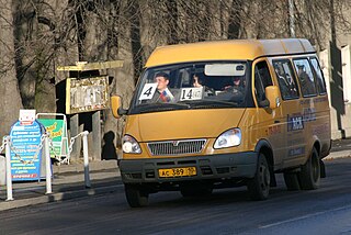
Pavlovo, also known as Pavlovo-na-Oke, is a town and the administrative center of Pavlovsky District in Nizhny Novgorod Oblast, Russia, located on the right bank of Oka River in the northwestern part of the Volga Upland. As of the 2010 Census, its population was 60,698.

Volodarsk, Russia Town in Nizhny Novgorod Oblast, Russia

Volodarsk is a town and the administrative center of Volodarsky District in Nizhny Novgorod Oblast, Russia, located on the Seyma River 50 kilometers (31 mi) west of Nizhny Novgorod, the administrative center of the oblast. Population: 9,928 (2010 Census); 10,989 (2002 Census); 11,034 (1989 Census).

Ardatov, Nizhny Novgorod Oblast Urban-type settlement in Nizhny Novgorod Oblast, Russia

Ardatov is an urban locality and the administrative center of Ardatovsky District of Nizhny Novgorod Oblast, Russia, located on the Lemet River, 162 kilometers (101 mi) southwest of Nizhny Novgorod. Population: 9,566 (2010 Census); 10,117 (2002 Census); 10,027 (1989 Census).

Mukhtolovo Urban-type settlement in Nizhny Novgorod Oblast, Russia

Mukhtolovo is an urban locality in Ardatovsky District of Nizhny Novgorod Oblast, Russia, located 165 kilometers (103 mi) southwest of Nizhny Novgorod. Population: 5,005 (2010 Census); 5,711 (2002 Census); 5,868 (1989 Census).

Vyezdnoye Urban-type settlement in Nizhny Novgorod Oblast, Russia

Vyezdnoye is an urban locality in Arzamassky District of Nizhny Novgorod Oblast, Russia, located on the left (southwestern) bank of the Tyosha River, opposite the city of Arzamas, 115 kilometers (71 mi) south of Nizhny Novgorod. Population: 8,089 (2010 Census); 7,992 (2002 Census); 8,310 (1989 Census).

Gavrilovka, Dzerzhinsk, Nizhny Novgorod Oblast Urban-type settlement in Nizhny Novgorod Oblast, Russia

Gavrilovka is an urban locality under the administrative jurisdiction of the city of oblast significance of Dzerzhinsk in Nizhny Novgorod Oblast, Russia, located 28 kilometers (17 mi) west of Nizhny Novgorod. Population: 803 (2010 Census); 712 (2002 Census); 740 (1989 Census).

Zhyolnino Urban-type settlement in Nizhny Novgorod Oblast, Russia

Zhyolnino is an urban locality under the administrative jurisdiction of the city of oblast significance of Dzerzhinsk in Nizhny Novgorod Oblast, Russia, located 40 kilometers (25 mi) west of Nizhny Novgorod and 2 kilometers (1.2 mi) southwest of Dzerzhinsk. Population: 896 (2010 Census); 696 (2002 Census); 1,112 (1989 Census).

Diveyevo human settlement in Diveyevsky District, Nizhny Novgorod Oblast, Russia

Diveyevo is a rural locality and the administrative center of Diveyevsky District of Nizhny Novgorod Oblast, Russia. Population: 6,408 (2010 Census); 6,500 (2002 Census); 5,511 (1989 Census).

Avtozavodsky City District or Avtozavod is one of the eight districts of the city of Nizhny Novgorod, Russia. It is located in the southwest of the Lower City of Nizhny Novgorod, on the low left bank of the Oka River and has a land border with Leninsky City District to the north. It is also connected by the Myza Bridge with Prioksky City District in the Upper City. Population: 303,054 (2010 Census); 314,494 (2002 Census); 340,378 (1989 Census).

Sovetsky City District, Nizhny Novgorod human settlement in Nizhny Novgorod, Nizhny Novgorod Urban Okrug, Nizhny Novgorod Oblast, Russia

Sovetsky City District is one of the eight districts of the city of Nizhny Novgorod, Russia. Population: 143,401 (2010 Census); 154,205 (2002 Census); 175,600 (1989 Census). Area: 31 square kilometers (12 sq mi).

Bogorodsky District, Nizhny Novgorod Oblast District in Nizhny Novgorod Oblast, Russia

Bogorodsky District is an administrative district (raion), one of the forty in Nizhny Novgorod Oblast, Russia. Municipally, it is incorporated as Bogorodsky Municipal District. It is located in the west of the oblast. The area of the district is 1,459 square kilometers (563 sq mi). Its administrative center is the town of Bogorodsk. Population: 65,677 ; 30,864 (2002 Census); 33,693 (1989 Census). The population of Bogorodsk accounts for 54.1% of the district's total population.

Diveyevsky District District in Nizhny Novgorod Oblast, Russia

Diveyevsky District is an administrative district (raion), one of the forty in Nizhny Novgorod Oblast, Russia. Municipally, it is incorporated as Diveyevsky Municipal District. It is located in the south of the oblast. The area of the district is 844.8 square kilometers (326.2 sq mi). Its administrative center is the rural locality of Diveyevo. Population: 16,618 ; 17,848 (2002 Census); 18,375 (1989 Census). The population of Diveyevo accounts for 38.6% of the district's total population.

Gaginsky District District in Nizhny Novgorod Oblast, Russia

Gaginsky District is an administrative district (raion), one of the forty in Nizhny Novgorod Oblast, Russia. Municipally, it is incorporated as Gaginsky Municipal District. It is located in the southeast of the oblast. The area of the district is 1,064.2 square kilometers (410.9 sq mi). Its administrative center is the rural locality of Gagino. Population: 12,444 ; 15,079 (2002 Census); 17,473 (1989 Census). The population of Gagino accounts for 31.3% of the district's total population.

Knyagininsky District District in Nizhny Novgorod Oblast, Russia

Knyagininsky District is an administrative district (raion), one of the forty in Nizhny Novgorod Oblast, Russia. Municipally, it is incorporated as Knyagininsky Municipal District. It is located in the east of the oblast. The area of the district is 769.9 square kilometers (297.3 sq mi). Its administrative center is the town of Knyaginino. Population: 11,922 ; 12,758 (2002 Census); 12,827 (1989 Census). The population of Knyaginino accounts for 56.3% of the district's total population.

Perevozsky District District in Nizhny Novgorod Oblast, Russia

Perevozsky District is an administrative district (raion), one of the forty in Nizhny Novgorod Oblast, Russia. Municipally, it is incorporated as Perevozsky Municipal District. It is located in the southern central part of the oblast. The area of the district is 769.2 square kilometers (297.0 sq mi). Its administrative center is the town of Perevoz. Population: 16,519 ; 18,024 (2002 Census); 17,146 (1989 Census). The population of Perevoz accounts for 55.7% of the district's total population.

Sergachsky District District in Nizhny Novgorod Oblast, Russia

Sergachsky District is an administrative district (raion), one of the forty in Nizhny Novgorod Oblast, Russia. Municipally, it is incorporated as Sergachsky Municipal District. It is located in the southeast of the oblast. The area of the district is 1,243.8 square kilometers (480.2 sq mi). Its administrative center is the town of Sergach. Population: 31,296 ; 35,779 (2002 Census); 42,588 (1989 Census). The population of Sergach accounts for 68.3% of the district's total population.

Vadsky District District in Nizhny Novgorod Oblast, Russia

Vadsky District is an administrative district (raion), one of the forty in Nizhny Novgorod Oblast, Russia. Municipally, it is incorporated as Vadsky Municipal District. It is located in the southern central part of the oblast. The area of the district is 742.7 square kilometers (286.8 sq mi). Its administrative center is the rural locality of Vad. Population: 15,626 ; 16,442 (2002 Census); 15,365 (1989 Census). The population of Vad accounts for 42.9% of the district's total population.

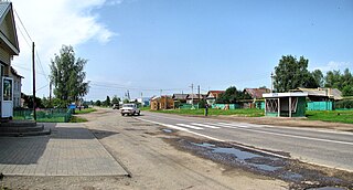
Vad is a rural locality and the administrative center of Vadsky District, Nizhny Novgorod Oblast, Russia. Population: 6,698 (2010 Census); 6,759 (2002 Census); 6,058 (1989 Census).

Urazovka is a rural locality and the administrative center of Krasnooktyabrsky District, Nizhny Novgorod Oblast, Russia. Population: 1,626 (2010 Census); 1,916 (2002 Census); 2,303 (1989 Census).

Spasskoye is a rural locality and the administrative center of Spassky District, Nizhny Novgorod Oblast, Russia. Population: 3,947 (2010 Census); 4,092 (2002 Census); 4,044 (1989 Census).

References

  1. Russian Federal State Statistics Service (2011). "Всероссийская перепись населения 2010 года. Том 1" [2010 All-Russian Population Census, vol. 1]. Всероссийская перепись населения 2010 года [2010 All-Russia Population Census] (in Russian). Federal State Statistics Service.
  2. Russian Federal State Statistics Service (21 May 2004). "Численность населения России, субъектов Российской Федерации в составе федеральных округов, районов, городских поселений, сельских населённых пунктов – районных центров и сельских населённых пунктов с населением 3 тысячи и более человек" [Population of Russia, Its Federal Districts, Federal Subjects, Districts, Urban Localities, Rural Localities—Administrative Centers, and Rural Localities with Population of Over 3,000](XLS). Всероссийская перепись населения 2002 года [All-Russia Population Census of 2002] (in Russian).
  3. "Всесоюзная перепись населения 1989 г. Численность наличного населения союзных и автономных республик, автономных областей и округов, краёв, областей, районов, городских поселений и сёл-райцентров" [All Union Population Census of 1989: Present Population of Union and Autonomous Republics, Autonomous Oblasts and Okrugs, Krais, Oblasts, Districts, Urban Settlements, and Villages Serving as District Administrative Centers]. Всесоюзная перепись населения 1989 года [All-Union Population Census of 1989] (in Russian). Институт демографии Национального исследовательского университета: Высшая школа экономики [Institute of Demography at the National Research University: Higher School of Economics]. 1989 via Demoscope Weekly.

Coordinates: 56°14′27″N43°58′51″E / 56.2408°N 43.9808°E / 56.2408; 43.9808